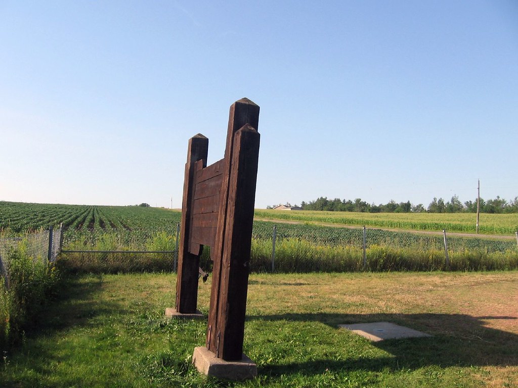
A spot in the middle of a soybean field in north-central Wisconsin marks a confluence of great significance to people who appreciate strange geography. Two invisible lines cross near the small town of Poniatowski; one representing 45 degrees north latitude and one representing 90 degrees west longitude.
The importance of this particular latitude is perhaps more easily rationalized than the longitude. Latitudes range from zero degrees at the equator to ninety degrees at the poles. Thus, 45 degrees north latitude marks a band halfway between the equator and the north pole. Yes, I recognize there are some complexities to this but the general concept is understandable.
However, longitude is based upon a prime meridian running through Greenwich, England. It’s there because an International Meridian Conference decided it should be that way in 1884. Had another prime meridian been selected then this particular 45N 90W spot would have been utterly meaningless. Then it would be just another nondescript Midwestern field. So I would have visited some other obscure point instead.
Markers

Let’s go directly to the sign dedicated to this oddity:
“GEOLOGICAL MARKER
This spot in Section 14, in the Town of Reitbrock, Marathon County is the exact center of the Northern half of the Western Hemisphere. It is here that the 90th meridian of longitude bisects the 45th parallel of latitude, meaning it is exactly halfway between the North Pole and the Equator, and is a quarter of the way around the earth from Greenwich, England.
MARATHON COUNTY PARK COMMISSION”
Numerous websites note that it really shouldn’t be called a “Geological” marker. Give yourself a pat on the back if you caught that one too. Unfortunately, It’s probably a little late for them to change the sign.

A small rectangular concrete slab rests on the soil a few feet in front of the sign. At the center of the block sits a metallic circular marker reading: “MARATHON COUNTY SURVEYORS OFFICE / IMPRISONMENT OR FINE FOR DISTURBING THIS MARK / 45.00° N + 90.00° W”
A Park Too

This is the little pocket park that Marathon County dedicated to the crossing of the two lines. It’s only 50 feet wide and 125 long. So it provides just enough room for a couple of cars to pull in without knocking anything over. I couldn’t get a good straight-on photograph during my visit because it was a wonderfully beautiful morning with the sun rising brightly and directly above the sign. It seemed great for visiting but bad for photography.
The slab marker appears to the right, where a shadow from the base of the sign touches the ground. Fields surround the park on three sides and a road runs along its western edge. It provides easy access but the park itself is so small and innocuous that I nearly drove past it without even realizing it.
This was also about the time my wife and kids announced that if I ever wanted to see anything more obscure I’d probably have to do it on my own. They were mildly accommodating but hardly enthralled by the hour-long detour. However this isn’t the first time I’ve gone out of my way for the intersections of imaginary lines and it probably won’t be the last.
The Secret
Since you’ve been kind enough to read all the way down the page it’s time to let you in on a dirty little secret. The two lines don’t actually cross at the marker in the park. They meet a couple of hundred yards away in the middle of the field. I guess the county didn’t have enough money to buy all of the land for an easement. Or maybe it wasn’t worth the trouble or effort. Perhaps they figured it was close enough for any odd straggler who happened to visit.
I confirmed this with my hand-held GPS receiver. I wasn’t detecting a whole lot of enthusiasm for traipsing out into the field to reach the exact spot so I considered this encounter “close enough” for me too. Then I closed the books on another adventure.

Leave a Reply