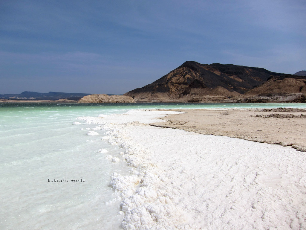
I was poking around the CIA World Factbook (doesn’t everyone?) and came across an interesting page that listed “miscellaneous geographic information of significance not included elsewhere.” That’s wonderful, I thought, a page of international odds-and-ends that didn’t fit within the book’s prescribed format. Yes, I live for moments like that.
It listed little tidbits on just about every nation around the globe. Then my mind wandered over to the entry for Djibouti:
“strategic location near world’s busiest shipping lanes and close to Arabian oilfields; terminus of rail traffic into Ethiopia; mostly wasteland; Lac Assal (Lake Assal) is the lowest point in Africa and the saltiest lake in the world”
That’s a lot of miscellany for such a tiny nation, a place slightly smaller than the U.S. state of Massachusetts and populated by fewer than a million residents. The thought of Lac Assal fascinated me and a nation described as “mostly wasteland” amused me as well. I’m not sure the residents would necessarily agree with that characterization.
Lac Assal
Sources agreed that Lac Assal is the lowest point of elevation in Africa. However, there’s some variation in the recorded altitude. It seems to center at about -155 metres (-509 feet) give or take a few metres. A rift valley on a geologic fault formed Assal Lake. Here the plates split apart, a volcano created a crater, and a depression formed well below sea level. Any water that finds its way into the valley and the crater has no way to escape. Lac Assal doesn’t have an outlet to the sea.

The salinity grew intense due to minerals eroding from the surrounding terrain that washed down into the lake and remained there, while the water evaporated. This is typical of endorheic basins — the same condition exists in Utah’s Great Salt Lake (my visit). The CIA referred to Lac Assal as the “saltiest lake in the world” and that may be true, although Don Juan Pond in Antarctica is allegedly saltier. Lake? Pond? Whatever. Lac Assal is really salty and it’s a source of industry for the area. Huge salt flats are clearly visible there.
Ghoubbet El Kharab
That’s all interesting, however I’m most fascinated by its proximity to the sea. Maybe 10 kilometres separates Lac Assal from Ghoubbet El Kharab (or Lake or Bay of Ghoubet). Take a close look at Ghoubbet El Kharab (map). A narrow passageway connects it to the Gulf of Tadjoura which in turn connects to the Gulf of Aden. Thus, the surface of Ghoubbet El Kharab sits at sea level. And the lowest point in Africa is a mere ten klicks away! So only one narrow ridge of stone separates Africa’s lowpoint from being the sea floor.
In fact, Ghoubbet El Kharab is Lac Assal’s main source of water. Certainly whatever rain falls within the basin, as lacking as that may be, flows into the lake. Even so, much more water seeps through fissures in the stone wall between Ghoubbet El Kharab and Lac Assal. So the stone separating the two features serves as a dam with cracks in it.
Tourism
Tourists visit Lac Assal generally in winter. The temperature can hit 50° Celsius (122° Fahrenheit) in the summer, and it becomes truly life threatening.
However, there are other hazards. A civil war embroiled Djibouti between 1991 and 1994 and matériel still remains scattered throughout the countryside. The United States Embassy issued a security message in 2012 after a nearby land mine injured a boy (map). So if you go — and I hope someday some of you do — time it right and stick to the roads. And take lots of photos.

Leave a Reply