Arapahoe Exclaves in Denver

I’ve kept my eye on a certain set of geo-oddities for a long time. Arapahoe County possessed multiple exclaves fully enclosed within the boundaries of Denver City/County, Colorado.

Denver had to find a way to grow as people moved into the area. So they found an easy solution. They simply annexed land from their neighboring counties wherever necessary and possible. Denver succeeded in their expansionist strategy most of the time but not always.

Small parcels of Arapahoe County territory escaped annexation into Denver, but at an unusual cost. They became stranded. They are totally isolated and physically separated from the rest of Arapahoe County.


Glendale

The larger exclave defines the boundaries of the City of Glendale, a 0.6 square mile (1.4 sq. km.) tract with a population of about 4,500. There is also a second, much smaller triangular parcel nearby that doesn’t seem to house much of anything.

Municipal Center in the Glendale, Colorado exclave. Photo by howderfamily.com; (CC BY-NC-SA 2.0)

I discovered that it’s really easy to drive to Glendale. However, it was a bit more difficult to determine when I’d actually arrived officially within its borders. I saw no signage announcing any crossings into Arapahoe County. On the other hand, Glendale itself was entirely indistinguishable from surrounding Denver. You would absolutely not be able to determine that you’d encountered anything unusual geographically unless you knew about this anomaly in advance. Glendale blends in seamlessly with Denver.

The Municipal Center

Naturally I researched and calculated the boundaries with painstaking precision ahead of time. Then I programed my destinations into a portable GPS. I figured, logically, that I’d find the Glendale Municipal Center within Glendale proper. That seemed like the safest of bets. After all, who would have the audacity to locate Glendale’s center of government outside of its boundaries?

The maps agreed and I set off on the most direct route to this specific destination. I arrived without difficulties and I took a photograph with my crappy mobile phone camera to document my achievement for posterity.

A Public Park
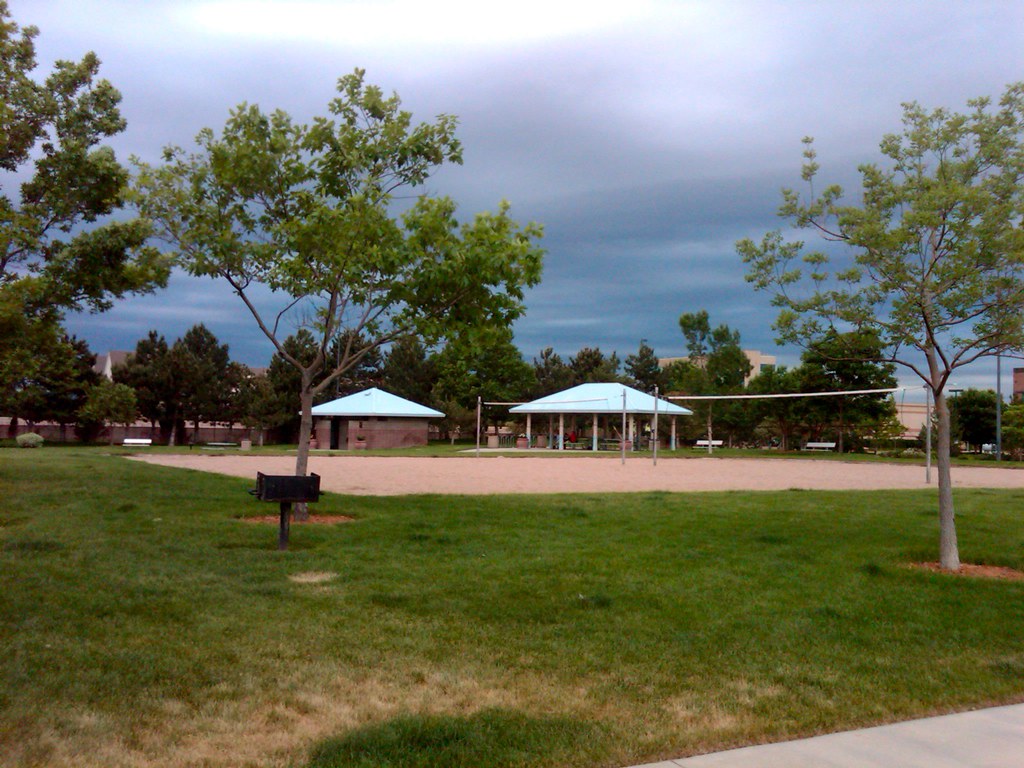
Public park in the Glendale, Colorado exclave. Photo by howderfamily.com; (CC BY-NC-SA 2.0)

That wasn’t enough. I wanted to experience all 0.6 square miles of this glorious anomaly. I’d researched a spot unquestionably within the heart of the oddity where I knew I could also find parking without any problems (special thanks to Google Street View). So I found myself at a place called Creekside Park.

I had to operate quickly. A thunderstorm loomed on the horizon with amazing cloud-to-ground lightning strikes like one only sees out here in the West. People stared at me like I was half-crazed. There I stood in the middle of the parking lot, thunderstorm looming, car running, door wide open, snapping rapid-fire photos of some random park.

I know that all of you understand this fascination of mine. Unfortunately it’s not well understood by the public at large. But I captured my geo-oddity and I called it a success.


Totally Unrelated

I read “USA Today” about twice a year, usually when it’s been left at the door of my hotel room as has been the case all this week. It had an article a couple of days ago — and fortunately it’s still online — that talks about a United States interstate highway signed entirely in the metric system: I-19 is in midst of metric muddle. Enjoy!

Oh, and here’s something I stumbled across from a different source about a con man caught sneaking across the border in Vermont.

I wish I had more time to explore these topics but unfortunately my work and travel plans have made that impossible this week.


Posted

in

, ,

by

Comments

5 responses to “Arapahoe Exclaves in Denver”

  1. pfly Avatar

    Hehe, good work! Thunderstorms in Denver are amazing.

  2. Jim Avatar

    Just a little bit south of Glendale is an Arapahoe Exclave called “Holly Hills”. I found some information on it in a City-Data thread:
    http://www.city-data.com/forum/denver/142334-holly-hills.html

    Interestingly, this exclave is split in two by I-25.

    Arapahoe also has the best named GIS system: ArapaMAP
    http://gis.co.arapahoe.co.us

    It looks like there’s a small area of Adams County within Denver county as well. Old Aerial shots show a parking lot full of trucks and boats, and new ones show a newly developed residential area.
    http://maps.google.com/maps?f=q&source=s_q&hl=en&geocode=&q=80249&sll=39.911843,-104.624176&sspn=0.561435,1.005249&ie=UTF8&hq=&hnear=Denver,+Colorado+80249&ll=39.782718,-104.761822&spn=0.002317,0.003927&t=h&z=18

    Adams County has a similar system, but I can’t find any more information for the lot that is an exclave in Denver County.
    http://www.gis.co.adams.co.us

    Similarly, it looks like there my be a parcel or two of Jefferson County as an exclave in Denver County.

    You can see a lot of the gaps on this map:
    http://planning.dpsk12.org/DistrictMaps/Denver_neighborhoods_2008.pdf

    Awesome work! I hope to see more Colorado oddities before you leave town!

  3. Matt Avatar
    Matt

    If you like enclaves and appendages, you should visit Ohio, which had, or used to have very liberal annexation laws, from the cities’ point of view anyway. Columbus is splattered throughout with islands of unincorporated land. Also, Gaithersburg, Maryland, looks like a doughnut with a big hole in it.

  4. Cape May Avatar
    Cape May

    The Boston area has some weird exclaves. There are two exclaves of Norfolk County, one in Plymouth County and one that straddles Suffolk and Middlesex Counties. As a result of the latter, Suffolk County has a semi-exclave into Middlesex County which is barely connected to the rest of the county by a thin border. I’d like to know the stories behind these exclaves.

  5. Dale Sanderson Avatar

    I live about a half-mile from Glendale, and there’s actually a pretty easy way to tell whether you’re in Denver or Glendale: just look at the street sign blades. Signs located on a Denver parcel are green, while signs located on a Glendale parcel are blue. Also, at several of the more well-traveled entry points into Glendale, the city has placed concrete mini-sculptures that say “Glendale”. But you’re right: I don’t believe there are any references to Arapahoe County. Most Denverites would probably be surprised to hear that Glendale is in Arapahoe… they probably think of it as nothing more than a neighborhood within Denver.

    In my opinion, the other Denver enclave is more indistinguishable from Denver proper. For one thing, it doesn’t have a real name. Someone upthread mentioned “Holly Hills”, but the majority of people living in Denver metro wouldn’t have any idea whence that term refers. The sign blades are the same green as Denver’s, but if you look closely, you can see that the Arapahoe County signs have a different style. Also, there are some areas within this enclave where it appears that the building/zoning/property requirements are a little more lax than in Denver proper.

    Once, when I was in high school, I drove my girlfriend to the little park in the middle of South Dahlia Lane (which is in the northwest part of this enclave). We hadn’t been parked for more than a couple minutes when a resident came out with a notebook and pencil, and copied my license plate number. I asked him what was going on, and he explained that crime is a problem in their neighborhood, since they have to rely on the Arapahoe Co. sheriff’s dept.). He then proceeded to write down my name. I point that out to demonstrate that enclaves are more than map anomalies – they can have real-life ramifications.

Leave a Reply

Your email address will not be published. Required fields are marked *

Latest Comments

  1. Hi Mr. Howder — Just going from memory, I recall that your “rule” for counting a nation/state/county is “if I’m…

  2. Does anyone have actual music to the song – Tanaha ,Timpson. Bobo and Blair ?? It was recorded by Tex…