Lines continue to fascinate me, both imaginary and real. I found myself pondering the website of Australian Rail Maps, looking at their Western Australia page. I’d heard about a specific segment crossing the hauntingly desolate Nullarbor Plain and I intended to investigate it further. It’s here, between kilometre 797 west of Ooldea (South Australia) and kilometre 1,275 west of Loongana (Western Australia). The track runs exactly straight without a single curve, jog or turn.
Reputedly this is the longest continuous stretch of absolutely straight railroad track anywhere on earth. The segment runs an amazing 478 km (297 miles) dead straight through one of the emptiest quarters imaginable. It’s easily visible even when I zoom the map image far enough out to show the entire Australian continent.

The Indian Pacific, a passenger train operated by the Great Southern Railway, provides an opportunity for visitors to experience this segment in person. Service runs in both directions twice a week, with the total trans-Australian journey taking about three days coast-to-coast.
There is very little to see beyond the beauty of the Nullarbor itself. Nonetheless there are a couple of towns located along this straight-arrow path.
Forrest

The town of Forrest, named for John Forrest the first Premier of Western Australia, somehow clings to life upon the outback (map). It did hold one minor historical distinction. Airlines used it as a passenger stop on a route between Perth and Adelaide a couple of generations ago. That was back in the early 1930’s when airplanes couldn’t cover long distances without refueling. They had to bunny-hop their way across the continent in brief spurts. Airplanes would drop down to the strip at Forrest, refuel, and continue with their longer journey. People could overnight there in a local hotel if they desired. Life was fine.
It doesn’t seem like there’s much there today judging by the satellite image. It had nothing but a few buildings and the airport itself.
Cook

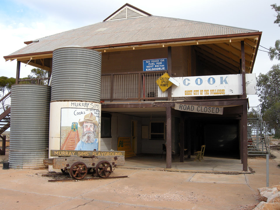
The town of Cook seems a lot larger, but looks can be deceiving. The town existed solely to support the railroad (map). Unfortunately it lost its primary purpose in 1997. That’s when private owners took control of the railroad and decided they no longer needed Cook. The Indian Pacific still stops here — the only scheduled passenger stop along the Nullarbor route — providing a chance for people to stretch their legs while the locomotive refuels.
However only a few residents remain and it will likely become a ghost town soon. Many of the buildings have been abandoned, left behind to slowly crumble into the harsh terrain.
Is this the longest completely straight line in Australia? Is it the longest straight line in the world? I don’t know but I haven’t been able to find any longer. But I did uncovered some vehicular roads that claim to have great lengths although nothing on the order of this railway. I suppose that’s because highway engineers put a few curves and wiggles in the roadbed on purpose to keep drivers from falling asleep. That’s much less of an issue with a train.
I’m certain that the very knowledgeable readers of Twelve Mile Circle will know better. So rise to the challenge and mention any longer lines in a comment if you are aware of any. Remember, I’m talking about an actual contiguous line etched upon the terrain such as a road or a pipeline. It should be visible in satellite imagery. I’m not talking about something like a national border that has been surveyed and designated with boundary markers.

Leave a Reply