Water flows downhill naturally towards the sea. At a continental divide, water on each side of the divide will flow towards a different sea. Sometimes the final destinations will be hundreds or even thousands of kilometres apart.
Occasionally a divide will pass through a standing body of water such as a pond or a lake. The largest such occurrence involves Wollaston Lake in Saskatchewan, Canada, with a surface area of 2,286 square kilometres.
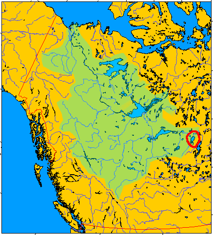
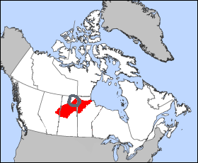
Wollaston Lake drains both towards the Arctic Ocean and Hudson Bay. I’ve circled its approximate location on the two images below that I found on Wikimedia Commons.
To the Arctic Ocean

Drainage to the Arctic Ocean starts with the Fond du Lac River, which springs from Wollaston Lake’s northwestern side. From there, water flows into Lake Athabasca, and then into the Mackenzie River system, and finally into the Arctic Ocean.
To Hudson Bay

However if water flows out of the northeastern side of the lake it takes a dramatically different path. It will go into the Cochrane River and then Reindeer Lake, and finally into the Churchill River system which completes its journey at Hudson Bay. This is quite a bit shorter than the other route.
Wollaston Lake presents a rather unusual situation. The continental divide remains rather fluid, literally, and shifts based on currents instead of the contours of the land.

Leave a Reply