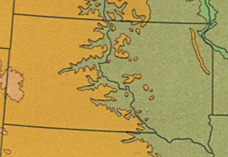
I poured over maps for a project that’s been slowly forming at the back of my mind — I know that must come as a surprise — and I noticed an anomaly I’d overlooked in all the other times I’d examined this particular patch. I think it had to do more with the vertical scale of the map than the actual feature itself. This particular topographic relief map just happened to select 2,000 feet (610 meters) as a breakpoint between color gradients.
A Feature Appears
Magically, a thin line rose from the plains of northeastern South Dakota. It would have disappeared entirely into the background had the mapmaker chosen 2,500 feet or a half-mile to differentiate elevation; an indistinguishable element.

I’d stumbled upon the Coteau des Prairies, a 200 by 100 mile plateau located primarily in South Dakota but also extending to a lesser extent into Minnesota and North Dakota. Early French explorers provided the name “Coteau” translating roughly to hill or upland in this context.
Granted it’s barely perceptible at first glance which is probably why I’d never paid much attention to it before. Look closely at Google Maps in terrain mode (map): notice the area marked by all the small ponds and lakes and you will begin to see it.
Glaciers and Ice Ages

Glaciation formed countless pockmarked depressions which now serve as natural basins. Glaciers are responsible for just about everything observable here. Numerous flows of ice moving back-and-forth across the landscape left deposits that reached as high as 900 feet (275 m).
So something interesting happened in the final glaciation. This time one place had just enough resistance to block the frozen mass as its tendrils descended from the north. The Coteau des Prairies plateau remained ice-free.
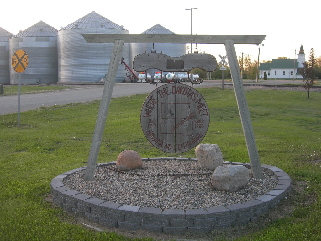
The flow split as it moved south , creating a recognizable tip just east of present-day Havana, North Dakota (map). It gouged the surrounding plains to the east and west as it passed, allowing elevation features to become even more pronounced upon retreat. Coteau des Prairies would have appeared as ice-free sawtooth cutting into the snowcap during the Wisconsin glaciation, perhaps ten or fifteen thousand years ago.
As It Appears Today

Google Street View (image) doesn’t do it much justice, unfortunately. Nonetheless, follow the link and pan the image above about 180° and you’ll see a wooden observation post in the distance. That’s the Joseph N. Nicollet Tower of the Heritage Museums of the Coteau des Prairies, in Sisseton, South Dakota. It’s supposed to offer a great view of a tri-state area and the admission price is right (free). The tower adds another seventy five feet of height above the plains which would be a distinct advantage to Street View.

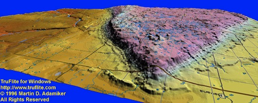
It’s much easier to observe the formation with an exaggerated scale. This image, looking from the north increases elevation by a factor of 20X (you can use Havana, ND in the lower-right as a point of reference). Now it’s obvious to see why some say Coteau des Prairies has a “flatiron” shape. The wedge and flat plateau practically jump from the screen.
Stereotypically, the North American continental interior seems bland and featureless. The landforms are not as dramatic as other areas. However, look closely enough and all sorts of interesting variations begin to appear.

Leave a Reply