It began with a simple premise. Finish Virginia. The Commonwealth of Virginia was a particularly difficult journey for County Counters due to its odd configuration of 95 counties and 38 independent cities. It also happened to be my home state. I’d long been irritated that I still hadn’t completed it. I’d chipped away at the 133 different borders that needed to be crossed until I finally got it down to a mere 5 last summer. That’s when I decided I simply had to hit the road and get it done.
That was the plan, a single weekend of constant driving because of course the residual counties remained at far-flung, inaccessible western edges of the state. Then my wife suggested we could move it from a solo quest into a family adventure during the kids’ spring break. We could see more of the area in depth and actually enjoy a few places along the way. That was fine with me. We could go to the moon and back for all I cared as long as we hit those five remaining Virginia counties.

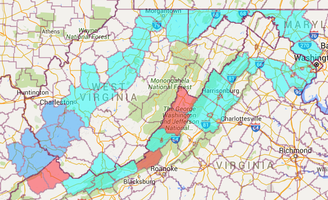
Thus the route switched from a simple out-and-back to a counterclockwise loop through the rugged Appalachian terrain of Maryland, West Virginia, Kentucky and of course Virginia. That allowed me to pick-up some new counties in West Virginia and Kentucky (in blue) in addition to the five in Virginia (in red) as well as revisit some old favorites (in teal). That pushed my total of new captures up to an even dozen.
Still, Virginia remained the true goal so I focused an inordinate attention on the missing five.
Dickenson and Buchanan Counties

Dickenson and Buchanan Counties abutted each other about as deep into southwestern Virginia as one could travel. I didn’t know much about either place. Their populations, frankly, surprised me. Many of their towns hugged riverbanks as did their roads — a logical consideration given the steepness and density of surrounding mountains — so maybe those conditions concentrated most of the people along our path. It seemed like a lot more than I expected. Afterwards I checked. Dickenson had 15,000 residents and Buchanan had 25,000 so my perception was correct. Many more people lived there than I would have expected. The area also felt downtrodden. Residents had been fleeing the mountains for the last couple of decades as coal mining jobs continued to disappear.
They were both stunningly beautiful places. We stopped at Breaks Interstate Park, straddling the boundaries of both counties and the Commonwealth of Kentucky (map).
Craig County

I crossed into Craig County the following day and added it to my list of successful captures. We were in a hurry, in the midst of a long day of driving, and there wasn’t much in the way of “attractions” found in Craig other than its winding roads through verdant countryside.
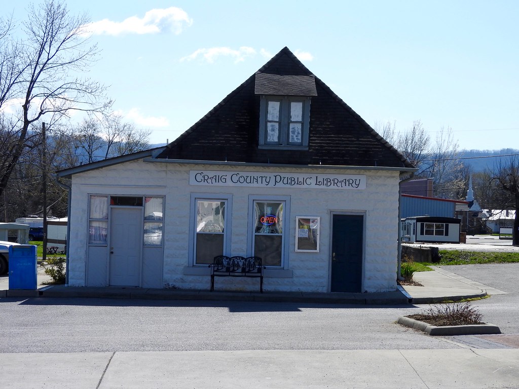
A momentary stop at a local convenience store in the center of town — it’s only town, New Castle — offered a brief opportunity to stretch our legs. I noticed the nicest little public library across the road, not much larger than a shed (map). It was open although we kept rolling. When would I ever be able to return a book? I suspected that this might be the one and only time I’d ever get to see Craig County in person. I better take a picture.
Bath and Highland Counties

Bath and Highland Counties shared a common border, yet they couldn’t have been more distinct. Bath became one of Virginia’s premiere romantic weekend getaways, only about three hours away from Richmond or Washington. Twelve Mile Circle featured it in Taking a Bath in 2014. The county hosted a number of well-known spas and resorts including The Homestead.
We drove through quaint towns, past several golf courses and along opulent country estates with exceptionally manicured lawns. I’m not sure why I’d never managed to touch Bath County before. I’d certainly known a lot of people who stayed at The Homestead.
Then I arrived at the final remaining Virginia county, Highland (map). Of course I had to stop at the border and memorialize this momentous occasion as I finished the state. Everything Bath was, Highland was not, well, except that they were both exceptionally rural. One must really want to see Highland to actually visit it in person because it wasn’t along any easily accessible path that one would normally take.
It seemed appropriate that my final county also had Virginia’s smallest population with a little more than two thousand residents where cattle vastly outnumbered people. Highland’s single town, Monterey, had only 150 people living there. Several mountain ridges ran through Highland, cutting it into parallel ribbons of rock and valley.
We entered from the south using a valley. We exited to the east — towards the state’s centers of population — on U.S. Highway 250. That was Highland’s major road and it was a difficult, twisting climb. I’m certain that’s why so few people ventured into Highland and why it remained on my list of missing counties until the bitter end.
Done!
I finished Virginia. I hadn’t expected much else as I planned the trip. There didn’t seem to be a lot of things to do out there on the looping mountain roads, or so I thought. I’m not sure I’ve ever driven so long without ever encountering a level grade or a straight stretch of roadway before, and never once did I ever encounter an opportunity to put the car on cruise control. However I was wrong about nothing to see. Twelve Mile Circle will shift into travelogue mode for the next several articles as I describe a fascinating journey at the intersection of three states in a corner of Appalachia.
Appalachian Loop articles
See Also: The Complete Photo Album on Flickr

Leave a Reply