Notions of endless horizons came to mind as I prepared for an Appalachian Loop. We would cross mountaintops, dip into hollows and follow valley flatlands along tumbling rivers amid early signs of spring. This journey promised stunning scenery in a little-visited and often under-appreciated rural preserve.
People who ventured into Appalachia as tourists usually came in summer. Nobody would be silly enough to come in March — nobody — unless they wanted a reasonable chance of miserable weather, or they had an ulterior motive like I did. Some of the places surely must see crowds later in the year. Not in March. That was just the way I liked it; 12MC zigs when everyone else zags.
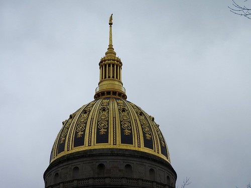
West Virginia State Capitol

I’ve been to Charleston three times in as many years. The city offered an odd hybrid of small town feel with urban amenities, and fewer than a quarter-million residents in its larger metropolitan area. Yet, it was West Virginia’s capital and largest city. I mentioned our Charleston plans to acquaintances and they nodded heads approvingly. South Carolina should be so nice at that time of year, they said. Then I noted wryly that it was the other Charleston, the one in Appalachia, and waited for their confused expressions. I rather enjoyed that.
We arrived on a Friday afternoon at what should have been the height of Rush Hour and barely slowed down, a nice change from terrible traffic back home. Charleston sat along both sides of the Kanawha River, with tough rocky terrain hemming it in. Yet along the river where the city sat, there was hardly a hill to be found (terrain). It was flat. This fascinated me during every one of my visits, driving hours through mountains and arriving at a city as flat as a tabletop.
The dome of the state capitol building (map) rose over the riverbank, this photo taken from the far side of the Kanawha River at dawn from the campus of the University of Charleston. We got an opportunity to tour the capitol complex and the state museum later in the day. I’d recommend the museum, by the way. It was extremely well done.
Pikeville Cut-Through

Scenic views filled our dashboard multiple times along the route, simply driving around. However I knew nothing about the overlook atop Bob Amos Park in Pikeville, Kentucky until 12MC reader “Andy” suggested it. The precipice perched high above what was officially called the Pikeville Cut-Through (map).
Pikeville, like Charleston, hugged the relatively level lands along a river. The town followed a U-shaped bend on the Levisa Fork of the Big Sandy River. The river used to flood into Pikeville’s streets and homes from time-to-time because there wasn’t anywhere else for the water to go when it rose. That was simply a hazard of living within a narrow Appalachian valley. People in town simply endured it for the first hundred and fifty years.
The mayor came up with an audacious plan. Why not simply cut through a mountain and remove the U-shaped bend, and straighten out the river? It sounded crazy although the Army Corps of Engineers picked it up in 1973 and finally finished it 1987.
A marker at the site described an effort to remove 18 million cubic yards of earth, “the largest engineering feat in the US and second in the world only to the Panama Canal.” Now a highway, a railroad and a river pass through the cut instead of downtown Pikeville. Meanwhile the town earned some nice parkland where the river once flowed, plus an artificial oxbow lake, and a River Drive (terrain) no longer crossing a river.
The overlook gave excellent views of Pikeview and the Cut-Through.
Them’s the Breaks

Reader Andy also suggested Breaks Interstate Park. The interstate portion of its name came from its location, crossing the border of Virginia and Kentucky. The two states offered a single highland experience, cooperatively. Breaks seemed a bit more confounding, providing a name both to a park and to a town just outside of its limits. Once again an on-site marker offered an explanation: “The name ‘Breaks’ was derived from a break in Pine Mt. created by the Russel Fork of the Big Sandy River as it carved a 1000 ft. deep gorge on its way to join the Ohio River.” That actually made sense.
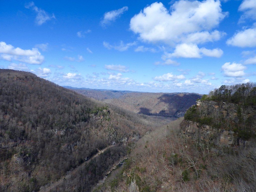
The park offered several distinct scenic vistas. The one in this photo was called Stateline Overlook (map). I’d actually like to return to Breaks Interstate Park someday when the weather is nicer. We barely scratched the surface of what would be available at warmer times of the year.
The View that Got Away

It rained as we approached Bluefield, a town bisected by the border of Virginia and West Virginia. It rained the only other time I visited Bluefield so I guessed the town had it in for me. Still, I’d heard good things about its East River Mountain Overlook and I felt optimistic as we drew closer. Then I noticed low clouds brushing against nearby mountains. We still drove to the top — one never knows when clouds might cooperate or not — and discovered a great white wall of icy fog. I’m sure it would have been a lovely experience. Not this time.
That was far from the only opportunity for impressive views so we pushed father along Virginia’s Appalachian spine the next morning. That’s when we entered the Alleghany Highlands north of Covington and I took the photograph above (map). It was a worthy consolation prize.
Falling Spring Falls

A little farther down the path, still within the Alleghany Highlands, crashed Falling Spring Falls (map). It certainly deserved an award for convenience, within easy eyesight of US Route 220 and adjacent to convenient parking. That was my kind of waterfall, a single 80 foot (25 metre) drop with no physical effort required.
Even so I overcame my inherent laziness and scrambled down a path to get a photo from the bottom. I wasn’t quite sure if that was allowable. It felt ambiguous. A fence separated the parking area from the falls although visitors could circumvent the barrier easily enough with a short walk, and no signs prohibited it. The path seemed well-trodden. I figured it was an “at your own risk” activity so I went for it. No harm no foul, I supposed.
Shenandoah Caverns

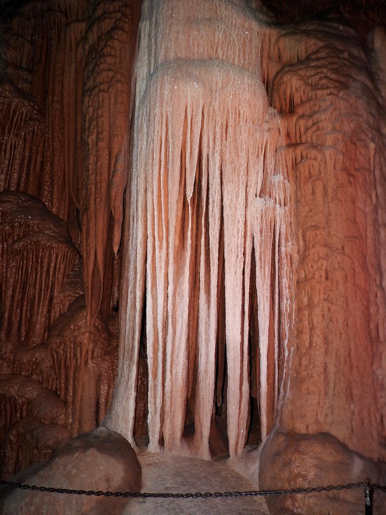
On the final day we pushed into Virginia’s Shenandoah Valley on the way home, a rolling plain sandwiched between Appalachian Mountains and the Blue Ridge. It featured one of my favorite topographies: karst. Wherever one finds karst one finds limestone, and water bubbling through limestone dissolving it. That meant caves.
I’ve toured caverns in many different places and I’ve always thought that some of the best could be found along this strip of Virginia. Somehow I’d never been to Shenandoah Caverns before (map). We had a little extra time, it fell directly along our path, and even the kids loved caves, so why not?
Nobody said that a scenic vista couldn’t be subterranean.
Appalachian Loop articles
See Also: The Complete Photo Album on Flickr


Leave a Reply