Australia’s Shortest Internal Border

What is the shortest border in Australia between any state or territory? Take a look at the map and see if you can figure it out. You won’t, but try anyway.


Australian Capital Territory and New South Wales?
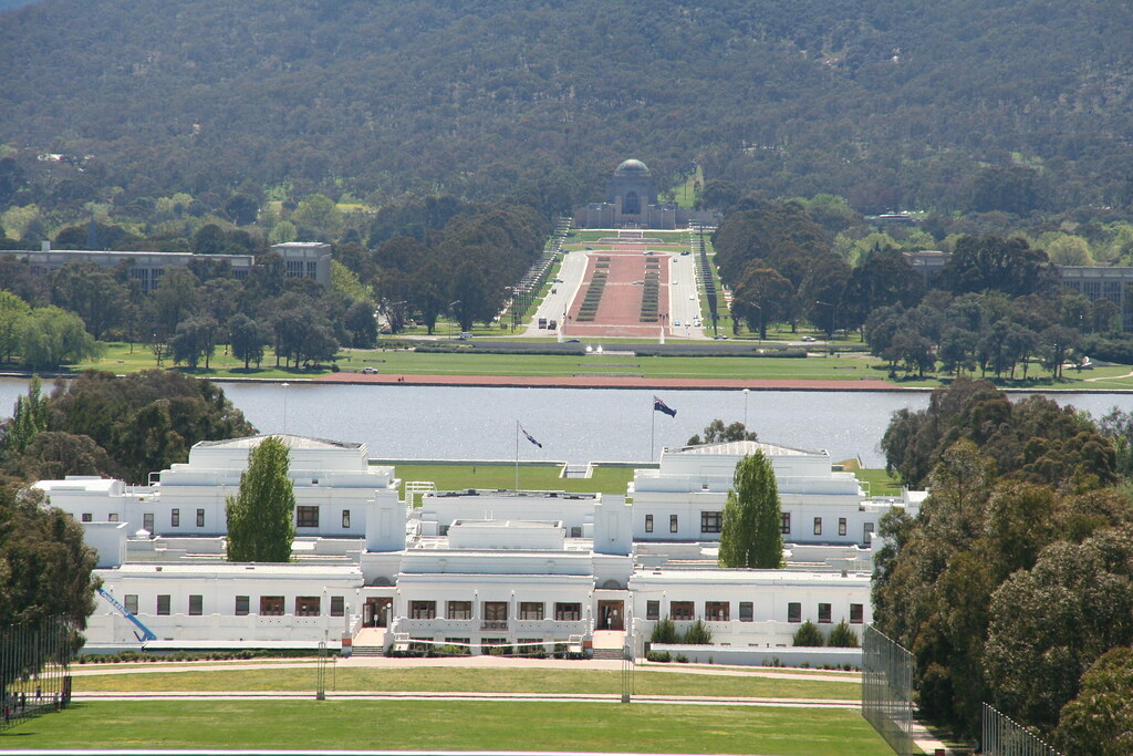
Canberra. Photo by Rachel Clarke; (CC BY-NC 2.0)
Canberra

If I were forced to guess quickly I’d probably say that a likely choice would be the border between the Australian Capital Territory (ACT) and New South Wales. The ACT is a small enclave completely surrounded by New South Wales that was created in 1911 to hold the Federal capital. Construction of Canberra, the new capital city, started two years later. The entire border stretches only 306 kilometres (190 miles). That’s pretty short but it’s not the shortest.

If you’re particularly savvy you may know about the Jervis Bay Territory and consider that a likely candidate instead. It used to be part of the ACT until 1989. At that time the ACT achieved self-government and Jervis Bay became a separate entity administered by the Minister for Territories.


Jervis Bay Territory and New South Wales?

The Commonwealth Government purchased Jervis Bay from New South Wales in 1915. The intent was to provide the landlocked Australian Capital Territory with a seaport via a 173 kilometre (85 mile) railroad connection. However, with the relationship now severed, the standalone Jervis Bay Territory covers a tiny 70 square kilometres, and its land border with New South Wales stretches only 32 kilometres (20 miles). The 2001 census recorded 611 inhabitants in Jervis Bay, associated mainly with the Royal Australian Navy base HMAS Creswell.


Tasmania and Victoria?

That’s a really short boundary, but unbelievably it’s still may not be the shortest internal border within Australia. For that we need to consider the least likely of candidates, Tasmania. But Tasmania is an island, right? How could it possibly share a land border with another Australian state or territory?

Tasmania is indeed an island. However, the state of Tasmania includes the island of that name plus a number of outlying islands.
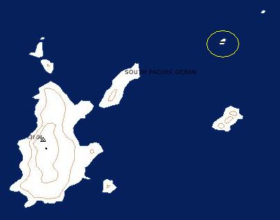
Hogan Islands - Boundary Islet
The Hogan Group of Islands – Created using Geoscience Australia MapConnect

The Hogan Group, lying in the northern Bass Straight, falls primarily within Tasmanian territory. However the boundary between Tasmania and Victoria, set at latitude 39° 12′ South, happens to cut directly through the area and coincidentally cleaves a rocky little outcrop known appropriately enough as Boundary Islet.

This is a satellite image of Boundary Islet. It’s so small (85 metres by 160 metres) that Google Maps does not even include it on some of its views. It contains Tasmania’s only land border, and the line between Tasmania and Victoria stretches a mere 0.085 kilometer, shorter than the length of a football field.

A table of Australian state and territory border lengths and other geo-trivia resides at Geoscience Australia, a site that I’ve enjoyed picking through lately.

Comments

6 responses to “Australia’s Shortest Internal Border”

  1. aletheia kallos Avatar

    why assume your reader cant or wont etc

    or
    tho particularly savvy
    is somehow not quite savvy enough

    & how can you assume the boundary crosses the full 85 meters
    seeing as it isnt actually marked but only hypothetically delineated
    http://www.expeditionoz.com/blog/2008/09/23/victorian-tasmanian-land-border#comment-76

    to come closer to the actual truth
    i believe one must at least overlay the satpic of the island with the referenced parallel of latitude expressed in the official australian geodetic datum

    & who is savvy enough to do that

  2. Matthew Prull Avatar

    That’s really cool, and now I want to visit Boundary Islet to see it for myself. However, maybe to add to Aletheia Kallos’ point, I noticed that in Google Earth the entirety of Boundary Islet is north of 39° 12? S, and that would place it fully within Victoria. Of course, I don’t know how accurate Google Earth is with respect to latitude and longitude coordinates – it may not be as accurate as we would like here. Nevertheless, it would be cool to do some investigations on this boundary to see whether it really does pass through the Islet. Alas, I don’t know how to do the overlay that the above comment suggested. This boundary reminds me of Märket Island near Sweden & Finland – familiar with that one?

    1. Twelve Mile Circle Avatar

      Good points! As to whether the boundary truly passes through Boundary Islet, I’d offer two inputs:

      1. The source is the Australian Government, specifically the organization that handles mapping and surveying. You can see their history here. I’d hope they would have fact-checked this before posting it, especially since they make a pretty big deal out of it. Otherwise it would be pretty embarrassing to them and their reputation.
      2. I’ve done extensive coding with the Google Maps API. I’ve noticed that Satellite layer in particular often falls a little off of what can be seen on the map layer. It wouldn’t take much margin of error for the islet to fall entirely on one or the other side of the boundary.

      I’m inclined to believe that the preponderance of the evidence, and possibly evidence beyond a reasonable doubt, supports that the boundary does indeed pass through Boundary Islet. I’ll gladly revise that if the Australian Government website proves to be incorrect.

      As for the post in general, I’m just havin’ a little fun with this entry, just pulling the Intertubes’ collective leg. No offense intended to those who already knew the answers. The subset of people both knowledgeable and savvy enough to fall outside of my wildly presumptuous and reckless statements should feel free to have a little chuckle at my expense. I don’t take myself all that seriously and likewise neither should the readers of Twelve Mile Circle. 😉

  3. Gerard Avatar
    Gerard

    I was around Jervis Bay last month. Unfortunately there are no mobile phone towers within the Jervis Bay Territory, so even if I had visited your site while I was there it wouldn’t have recorded me as being in JBT but rather across the border in NSW. I recall reading that you like having visitors from unique places, but that won’t be possible from JBT until they get their own mobile phone tower.

    If you go to this Australian mobile phone tower web page, zoom out a bit on the map then select ‘nearby sites’ you’ll see the lack of mobile towers in the JBT.
    http://www.rfnsa2.com.au/SiteInformationReports/Index?sid=xU82n1R3dOFfyeb7jevn2cS7zR2HbbYW18j8HxcupZmwaXIHCx&siteID=2540029

    1. Twelve Mile Circle Avatar

      I appreciate the effort anyway, Gerard! Thanks for thinking of 12MC while you were there…

  4. Brian Needham Avatar
    Brian Needham

    But the border itself extends past Boundary Island in both directions.

Leave a Reply

Your email address will not be published. Required fields are marked *

Latest Comments

  1. Hi Mr. Howder — Just going from memory, I recall that your “rule” for counting a nation/state/county is “if I’m…

  2. Does anyone have actual music to the song – Tanaha ,Timpson. Bobo and Blair ?? It was recorded by Tex…