Better Sister Cities

Sister Cities International’s mission promotes “peace through mutual respect, understanding, & cooperation — one individual, one community at a time.” I find that laudable although I wonder how they establish these relationships. Does it involve some sort of affinity perspective or does someone simply say, “hey, wanna be our sister city?”

My hometown — Arlington, Virginia — has a number of sister cities:

“To date the Arlington Sister City Association has a relationship with five cities from around the world. The first sister city relationship was established more than fifteen years ago with Aachen, Germany. The second sister city was established shortly after with Coyoacan, Mexico. In 2003, Arlington became sister cities with Reims, France after several years of student exchanges and cultural programs. We have a very active relationship with San Miguel, El Salvador, and our newest sister city agreement was signed on May 23, 2011 with Ivano-Frankivsk, Ukraine.”

Ivano-Frankivsk. Photo by Serge Bystro; (CC BY 2.0)
Ivano-Frankivsk

Setting aside that Arlington isn’t technically a city (it’s a county) I still wonder how they came up with their list. San Miguel, El Salvador seems like a great choice because of the large Salvadorian community that has immigrated into the area. I’m sure that Ivano-Frankivsk, Ukraine is also a wonderful place so I hope nobody takes this personally, but how did they come up with that pairing?

I’d like to suggest something a little less random, at least to the geo-geek community: maybe subsequent rounds of Sister Cities selections could be based on locations with the same latitude or longitude? A quick mapping exercise introduces all sorts of possibilities.


Latitude

Kesennuma. Photo by Avisionn Photo; (CC BY-NC-ND 2.0)
Kesennuma Damage

A wealth of latitude options present themselves simply due to the placement of continents. Heading due east, the line runs through several European and Asian nations.

  • Portugal: It goes right through the Azores (been there!) but it never makes landfall. It then hits Lisbon, which is a much better choice anyway.
  • Spain: How about the party island of Ibiza?
  • Italy: Both the southern tip of Sardinia and the mainland itself
  • Greece
  • Turkey: It practically slices Turkey in half, the largest town bisected probably being Kayseri.
  • Armenia: the tiniest little slice imaginable at its southern border
  • Azerbaijan.
  • Iran
  • Some Stans: Turk; Uzbek and Tajik.
  • China: Tianjin for certain, but oh-so-close to Beijing too.
  • North Korea: Indeed, Pyongyang would be a possibility based purely on geography but that might not be an optimal choice for plenty of other reasons.
  • Japan: Kesennuma, Miyagi Prefecture (map). This could be a solid selection. An earthquake, tsunami and a fire damaged the city heavily, and it could probably use a helping hand.

Longitude
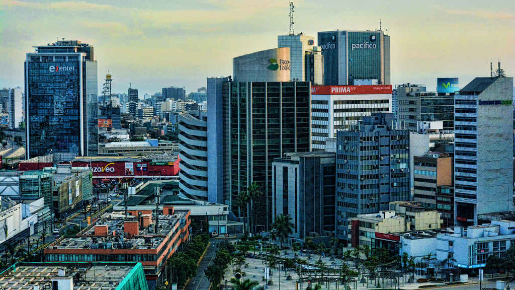
Vistas de Lima. Photo by Mariano Mantel; (CC BY-NC 2.0)
Lima

There are fewer longitude options, but some interesting ones here as well.

  • Canada: The line doesn’t cross any major cities, falling about halfway between Toronto and Ottawa. The largest town seems to be Pembroke, Ontario, home of the “Annual Pembroke Old Time Fiddle & Step Dancing Championships.”
  • The Bahamas: Marsh Harbour on Great Abaco falls along the line.
  • Cuba: It probably remains off the list for the foreseeable future even if some detractors call Arlington a Socialist Republic.
  • Jamaica: Now, that’s more like it; Ocho Rios would be the specific town.
  • Colombia
  • Ecuador
  • Peru: It runs right through Lima (map), which is rather impressive.

This is a game you can play at home too. Are there any remarkable lat/long Sister Cities for your hometown?


Posted

in

, , , ,

by

Comments

11 responses to “Better Sister Cities”

  1. The Basement Geographer Avatar

    There’s just one country sharing our longitude, the United States. Ruling out Spokane since it’s only 4.5 hours away, the line runs right through California’s Inland Empire, specifically San Dimas. Perhaps we could form a bond around the Bill & Ted movies? Yorba Linda, Orange, Santa Ana, and Irvine also sit on the line. There’s also Baker City, Oregon, which shares a somehwat similar history.

    Latitude, however, provides plenty of options:
    England: Plymouth
    France: Arras (appropriate given Canada’s role at the Battle of Arras in World War I)
    Belgium: Charleroi
    Germany: Koblenz, Frankfurt, Wiesbaden, Hof
    Czech Republic: Prague (natural given the high per-capita alcohol consumption here!)
    Poland: Silesian metropolitan area
    Ukraine: Right through the middle of Kyiv
    Russia: Kamyshin
    Mongolia: Darkhan
    Russia (again): Komsomolsk

    1. Twelve Mile Circle Avatar

      Strange things are afoot at the Circle K: I thought I was the only one who reflexively thought of Bill and Ted at the mention of San Dimas.

      1. The Basement Geographer Avatar

        I haven’t been able to look at a Circle K straight in twenty years.

  2. Phil Sites Avatar

    Looks like Arlington’s mirror opposite at 77.083685 E runs right near something called Mamuti Langan in China’s Xinjiang Province. I google searched and all I found was a pomegranate farmer named Mamuti from Langankule (further south, same province) – but maybe it has something to do with him, perhaps he can foster relations that lead to a sixth sister city?

    If you go 38.889922 S as well you’d run very close to Ile Saint-Paul – an uninhabited French Island.

  3. Kandice Avatar
    Kandice

    My hometown of Marietta, GA comes tantalizingly close to doing just this. One of Marietta’s two sister cities is Heredia, Costa Rica. The easternmost part of the city limits of Marietta extends to 84°30’W. Looking at Google Earth, the westernmost part of Heredia extends to about 84°8′ or so. I know people whose commute extends across these longitude lines here in Metro Atlanta, so I would say they meet the spirit of the criteria, if not the letter.

    Nothing really of note on the latitude line, it skirts to the south of Rabat and north of Beirut, it pierces Ube, Japan. Although not a city, it does slice through Joint Base Balad, aka Camp Anaconda in Iraq.

  4. AF Avatar
    AF

    How are you making the lat/lon lines?

    1. Twelve Mile Circle Avatar

      I went into “My Places” in Google Maps and created a quick map; then simply drew a couple of lines.

  5. Thias Avatar
    Thias

    The famous Welsh village of Llanfairpwllgwyngyllgogerychwyrndrobwllllantysiliogogogoch is a sister city of a french small town called… Y! Just one letter (pronounced like an ‘e’ for english-speakers).

    1. James D Avatar
      James D

      My favorite short-named French village is Eu, mainly because it is supremely ungooglable (to the point where they seriously considered renaming it). Oh, and there is a curious little song about its mayor by Jean Vatout, but the less said about that the better.

  6. Dave Avatar
    Dave

    All fairly inexact, but Houston, TX shares a longitude (95-30W) with Lake of the Woods and the Northwest Angle in Minnesota (that’s pretty cool if not a city) and a small town in Veracruz state, Mexico, called Isla (which despite its name, “Island,” is up in the mountains).
    Latitude gives more options: we share 29-45N with Gainesville, FL; Ningbo, China (not too far south of Shanghai); Chongqing, China; Shiraz, Iran; and the very southern edge of Cairo, Egypt.

    However, our real 17 sister cities are similar to us in that every one is a major port and/or a center for oil/gas/petrochemicals. http://www.sistercitiesofhouston.org/wp/?page_id=9

  7. James D Avatar
    James D

    I got some really fun results for my hometown (Cardiff, Wales: 51.48170, -3.17953).

    Longitude:

    Baltimore. No, not the Maryland city, but the village in Co Cork, Ireland.
    The northern tip of Newfoundland. My line actually passes a few miles south of L’Anse aux Meadows, but it’s near enough for me to claim it.
    The Manicouagan Crater, Quebec. (I know it’s not a city, but…) I’ve always thought that this is exactly what craters should look like. There’s part of me that would love to get a speedboat and do a couple of laps of the lake.
    The Banff National Park, Alberta. Once more it’s a not quite, but I’m claiming Lake Louise.
    Amchitka Island. Yes, the Aleutian islands dip down that far. And where the island chain crosses 180°E/W, that’s the latitude of Cardiff. And interestingly, Amchitka is where the USA carried out underground tests of nuclear bombs.
    Astana. My line misses all the cities in the former Eastern Bloc until it reaches Germany, but the nearest near miss is the capital of Kazakhstan, a few miles to the south.
    Halle an der Saale. A lovely historic city where George Friderich Handel spent the first 17 years of his life.
    Bochum. Because the Ruhr flows west, I could bag most of the cities along there, but I will choose Bochum, because I scored a direct hit on the Rathaus. As an aside, my line also crosses the Möhne Reservoir, but the less talk about direct hits there the better.
    Baarle. Although my line only crosses the Belgium-Netherlands border four times in this area, passing to the north of the exclavorama, this still deserves a mention.
    Kennington Oval, London. Now that would be an interesting trivia question: which test cricket venue is further north, the Oval or Sophia Gardens? They actually seem to be a dead heat.
    Pill, Somerset. The home port of the Avon pilots, who would guide ships up the gorge to Bristol.

    Latitude:

    Edinburgh. The Canongate Kirk, to be precise. So, yes, the Scottish Parliament Building is west of the Senedd. But only just.
    Roslin. The less said about the Holy Blood Holy Grail loonies the better. Much more interesting is the 1303 Battle of Roslin, about which Walter Bower wrote a largely fictional account.
    Hay-on-Wye. According to bookseller Richard Booth, Hay is independent.
    Guingamp. A small town in Brittany, noted for its three ruined castles.
    Guadalajara, Spain. This should be of architectural interest, given its mixed Christian and Islamic history.
    Timbuktu, Mali. This isn’t quite exact, but I couldn’t resist. And it *is* twinned with Hay-on-Wye, which I mentioned above.

Leave a Reply

Your email address will not be published. Required fields are marked *

Latest Comments

  1. Hi Mr. Howder — Just going from memory, I recall that your “rule” for counting a nation/state/county is “if I’m…

  2. Does anyone have actual music to the song – Tanaha ,Timpson. Bobo and Blair ?? It was recorded by Tex…