Loyal reader Ken has attended Burning Man a number of times and suggested I highlight some of the geographic quirks associated with it. He was even kind enough to provide the topics! I’ve never experienced Burning Man so I was grateful to begin this article with a pre-packaged outline. All of the ideas below came from Ken except for the last little tidbit. I simply took his suggestions and put them in different words along with a few graphics. It also took me a lot longer to get around to this than I would have hoped. I always appreciate reader suggestions although it takes me awhile to figure out how to include them sometimes.
What is Burning Man?
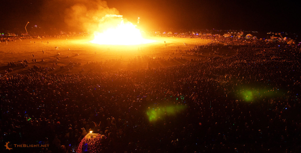
Well, it’s this (and so much more):

It’s a week-long gathering held annually on the Black Rock Desert playa in western Nevada (map). I’m not sure I can adequately describes what takes place there. Maybe 12MC attendees can post their recollections in the comments. I’ll simply borrow the description that Burning Man uses for itself.
“Once a year, tens of thousands of people gather in Nevada’s Black Rock Desert to create Black Rock City, a temporary metropolis dedicated to community, art, self-expression, and self-reliance. In this crucible of creativity, all are welcome.”
I did mention Burning Man in Twelve Mile Circle a couple of years ago. I said it could possibly serve as a modern proxy for the nineteenth century Camp Meeting phenomenon. The focus shifted away from religious devotion in its current incarnation although it still retained the desire of people to band together in community each year. In one new twist, it followed a “leave no trace” philosophy. Every artifact of Black Rock City must be removed at the conclusion of each festival.
Black Rock City

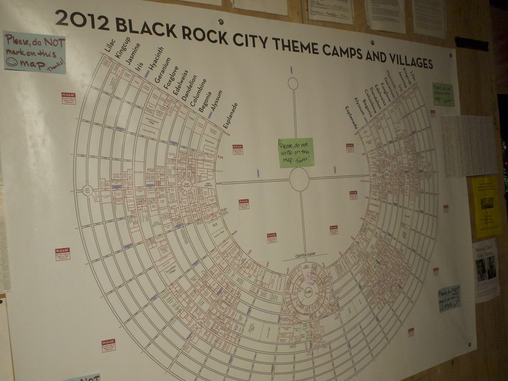
I wondered how I might describe the geographic layout of Black Rock City without a map because “Burning Man does not maintain a portfolio of ‘stock’ or PR images” with proper licensing. I figured a photograph of a map would constitute fair use. So that’s the route I took instead of borrowing the much better map on the Burning Man site that might possibly run astray of a copyright.
The layout seemed logical. Radial streets followed the pattern of an analog clock in fifteen minute increments. Circumference streets began with Esplanade closest to the center and then proceeded in alphabetical order outward from the center. The alphabet streets changed each year based on the chosen art theme. In 2015 they selected Arcade, Ballyhoo, Carny, Donniker, Ersatz, Freak Show, Geek, Hanky Pank, Illusion, Jolly, Kook and Laffing Sal, to fit the Carnival of Mirrors theme.
Finding someone in a crowd of tens of thousands would be a daunting task ordinarily. The layout simplified efforts. Let’s say, and I’ll pick something randomly from the 2015 Unofficial Map of Black Rock, someone wanted to visit her friend at Ganesh Camp. She would simply wander over to 3:30 & G(eek).
County Road Conundrum
The road leading up from Gerlach to Black Rock City, as Ken noted, was signed Washoe County Route 34. Nonetheless several miles of the road highlighted above — including the portion nearest Burning Man — strayed into Pershing County.
12MC had observed similar situations before such as New York stealing roads from its neighbors. It was nice to see another example albeit at the county level. I found a photograph that corroborated Ken’s recollection. I can’t reproduce it here because of its copyright notice although I could certainly link to it and let readers check it for themselves. Clearly this spot at the entrance to the festival was physically located in Pershing County and nonetheless signed Washoe.
Did Pershing contribute to road maintenance for the segment on its own side of the border? I don’t know. Washoe certainly had more financial resources, seeing how Reno was included within its borders. Washoe was a long, skinny county and CR34 connected its northern portions to the remainder. The road ran all the way from Gerlach up to the Oregon border, 120 miles, with only eight miles in Pershing. Additionally the Pershing portion didn’t serve anything in Pershing except for an ephemeral Black Rock City once a year. I thought Pershing might have a case for not paying for maintenance although I didn’t know that to be true.
Fly Geyser

The Fly Geyser was an interesting attraction along CR34, not too far removed from Black Rock City. Geothermal activity created the wild design and coloration. However, it wasn’t natural. People exploring for geothermal energy sources failed to plug a well either accidentally or intentionally. Hot water continued to spew to the surface, creating a geyser cone from dissolved minerals. The attraction appears from the road although the site isn’t open to the public anymore (map). It looked like something that would fit within Burning Man itself.
The FBI
Recent Freedom of Information Act requests confirmed that Federal Bureau of Investigation agents conducted surveillance on Burning Man for the last several years. Apparently they’ve tested some of their new toys there along with placing undercover agents amongst the guests to watch the happenings. Next year Ken can play “guess the FBI agent” as he wanders across the playa. Is it the lady meditating in the yurt or the dude twirling fire batons? Inquiring minds want to know.
Equally odd, think about it from the perspective of the FBI agents who get paid to attend Burning Man and blend in with the crowd. I bet they have a lot of volunteers.

Leave a Reply