This has absolutely nothing to do with the Grateful Dead although they were indeed from California and noted for Truckin’. It is literally about trucks in California. However, feel free to listen to Truckin’ in the background if that would make you happy.
So, it all started out more grandiosely. I recalled a particularly awful drive on Virginia’s Interstate 81 last November where it seemed like every other vehicle on the highway was a truck. Some were driving with extreme aggression and well above the posted speed limit. The rest were poking along well below the limit. Of course I grew increasingly aggravated as I slalomed in between them.
That incident later inspired an online quest to find a highway with the highest percentage of trucks primarily so I could forever avoid it. That effort continues. I haven’t given up that search. Meanwhile I do have an answer for California that I found. It’s a great page from the California Department of Transportation.
I was able to download a spreadsheet of annual average daily truck traffic in 2011 which I then sorted to determine all California state highways with more trucks than cars. Only a small handful of places throughout the state met that high standard. Imagine the nightmare of routes where more than half of all vehicles are trucks, not “seems like it” but genuinely so, consistently, day after day, forever.
Of course I plotted those offending locations. I found it fascinating that almost all of them happen near borders.
I examined each area and I tried to determine what might account for an overabundance of truck traffic, paying particular attention to apparent clusters.
Calexico/El Centro
The top spot went to Rt. 115 at its junction with Rt. 78 in Imperial County. Trucks composed an astounding 81.9% of recorded vehicle traffic passing this point in 2011. That is such an amazing statistical outlier — no other point in the California managed to crack even 60% — that I had to wonder if it might have been a typographical error. I checked the math and it seemed to work. Nearby, Route 98 at Cole Road in Calexico also scored high with 56.36% trucks.
All truck traffic crossing from Mexico into the United States along this particular stretch of the border uses the “Calexico East” Port of Entry. That might explain Route 98. I’m not sure it explains Rt. 115. It doesn’t seem to follow a logical path between the port of entry and the outside world. Farms and fields surround the junction. Maybe trucks address some sort of agricultural purpose here instead?
Los Angeles/Long Beach

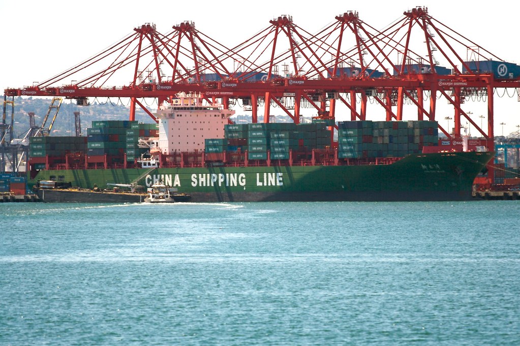
This one seemed more straightforward. The adjacent ports of Los Angeles and Long Beach are the two busiest container ports in the United States. Add their volume together and they handle three times the cargo of the next busiest port, New York/New Jersey.
Two spots nearby both hit 57.52% truck traffic, on Rt. 47 where it crosses the Commodore Heim Lift Bridge and shortly thereafter where Rts. 47 and 103 split. Notice their placement on a map. They are practically equidistant between two very active ports. A massive volume of containers heads in-and-out at any given time and this route serves as a good option. It’s a wonder the truck percentage wasn’t higher.
Maybe the brief stretch of Interstate 40 from Needles, California to the Arizona state line falls within this same cluster, even though it’s completely across the state? The highway provides a straight shot between the ports and several distant metropolitan areas including Flagstaff, Albuquerque, Amarillo and even Oklahoma City. The southeastern interior of California wouldn’t account for much local traffic, and containers originating in Asia would need to roll east in a steady stream to distant inland cities.
Bakersfield/McKittrick
I was going to guess that truck traffic near Bakersfield might be serving agricultural needs until I drilled-down to the exact spot. The junction of Rts. 58 and 33 happens in McKittrick, which falls outside of the fertile San Joaquin Valley. The terrain looked rather rough and pretty much dug-up by human activity. Thank goodness for Wikipedia and the likely explanation:
“The town is in the center of a large oil-producing region in western Kern County. Along State Route 33 to the south of the town is the Midway-Sunset Oil Field, the second-largest oil field in the contiguous United States; within the town itself, as well as to the west is the McKittrick Field; to the northwest is the huge Cymric Field; and along Highway 33 beyond Cymric is the large South Belridge Oil Field, run by Aera Energy LLC. East of McKittrick is Occidental Petroleum’s Elk Hills Field, formerly the U.S. Naval Petroleum Reserve.”
I don’t know if every truck passing through there serves the oil industry. However, it seems like a plausible reason for much of the 55.55% truck volume, absent further evidence.
National Forest
Of all roads with greater than 50% truck traffic, only Route 161 in Siskiyou County fell outside of southern California. It’s about as far away from the others as possible. The anomaly recorded 55.25% truck traffic at the far northern extreme of the state. There might be an agricultural reason for that because of nearby farms. There might also be another reason, forestry: Winema National Forest, Fremont National Forest, Modoc National Forest, Shasta National Forest and Klamath National Forest are nearby as are areas accessible to commercial logging. Maybe the trucks are hauling logs?

Leave a Reply