I recently recorded a question of amazing specificity, what I’d call a hyper-local geographic oddity that’s probably of interest only to a handful of people. Fortunately I’m one of those very few souls and maybe you are too. I’ll tie it in with a little history to widen the audience just a bit, so stick with it for a paragraph or two and see if it grows on you. It’s still an interesting exercise. Here’s the question, rephrased for clarity:
Where would the line between Northwest and Southwest Washington be, if Arlington and Alexandria hadn’t returned to Virginia?
I love this question — the history, the geography, the hometown appeal. That’s pretty much a trifecta for me. The shill who left this question behind in my web logs deserves a percentage of the cut. His check is in the mail.
History

First the history. Two points are germane to understanding and appreciating the question.
- The foundation of the District of Columbia traces back to the United States Constitution, Article 1 Section 8 as one of the Powers of Congress: “To exercise exclusive Legislation in all Cases whatsoever, over such District (not exceeding ten Miles square) as may, by Cession of particular States, and the Acceptance of Congress, become the Seat of the Government of the United States…” That’s exactly what happened. Ten miles square (i.e., ten miles on a side, not ten square miles) came from land located formerly in Maryland and Virginia. The District filled a perfect diamond shape set upon the Potomac River.
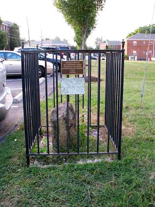
- The portion of the District formerly belonging to Virginia returned to Virginia in 1847, an action called retrocession. I won’t go into further detail here except to skewer some local mythology and folklore once again. It had nothing to do with the Government thinking they would never need that much land. It was a two-punch combo of issues related to the economy and to slavery specifically. Even though Virginia regained the land, there are still many of the ancient, original Washington, DC boundary stones on the Virginia side of the river today.
Quadrants
Next, it’s useful to understand that the District of Columbia is split into quadrants: northeast; northwest; southeast; southwest. The dividing lines radiate from the center of the United States Capitol dome but they are not of equal sizes because the Capital wasn’t placed in the center of the city. Southwest is particularly diminutive.
![USGS, modified by User:Postdlf [Public domain] via Wikimedia Commons](https://upload.wikimedia.org/wikipedia/commons/d/d7/DC_satellite_image.jpg)
Let’s draw some lines and answer the question. I’ve prepared a map that shows the original pre-1847 boundaries of the District of Columbia. The North-South quadrant line isn’t exactly straight but it’s irrelevant to the question so I haven’t included it. The East-West line is indeed straight so I’ve simply extended it across the Potomac River and into Virginia.
Southwest Washington would be one of the largest quadrants rather than the absolute smallest if only the Federal government hadn’t returned the land to Virginia.
Most of you can tune out now. Those of you who know the area well — and I do know there are some regular readers that fit into that category — might actually have an interest in some of the neighborhoods that fall within either side of that fictional line.
Drill down and take a closeup of a portion of the Rosslyn-Ballston corridor. The underground portion of the Metro’s Orange Line runs right through the area and has helped revitalize it over the last couple of decades. It looks like Rosslyn and Courthouse would be in the fictional Northwest while Clarendon and Ballston would be in fictional Southwest.

Leave a Reply