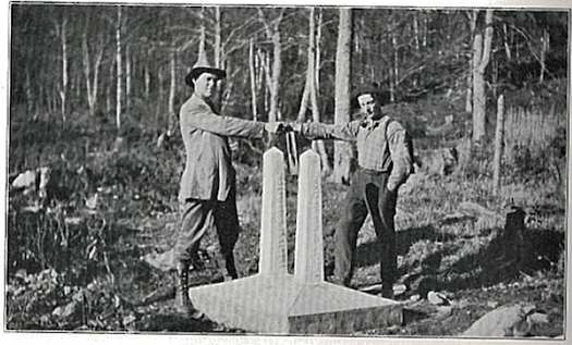
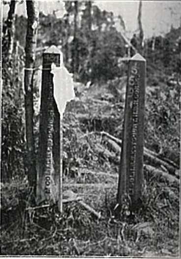
I wrote recently about the many thousands of tiny segments that form the boundary between Canada and the United States. Fittingly, I called the article Canada-USA Border Segment Extremes. I’d been following up on a query from loyal reader “Greg”. Back then he asked if I knew where he could find the shortest of those segments. He’d seen a reference to two monuments only 46 centimetres (18 inches) apart when he read the International Boundary Commission website. Unfortunately I didn’t know the location.
As an intellectual exercise, I loaded all of the boundary coordinates into a spreadsheet. Then I attempted to derive the answer mathematically. It wasn’t exact but I felt I’d narrowed the location down to two distinct clusters. I said at the time that, “I’m going to guess the 46 centimeter distance between two monuments falls within the eastern cluster”. It turns out I was correct but it was a lucky guess.
Here is the map I developed during that earlier attempt:
A Better Method
Greg took a more direct approach. He simply contacted someone on the International Joint Commission of Canada and the United States. It included contact information on its website so it was easy. They do have a different purpose than the International Boundary Commission. Nonetheless, they still have a keen interest in the physical placement of the border:
“Canada and the United States created the International Joint Commission because they recognized that each country is affected by the other’s actions in lake and river systems along the border. The two countries cooperate to manage these waters wisely and to protect them for the benefit of today’s citizens and future generations.”
Monument 484
Greg struck gold. The Commission wrote back and identified Monument 484, often called the “Double Monument”. I looked it up and this corresponds to a single combined monument of that number in the Highlands data set at N 45° 15.168, W 071° 12.291. Thus, my mathematical calculation never would have found the right answer. The data set considered it a single entity!
Google Streetview stopped maybe a hundred metres from the monument on the US side of the boundary; otherwise I’d have a great image for you. However, the border appears visibly through the path of cleared vegetation (image). The double monument is located right along the roadside at a small pullout between the two border stations. It appears as a dot.
This route looks to be the primary border crossing, maybe the only crossing, between Québec (where it’s Route 257) and New Hampshire (where it’s US Route 3 – Daniel Webster Highway). The monument should be easy to find. Hiking through miles of forest will not be necessary. This is the kind of lazy geo-oddity that I enjoy. It means I might actually visit it someday.
History

Greg’s source provided a copy of a page from a book which included a couple of vintage photographs of the double monument. I don’t have the exact citation, just the single page. However, the top of the page reads: “SEASON OF 1916 — THE HIGHLANDS” and lists it as page 69. Greg did some more digging and believes it may be the “Joint report upon the survey and demarcation of the boundary between the United States and Canada from the source of the St. Croix River to the St. Lawrence River….” published in 1925 by the International Boundary Commission. That sounds about right.

I also found the double monument in The Official Global GPS Cache Hunt Site which included information provided by people who have visited the Double Monument in person. There are some modern photographs along with the same two vintage photos I’ve posted here. It’s amazing how easy it was to find on the Intertubes once we knew it had a name.
There seem to be several stories purporting to explain the unusual nature of the double monument. I think I’ll go with the one that Greg got from the official source: “Two monuments were set 18 inches apart to mark an astronomic station from the survey of 1845. When the boundary was being retraced and they were found in the early 1900’s they were local landmarks and were reset in the same base.”
Thanks, Greg!

Leave a Reply