I failed to mention a specific Milwaukee example in the recent I Before E Like in Milwaukie article. That was intentional. I noticed a rather unusual reference included within the Geographic Names Information System that deserved further observation. This one featured two adjoining neighborhoods.
They had the dubious distinction of sharing a name with a rather unpleasant beer that I’ve done my best to avoid since my college days.
Old Milwaukee East Colonia and Old Milwaukee West Colonia borrowed from the road of the same name nearby. The situation was unlike, say, the Old Milwaukee Lane in Winston-Salem, North Carolina. That’s where Rexam Beverage Can Americas runs a factory. So I’m sure the Laredo reference was coincidental. Someone from Wisconsin probably lived near the border in decades past and the name stuck.
Along the Border
What was a Colonia, though? The literal Spanish translation meant colony, although it could also represent community, neighborhood or settlement more generally. However it had a very specific context in the southern United States borderlands. The Texas Secretary of State defined it as, “a residential area along the Texas-Mexico border that may lack some of the most basic living necessities, such as potable water and sewer systems, electricity, paved roads, and safe and sanitary housing.” The source provided additional statistics [link no longer works]:
“Colonias can be found in Texas, New Mexico, Arizona and California, but Texas has both the largest number of colonias and the largest colonia population. Approximately 400,000 Texans live in colonias. Overall, the colonia population is predominately Hispanic; 64.4 percent of all colonia residents and 85 percent of those residents under 18 were born in the United States. There are more than 2,294 Texas colonias, located primarily along the state’s 1,248 mile border with Mexico.”
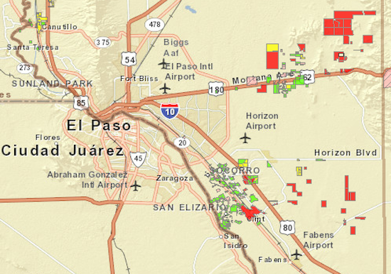
The Attorney General of Texas provided a handy interactive map.

Development
Developers built Colonias in a predominantly predatory manner beginning in the mid-20th Century. People with little income needed places to live. So speculators sold them undesirable scrub lands with little to no zoning or infrastructure at bargain prices. However, purchasers often couldn’t obtain ordinary loans from banks because of their unreliable incomes. So the owners sold plots to them in “contract for deed,” arrangements, i.e., rent-to-own. People wouldn’t own the land until they paid every monthly installment to the speculator.
Residents didn’t generally build their homes all at one time either. They built as they could when they had enough money to afford it. Maybe the foundation one year, then the framing and the roof, then later walls and interior work, all over a period of several years while living on the site the entire time. Structures appeared ramshackled in various stages of completion. Maybe they included plumbing or electricity or maybe not, or maybe eventually.
It was an arrangement that seemed to work in an unusual sense. Speculators made tidy sums on rent-to-own arrangements. Residents got a place they could call their own. They could improve it over time, and generally free of pesky building regulations and government oversight. None of that erased the grinding poverty of many residents though. Nor did it resolve the lack of basic necessities within numerous Colonias.
An Example
The interactive map contained color coding as defined by the state. Red was the worst, equating to “Lack access to potable water, adequate wastewater disposal or are un-platted — greatest public health risk.”

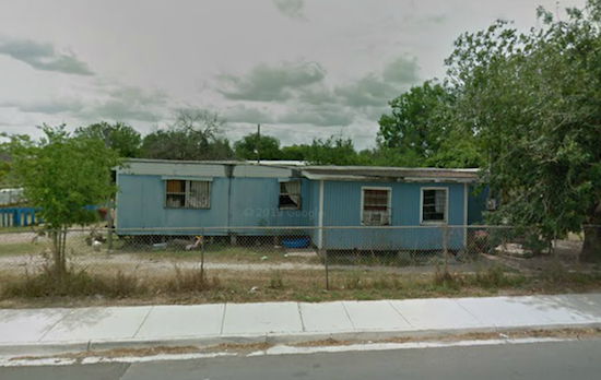
Cameron Park near Brownsville, Texas became a negative example of a Colonia. Multiple sources identified its numerous problems, along a derelict stretch of Spoil Banks Ditch. According to the United States Census Bureau, Cameron Park had a Hispanic/Latino population of 99.3%, a median household income of $24,851 per year, and a distressing 52.8% of residents living below the poverty line.
Wikipedia claimed, “Cameron Park is the poorest community of its size or larger in the United States, and is among the 100 poorest places in the United States”. Yet, Cameron Park was yellow on the interactive map, leading one to wonder how much worse conditions might get in places listed red.
Reform?
Colonias have attracted significant academic, media and government attention in recent years. Texas A&M University founded a Colonias Program to study issues and develop solutions. Major publications including the New York Times and CNN featured both problems and potential. The US Department of Housing and Urban Development created several programs, as did other Federal agencies such as the US Department of Agriculture. So did individual states along the border.

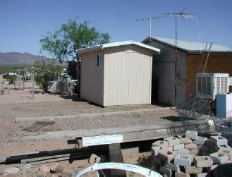
For example, the image above showed a modular bathroom built by the USDA’s Rural Development agency. This was for a Colonia in southern Arizona on land of the Tohono O’odham Nation. Lack of plumbing is an issue for all disadvantaged people along the border. The Tohono O’odham Nation, some readers may recall, last appeared on 12MC in Overheard in Mexico.
Fortunately the situation of Colonias has been improving slowly in recent years. Still, there is still a long way to go.
Colonia, New Jersey
The community of Colonia, New Jersey appeared to be completely unrelated, just an instance of an unfortunate coincidental name.

Leave a Reply