A strange alignment revealed itself as I planned my cross-country trip. I used the same basic set of assumptions for each of the four potential routes. First I divided the total driving duration by five to come up with approximately equal days on the road. That would average about seven hours of driving each day plus whatever time we wanted to spend on meals or sightseeing. Second, I wanted to be economical so I looked for hotel clusters on the outskirts of cities, maybe 25-50 miles from an urban core along an Interstate highway. Hotels would be less expensive there. Also, if I chose the western side I wouldn’t have to drive through a city’s rush hour the following morning.
I noticed a coincidence as I settled on potential stopping points for the third night. The northern and middle routes pointed towards a town called Weatherford. The mid-southern and southern routes did the same. However, one Weatherford was in Oklahoma and the other one was in Texas. Weatherford didn’t seem like all that common of a name. Maybe if they were both called something like Springfield, a name so common that the Simpsons adopted it, I could believe it. Could there be a connection between those two Weatherford places on the Southern Plains?
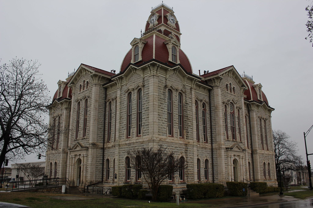
Weatherford, Texas
We actually stopped at Weatherford, Texas and I’ll get to that story in a future episode. Located due west of Dallas–Fort Worth by about a half-hour, it retained a lot of large town amenities without being truly urban. I guess it could be called an exurb, or an outer-suburb. Weatherford’s growth in recent decades certainly suggested such with about 25,000 residents and climbing. Even so it began much more modestly and remained that way for its first century until the outer bands of Fort Worth began to lap at its shores.
Thank goodness for the Texas State Historical Society’s Handbook of Texas, one of my favorite sources. Naturally it included an article on Weatherford.
Settlers of European descent didn’t move into the area until the 1850’s. That happened well after Texas had already split from Mexico, declared independence and subsequently joined the United States. As the new arrivals filled the blank parts of Texas the state needed to create new units at the local level and establish governance. Of course, these new places also needed names.
In 1855, two members of the Texas State Legislature coauthored legislation to establish a new county west of Fort Worth. Their names transferred to the geography the following year when the legislation went into effect. State Representative Isaac Parker stamped his name upon Parker County. State Senator Jefferson Weatherford did the same on Weatherford, which became the local seat of government for Parker County.
Senator Weatherford
Senator Weatherford didn’t do much else with his political career. He supported secession during the Civil War as did most people from the area. He was reelected a couple more times representing his constituents in Dallas County, and he passed away in 1867.
People have tried to find his grave in recent years. I don’t know why but they have. Supposedly his final resting place exists somewhere within the family cemetery of his wife, now on private property. Nonetheless, a stone with his name cannot be located in contrast to his name plastered practically everywhere across a decently sized town in Texas. Ironically, his one simple act as a Texas legislator served as his lasting memorial.
Weatherford, Oklahoma
Weatherford, Oklahoma began with modest roots like its similarly-named counterpart in Texas. However it fell farther west of a major urban area (in this case Oklahoma City) so it didn’t benefit from the same kind of boom. Only about ten thousand people live there today. Nonetheless it attracted Southwestern Oklahoma State University as well as the Stafford Air & Space Museum. Also historically, the iconic Route 66 ran directly down its main street. I almost wish I’d had a chance to stop in this Weatherford. Maybe someday.
Oklahoma also had a historical society and its website included an article about their Weatherford.
The United States government set aside the entire area as a reservation for the Cheyenne and Arapaho tribes in 1869. Similar to what happened in other sections of Oklahoma, the government made the land available to outsiders a couple of decades later. Here, homesteaders spilled into the territory in a land rush called the Cheyenne-Arapaho Opening of 1892. Towns sprang up instantly.
One town began to coalesce near the recently-established homestead of William and Lorinda Weatherford. She became the local postmaster and I guess she got to name the post office. The new town needed postal services and her setup stood only two miles up the road. The town’s mail went through Weatherford’s post office so the town adopted the family name.
William and Lorinda Weatherford
Here again, I wanted to look beyond the name of the town and gaze upon the namesakes instead. As it turned out, Lorinda lived until 1919 and William lived until 1925. They remained rather obscure except for having a town named for them. On the other hand, how many of us can say we’ve accomplished even that? The best my family ever got was a three-block street in Hillsdale, Michigan.
Conclusion
Well, I guess the occurrence of two towns named Weatherford led back to a simple coincidence. I couldn’t find any sort of relationship between the people or the places. Even so I still enjoyed checking into their histories. It reminded me of a typical Twelve Mile Circle article from back in the day.
Articles in the Cross-Country Series:
- The Plot Thickens
- Weatherford Art Thou?
- County Counting
- Zoos & Brews
- The Eastern Half
- The Western Half
- A Week in Phoenix
- Bonus!
See Also: The Complete Photo Album on Flickr


Leave a Reply