The Dayton trip came to an end but I still had a bunch of stuff to talk about that didn’t fit into any of the earlier articles. Naturally I’ve collected them all together within this final compilation to serve as a wrap-up. Then we can call this one done and move onto the next travel topic.
Into the Fog

I mentioned before that we were pretty lucky with the weather overall but it was a little on the chilly side. Winter didn’t seem to want to let go of its last frosty grip. The first half of the drive to Ohio proved particularly daunting which is why I grabbed a beer as soon as we arrived.
It began with a cold, steady rain as we left Virginia that lasted through the mountains of western Maryland and into West Virginia, finally clearing up around Morgantown. A lot of the drive involved a white-knuckle grasp on a particularly technical route, with heavy traffic over curvy roads. The worst came along Interstate 68 as Maryland gave way to West Virginia. We added a dense fog to the misery along this stretch.
The West Virginia Welcome Center near Bruceton Mills (map) hardly seemed welcoming, and barely discernible even at mid-day. By that time I needed a mental break to prepare for the rest of the drive. Visibility approached zero along these mountaintop stretches and driving speeds dropped to a crawl.
2nd Street Market
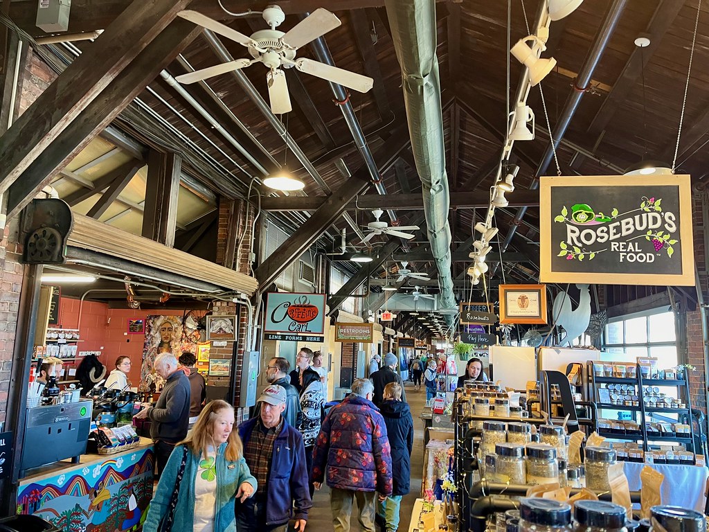
I referenced Dayton’s Second Street Market (map) in the previous article, and I stressed that it’s worth putting on any travel itinerary within proximity. It’s operated by Five Rivers MetroParks (Dayton’s regional park system), where “local growers, bakers, culinary specialists and artisans fill this charming historical freight house.” Nonetheless, a visit to the market requires some diligence and planning because of its limited hours. I promise it’s worth the effort.
A long, narrow hallway offers nooks for dozens of vendor stalls, with an array of visual delights and enticing aromas. We slowly made our way back-and-forth down the length of the former warehouse a couple of times, stopping frequently along the way.
Eastwood MetroPark
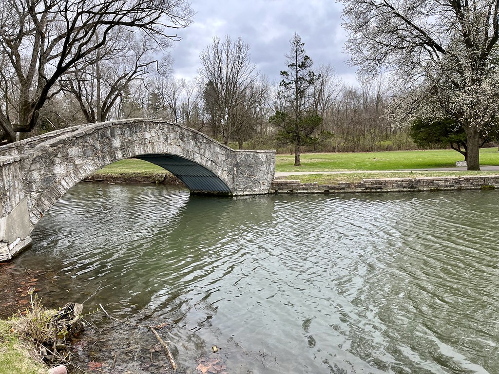
I like to run at least a couple of times every week even while I’m away from home. Naturally, that means I have to find a suitable location in an unfamiliar area. So I scour online maps for large parks with plenty of paved trails because I don’t know the roads well enough to tell what’s safe. That’s how I discovered Eastwood MetroPark on the eastern side of Dayton (map).
The park straddles both sides of the Mad River, and in fact it includes artificial lakes presumably fed by the river. Many of its amenities cater to boating or fishing, plus a golf course. But I was there to run and I found a lot of options. I could have run all the way to downtown Dayton and beyond if I wanted to, but I chose to take a shorter out-and-back in both directions along the river. The view got a little industrial the closer I got to downtown so I turned back and went the other way for awhile. For me it was all about the scenery.
Eclipse
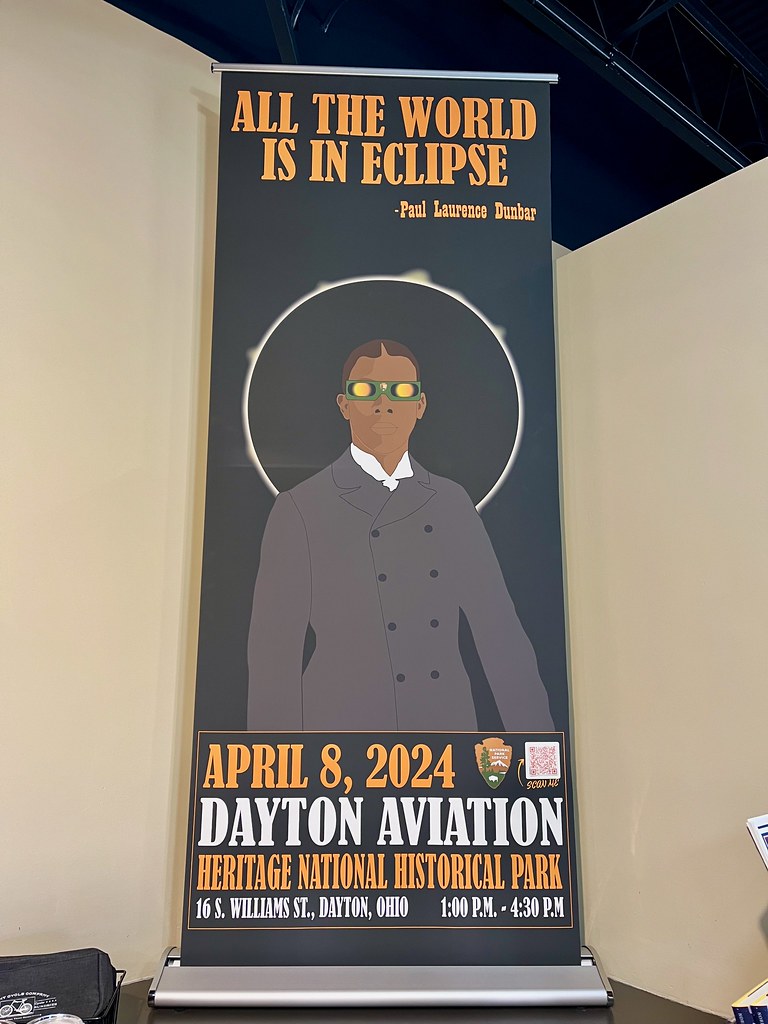
We were deep within the path of totality for the April 8, 2024 eclipse that crossed a big chunk of North America. Unfortunately were left on March 29. So in effect we got to see lots of advertisements for every town, school, business, etc., that planned to celebrate a rare celestial event we wouldn’t experience. What a bummer. I really wanted to be there especially after the untimely thunderstorm that ruined my total eclipse experience in Charleston, South Carolina back in 2017. I felt like I deserved a do-over.
But the world had other designs for me. First my plans to see the eclipse in Texas fell through. Then I learned that I had to go to Germany for work and and entire ocean would separate me from the eclipse zone. I felt a little jealous when a loyal Twelve Mile Circle reader went to the Indiana Highpoint at Hoosier Hill (where I stood a few days earlier) and experienced totality.
Is anyone interested in a meetup in Sydney, Australia for the July 22, 2028 eclipse, perhaps? It’s never too early to plan.
Smith Covered Bridge
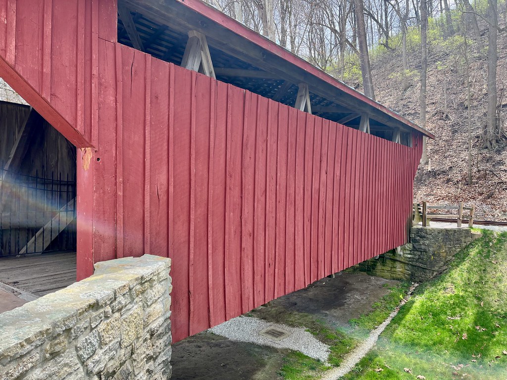
I’d already seen a bunch of covered bridges during the trip but apparently I wasn’t done yet. I found another one at the Carillon Historical Park in Dayton even when I wasn’t looking. It arrived there along with many other vintage structures as the park compiled its collection. Dating to 1870, the Smith Covered Bridge once crossed Little Sugar Creek near Bellbrook, Ohio. Originally it stood about a dozen miles southeast of its present location. However, I bet a lot more people see it at Carillon than at some rural crossing.
Minion

We came across this folk art Minion created from various tanks welded together while we drove past a light industrial area (map). Please pardon the photo quality. Unfortunately this was the best we could do on short notice from inside a moving vehicle.
Only after the fact did I discover that Roadside America already featured it and provided a much better photograph. Even the StreetView image was better. But I get points for trying, right?
Dead End at Night
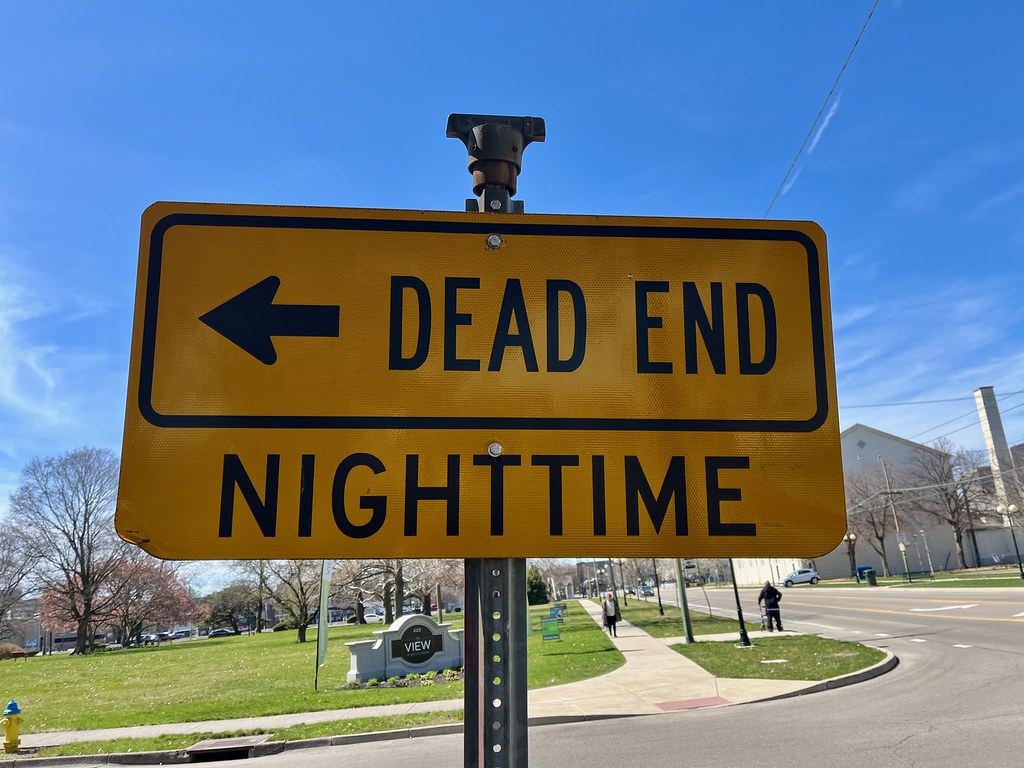
I’ll finish with this enigmatic street sign (map) since we have arrived at the Dead End of the Dayton travel series. I guess it confused me more than anything. So, if I’m interpreting this correctly, they close a gate when it gets dark? I’m not sure why they do that but it does run through an apartment complex. Maybe they had trouble with people speeding through at night or something.
I like weird signs so I’ll allow it.
Articles in the Dayton, Ohio Series
See Also: The Complete Photo Album on Flickr

Leave a Reply