The race series moved on to Colorado next. We’d intended to check into our hotel room in Lamar and sit by the pool, using that as an opportunity for our sole afternoon of rest. The hotel must have been busy the previous evening because our room wouldn’t be available for another three hours. We needed to find a way to fill the afternoon constructively. We consulted a map and noticed a national historic site about an hour away.
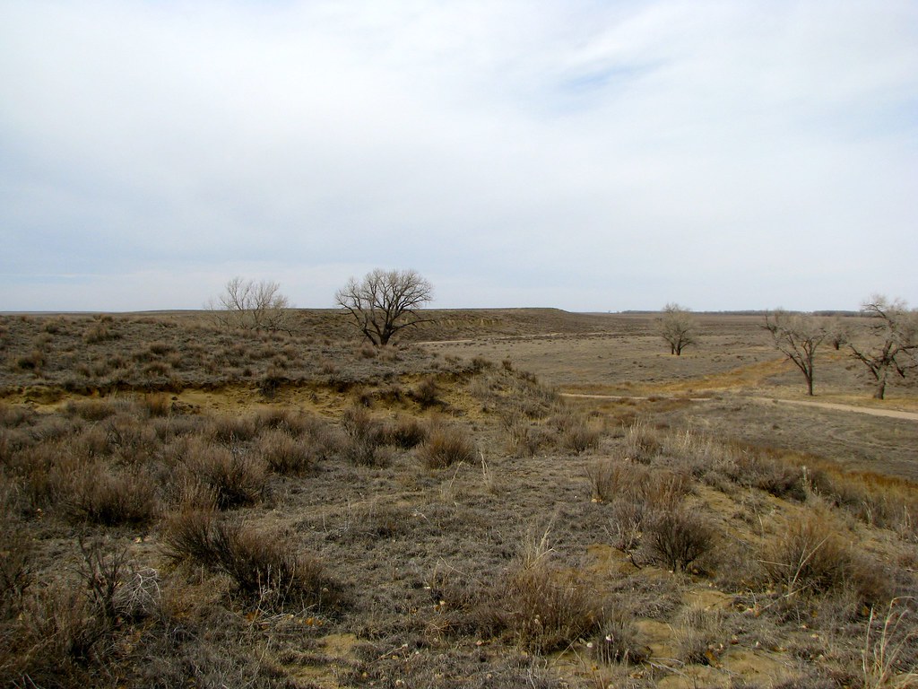
Sand Creek Massacre National Historic Site
I’d remembered hearing about the Sand Creek Massacre vaguely from history classes decades before. The site of the massacre was now one of the National Park Service’s newest properties, gaining official status in 2007. So we decided to drive up to it.
Bands of Cheyenne and Arapaho Indians established a camp along Sand Creek in November 1864. It was an ideal spot with abundant water, plenty of food, and set within a safe floodplain protected from the constant prairie winds. The camp stretched about a mile along the lower-elevated portion of the satellite image, above.
It was a friendly tribal gathering that had reported to a nearby fort on a mission of peace before establishing camp. Most of their warriors, completely assured of their safety, went onto the plains to hunt for bison. They left behind a gathering of mostly unarmed women, children and the elderly. U.S. troops under the command of Colonel John Chivington swept down on the encampment, ignored both a U.S. flag and a white flag of surrender hoisted by the tribes, and slaughtered an estimated 165 to 200 people without provocation.

The massacre receive widespread attention only because two of the U.S. officers refused orders and stood down their troops. Their complaints eventually reached all the way to the United States Congress which ordered an investigation, and which eventually condemned Chivington’s actions. Nonetheless, nobody was ever held accountable. Sand Creek became a turning point in the relationship between the U.S. government and the Plains Indians. There was “before Sand Creek” and “after Sand Creek.” Warfare on the plains would last another quarter-century as a result.
The Sand Creek Massacre site has a powerful emotional impact upon those who visit. It marks an ugly, scary part of American history that deserves to be remembered.
Dinosaurs!

We moved on to New Mexico the next day. The fifth and final race took place at Clayton Lake State Park the following morning. I’d seen Sauropod dinosaur tracks earlier on the trip at Black Mesa in Oklahoma. Those were a tad disappointing, honestly, a single line of tracks filled with sand and hard to discern even with exact coordinates in hand. (satellite view).
I’d heard about a much better set of tracks at Clayton Lake. Those were completely different from Black Mesa, with hundreds of tracks left behind by at least eight different dinosaur species, primarily varieties of plant-eating Iguanodonts. My photo represented only a small corner of a wide field of tracks. Unfortunately the location is totally washed out in satellite view. [October 2020 update – they can be see clearly in the current image; check out that link!]
Capulin Volcano
I’d put out a plea to the 12MC community before I left on my trip, asking for suggestions and recommendations for further adventures. Loyal reader Mike Lowe suggested Capulin Volcano National Monument. I’d never heard of it before although I noticed it was directly on our route and decided to add it to our itinerary.

I’m glad we stopped. A road corkscrewed around the volcano exterior to the lowest point of the rim. From there, one could park and then venture around the rim on a one-mile hike. The views were stunning.
Thank you, Mike!
Taos
Finally, with all of the races behind us, we ventured out on our own for a couple of days. We made it as far west as Taos, New Mexico the following day.

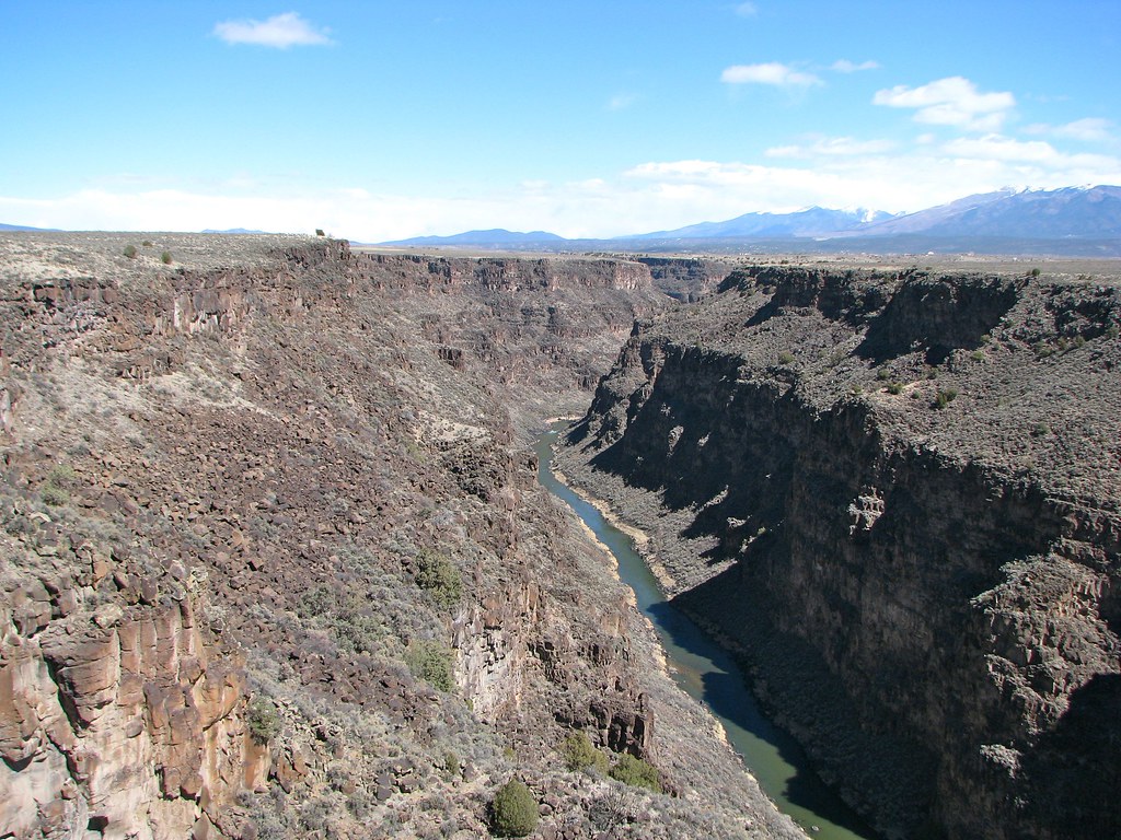
As featured in a previous article, the Rio Grande River doesn’t simply form a border between Texas and Mexico. It originates deeper within the United States and slices all the way through New Mexico before heading down to Texas. This includes a spectacular gorge west of Taos (map) best viewed from the Rio Grande Gorge Bridge. Here one can stand hundreds of feet above the river as it passes through the canyon that it dug into the solid stone of the valley floor.
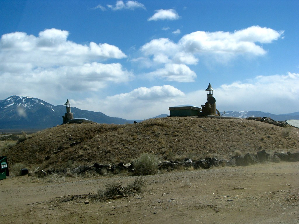
We also stopped at the Greater World Earthship Community nearby.

This was an unusual housing development constructed by Earthship Biotechture. Houses are self-sustaining and built of discarded materials such as automobile tires, glass bottles and aluminum cans. Many of them were above-ground although I liked the one in this photo the best. It reminded me of the fictional home of Luke Skywalker on Tatooine.
I have one more wrap-up article on the Dust Bowl Adventure and then I’ll return to the normal diet of geo-oddities.

Leave a Reply