Our family visits a different part of the United States every summer. This year we decided to travel through northern New Mexico and southern Colorado. We made it as far west as the Four Corners monument although we we spent only a few moments in Utah and Arizona. We toured through parts of Utah back in 2011. Arizona will need to wait for another day.
The embedded map showed our approximate route. We began our adventure at the Denver International Airport where we landed and rented a car. From there we drove down to Angel Fire, a ski resort town in New Mexico where I have family. That offered a nice base for a return trip to Taos, a place I last visited in 2013 during the Dust Bowl adventure.
The next swing included a series of National Park properties: Pecos National Historical Park; Bandelier National Monument; Chaco Culture National Historical Park; and Mesa Verde National Park. We also spent time in towns along the way including Santa Fe, Los Alamos and Durango. Then we drove back to Denver.
We packed a lot of activities into those ten days. From mountains to desert, from cold to warm, from historic to modern, we tried a little of just about everything. I didn’t capture many new counties on this trip though, for a couple of reasons. First, the immense size of counties out there made it difficult, although each capture covered a lot of territory on the map too. Second, I’d been to several of the places before. This was more about visiting friends and family, and showing the kids places I loved seeing during an epic road trip I took a quarter century earlier. Even so, I still found time for a few county captures, some under interesting circumstances
Pecos Subterfuge

The path from Angel Fire to Santa Fe, New Mexico would ordinarily go through Taos and enter Santa Fe from the north. I didn’t want to do that. I wanted to capture a couple of new counties by traveling along the eastern flank of the Sangre de Cristo Mountains, then loop back to Santa Fe from the south. That inefficient route led directly past Pecos National Historical Park. I used the park as my excuse. We enjoyed Pecos — and I’ll talk about that some more in a future article — although the actual reason focused squarely on the new counties, Mora and San Miguel.
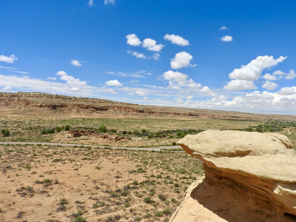
The park fell within San Miguel and the photograph above gave a nice overview of its terrain. Each afternoon the “monsoon” rains of summer covered the plains. Mora County looked similar, maybe a little greener, with an economy seemingly based on ranching. I didn’t see a lot of wealth in sparsely-populated Mora.
At one point we drove through its county seat, also called Mora, and the speed limit dropped down to 15 miles per hour (24 kph). You better believe I didn’t go a single mile per hour over that limit. It seemed like one of those places where speeding tickets probably funded the few public services that existed out there. I admit I had no evidence of that and perhaps I’ve made an unfair assessment. But I didn’t risk it either.
Let’s Make Sure at Los Alamos

I’d marked New Mexico’s smallest county, Los Alamos, as one I’d visited previously. Los Alamos made my tally many years ago during that previously-referenced epic road trip. However, I’ve since doubted that I actually captured it. No major roads between popular destinations cut through there. That was by design. Los Alamos served as a secret hideaway for scientists designing atomic bombs during World War 2. Nobody was supposed to travel to Los Alamos without a specific reason for being there.
The county, established formally in 1949, covered barely a hundred square miles (250 square km). I simply couldn’t see how I’d crossed its borders on that earlier trip. Why had I concluded otherwise so many years ago? This time I made sure to record my visit photographically for the sake of accuracy and completeness. It didn’t “count” as a new capture even if that might have actually been the case.
Giving William McKinley His Due

My exceedingly brief visit to McKinley County, New Mexico probably set a record for my most absurd county capture ever. It also became another exceedingly rare example of a “walk only” county like my recent visit to Cass County, Michigan.
McKinley happened during my trip to Chaco Culture National Historical Park. Nothing was easy about getting to Chaco Canyon. The National Park Service recommended the northern route that involved about 16 miles of mostly decent dirt and gravel roads. I took that route. Visitors could also approach from the south with about 20 miles of “at your own risk” dirt roads. The southern route, if I’d been more adventurous, would have brought me through McKinley County.
However, I noticed that I could head south from the Visitor Center, go a couple of miles along the southern dirt path, and reach McKinley. I decided to touch McKenly at its closest point, where the road ran directly along the county line. I simply needed to stop the car and touch a point of land just beyond the roadside (map). A barbed wire fence ran along there too, so I put my foot beneath the strands of wire. Then I gently patted the ground with my foot. County captured.
Colorado Backcountry

Actually I captured most of my new counties on a single day. We drove from Durango to Denver using the default route. We had some friends to visit in Denver so I didn’t want to go out of the way. Even so, that brought me through Archuleta, Mineral, Rio Grande, Saguache, Chaffee, and Park Counties for the first time.
Driving through Saguache offered particularly remarkable scenery. Much of the county sat in humongous bowl surrounded by mountains on all sides. Amazingly flat, filled with fertile fields, and yet the wide plain sat at an elevation of something like 8,000 feet (2,400 metres).
Park County also offered a little entertainment, if only as the setting of the South Park cartoon. That included a drive through Fairplay (map), the inspiration for the quiet mountain town where Stan, Kyle, Kenny and Cartman live.
Nine (possibly ten) new county captures didn’t seem like a lot from a numerical perspective. Nonetheless, we covered quite a bit of territory and had a great time doing it.
Articles in the Four Corners Series
See Also: The Complete Photo Album on Flickr

Leave a Reply