While the great outdoors flavored many of our decisions across northern New Mexico and southern Colorado, we also spent some time in “civilization” too. I tied to stay at least two nights in each place to create a little mental anchor. Otherwise we’d feel adrift in a vagabond existence. That offered time to explore a few towns along the way to complement amazing National Park Service properties. Nothing here should be confused with a comprehensive city guide. Sometimes we did the tourist thing and sometimes we avoided it. Twelve Mile Circle doesn’t necessarily cling to conventions.
Santa Fe

Santa Fe fell along our direct route. I figured we needed to stay near its historic Plaza (map) rather than a generic chain hotel out by the highway. I don’t mind cookie-cutter hotels ordinarily. It’s just a bed. However, Santa Fe always seemed to be one of those magical places best experienced in person. We needed to nestle near the action, an obvious choice for an extraordinary location.
The Santa Fe Plaza dated back to its earliest days as a Spanish outpost at the farthest reaches of the colonial empire. Don Pedro de Peralta served as governor of New Mexico and founded Santa Fe in 1610. Consider that for a moment. At that same time England barely maintained and nearly lost a foothold on the Atlantic coast at Jamestown. Meanwhile, the Spanish pushed their domain deep into the North American interior.
Santa Fe began as a walled fort to tame New Mexico and protect the Governor’s authority. The Plaza occupied a central space within that original fort. Santa Fe remained tremendously important continuously thereafter, with roads such as the El Camino Real and Santa Fe trail terminating here. It became and remained a capital city for much of its existence, and seemed a natural choice for the capital of the U.S. state of New Mexico upon its formation. Albuquerque grew larger although Santa Fe never ceded its crown.
The Plaza didn’t disappoint either. Pueblo-inspired architecture ringed the perimeter, filled with art galleries and jewelry stores that typified Santa Fe. We didn’t buy anything. We’re cheap. I enjoyed people-watching though. A row of stalls staffed by Native Americans selling traditional crafts defined its northern edge. Buskers of all types filled the square, my favorite being the men beating drums rhythmically accompanied by chants in traditional languages as sundown approached.
Los Alamos

Los Alamos offered a complete contrast to Santa Fe. It didn’t exist before the Second World War. Even today only twelve thousand people lived there, many associated in some manner with the nearby National Laboratory. Everything seemed sleek and modern. No patina of age appeared on buildings, streets or landscapes.
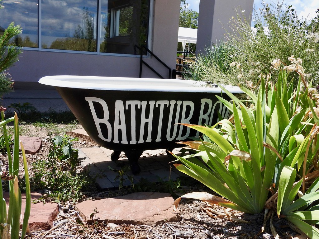
We didn’t stay overnight in Los Alamos although we stopped for lunch and toured the Bradbury Science Museum. There we saw artifacts from the Manhattan Project and replicas of the atomic bombs created in Los Alamos during the war. We also saw a curiously-named byway in the heart of town, Bathtub Row (map).
The United States government needed a remote, secret location to develop its atomic bomb. New Mexico met the criteria so the government seized the campus of the Los Alamos Ranch School. The most important scientists working on the Manhattan Project occupied homes on the vacated campus that once held the school’s teachers and administrators. Everyone else — the vast preponderance of workers — lived in temporary shacks or barracks. Only the original homes had bathtubs. Everyone else used showers. Bathtub Row became a shorthand for the the street where all of the bigwigs lived.
Durango

Durango seemed like a bit of a tourist town although we enjoyed it anyway. Once again, staying at a central location at the heart of town seemed to be the best alternative for us. Most of the action lined a half-mile stretch of Main Avenue east of the Animas River (map).
Imagine a stereotypical “Western” town straight out of the old movies and that pretty much described Durango’s appearance. I’m not sure what drew me there other than its proximity to Mesa Verde, not that I regretted the decision. I liked waking up early each morning for a stroll through quiet residential neighborhoods. It seemed like a well maintained and prosperous place.
Someone will be sure to ask if we rode the famous Durango & Silverton Narrow Gauge Railroad. Most people seemed to come to Durango for that express purpose. Our hotel sat within walking distance of the terminal. I’ve even enjoyed tourist trains in the past (e.g., the White River Flyer in Vermont; the Big South Fork Scenic Railroad in Kentucky). Still, we didn’t do it. I think we were all at the point where we’d seen enough scenery for awhile. Our boys also needed some downtime after continuous activity all week long. Plus, I’ll be honest, the six nearby breweries and brewpubs within Durango city limits might have influenced the decision.
Denver

I’ve been to Denver more times than I can count. We stopped there so we could spend some time with friends before heading to the airport, not to see anything specific. Our kids behaved themselves so well during the trip that we wanted to do something just for them. My older son in particular loves animals. He decided awhile ago that he wanted to visit every zoo in the United States and collect a map at each one. Hmmm… I wonder where he got that compulsive need to count things and look at maps?
Anyway, that’s how we ended up at the Denver Zoo (map). Our friends seemed up for it so they decided to tag along. I’m not sure they expected to spend six hours viewing, literally, every animal accompanied by a full set of stream of consciousness commentary. However, that’s how my older son roles. He earned it.
Articles in the Four Corners Series:
See Also: The Complete Photo Album on Flickr

Leave a Reply