The final day, like the end of all great adventures, was bittersweet. Nobody wanted to stop and yet we all had our lives to get back to and our responsibilities awaiting us that needed attention the next day. Most of the day’s ride would fly noticeably downhill. All of the gradual elevation we’d earned over many strenuous hours would come back to us in a 23-mile joyride into Cumberland. All we had to do was reach the final crest a few miles farther down the path.
However, Mother Nature envisioned one more little trick. Prevailing winds cranked up to a sustained 20 mph with gusts even higher, and blew from the opposite direction than usual. Heading out of Meyersdale going uphill with a strong headwind after riding so many miles seemed unusually cruel.
Eastern Continental Divide

A little wind couldn’t stop us though. It felt like conditions that I’d biked through all winter. So I pushed forward to the highest point along the trail, the Eastern Continental Divide (map), and waited for my companions.
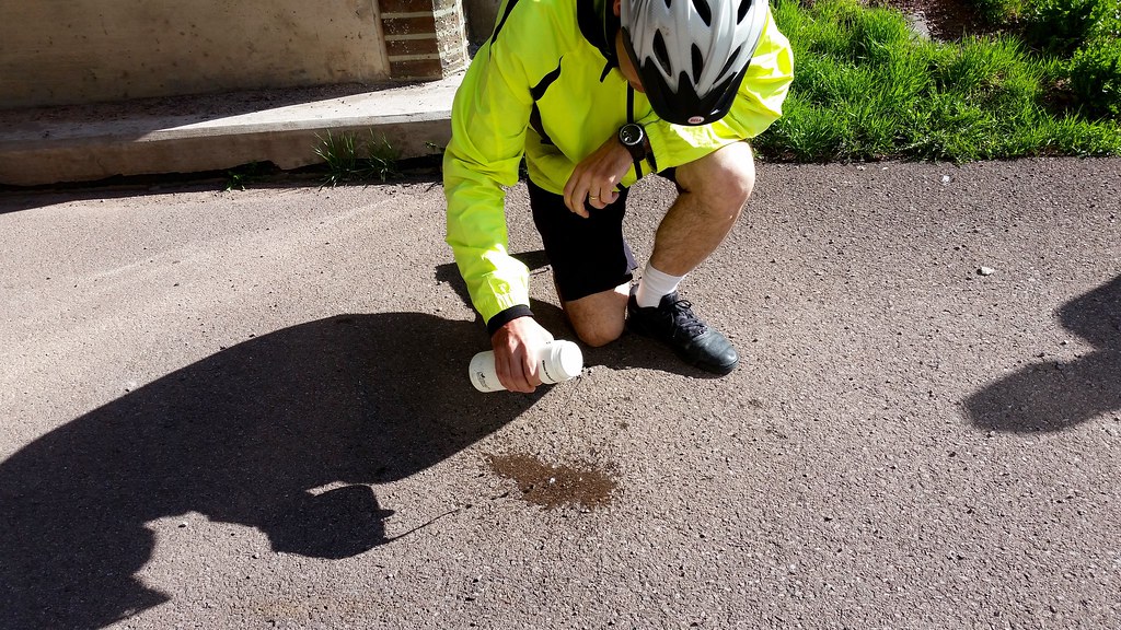
Loyal followers of Twelve Mile Circle will understand my excitement. This was a genuine geo-oddity of some significance. Water poured directly atop the divide will roll either towards the Gulf of Mexico or towards the Atlantic Ocean; two very different locations determined solely by the simple fate of how it teetered along a razor-thin line. I sacrificed a small stream of water from my bottle to the Geography Gods and wondered about the journey it would take. Actually it probably evaporated on the spot although I didn’t want to spoil my little fantasy moment.
The keepers of the GAP Trail obviously understood the importance of the Divide too. The small tunnel at this pivotal spot included an elevation map (photo) as well as several murals outlining the history of the area and the trail.
Now the well-deserved downhill sprint could begin.
A Big Savage Tunnel

Remember my long list of worries during the planning? The Big Savage Tunnel (map) sat right near the top. I didn’t have a fear of tunnels even though this one was particularly long, and the longest on the trail at 3,300 feet (one kilometre). Rather I feared it might be closed. There wouldn’t be an easy detour if we found its imposing steel doors padlocked.
The restoration took two years and $12 million so the Allegheny Trail Alliance wasn’t in any hurry to go through the trouble again. They closed the tunnel every winter to prevent ice damage. The tunnel would open again in early April or “sometime” in April or definitely before May, according to various websites I consulted. We’d had a particularly cold winter and I figured it might delay the schedule. I watched the trail alerts anxiously until I saw an announcement saying that it had opened for the season on April 3, 2015; two weeks before we would need it. I could relax.
The tunnel was in great shape, well lighted and a smooth ride.
Mason & Dixon Line

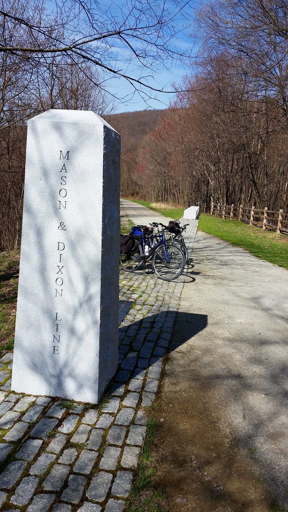
Another fascinating geographic division appeared just after we passed the landmark tunnel, the renowned Mason & Dixon Line (map). Twelve Mile Circle readers should be well acquainted with the line so I won’t go into great detail (e.g., surveyed by Charles Mason and Jeremiah Dixon circa 1763-1767, the traditional dividing line between north and south in the United States, the state boundary between Pennsylvania and Maryland). For me, it provided a great opportunity to take a bunch of photographs of our bicycles in two states at the same time. Shouldn’t bikes get a little geo-oddity love too?
Mishap

It was bound to occur. Oddly the first and only bit of misfortune during our entire trip happened a mere fourteen miles from our goal. One of our group ran over a twig at the exact same time he shifted gears. A twig hitting at that vulnerable point must have acted as a lever, twisting the chain and locking the pedals.
Even so we were lucky in adversity. This happened right before the Frostburg trailhead. We walked our bikes into town, had lunch, and made arrangements for a bicycle shop in nearby Cumberland to pick up the bike for repair while dropping-off a rental for the remaining few miles. We lost very little time, thankful that it hadn’t happened earlier in the trip many miles from the nearest town.
Finishing the GAP

On the Maryland side, the trail followed active tracks of the Western Maryland Scenic Railroad. Active, yes, although rather infrequent. The WMSR was a weekend excursion line operating only during the warmer months. I would have been overjoyed to see a vintage steam engine chugging up the mountain directly next to the bike trail. I’m not sure I’d have felt the same way if I’d been in the Brush Tunnel at the time — bikes and trains share the same tunnel (photo) — although seeing an antique train in general would have been nice. Unfortunately the first train of the season wouldn’t run for another couple of weeks.
I pedaled past the town of Mount Savage (photo) which I mentioned in an earlier article, Savages. It was pretty enough sitting way down in the valley although we were on a mission at that point, nearly finished and I kept going.
One last attraction did entice us to stop, the Bone Cave only four miles from our destination. Workers constructing a railroad cut stumbled upon the cave in 1912. There they found fossilized bones from Pleistocene-era animals dating back 200,000 years. Fossils included cave bears, saber-toothed tigers, mastodons and wolverines; some forty different species according to a marker placed at the entrance.
Finally the surface turned from gravel to asphalt, an oddly quiet situation after riding on rougher road for most of the last four days. People began to appear on the trail in abundance for the first time; walkers, joggers and recreational bikers. This offered another tantalizing clue that civilization couldn’t be too far ahead. Cumberland appeared on the horizon and we rolled into town for our final mile.
The trail ended at Canal Place, back where we’d caught our shuttle four days earlier. The countdown to Mile 0 finally ended. We offered congratulations to each other, took plenty of photos as evidence and headed towards our cars. Two hours later I was back home, still feeling great and wondering when I might be able to do something like this again.

Leave a Reply