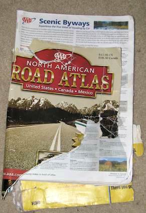
Admired objects are supposed to be handled with dignity. A good example is a national flag. It’s accorded a certain respect as it fades, rips or otherwise reaches the end of its useful life. In the United States there’s even a federal law that requires such things. The flag “should be destroyed in a dignified way, preferably by burning.” But what about a map? While I certainly wouldn’t equate a map with a national emblem, simply tossing it into a garbage bin doesn’t seem like a fitting end either.

I divide my maps into two distinct categories:
- Those that are collectibles that remain in pristine condition.
- Those that are working documents that live a tough existence on the road as I travel.
Here’s my dilemma. My primary working map, a 2001 version of the American Automobile Association’s AAA North American Road Atlas, remains solely on life-support at the moment. It’s been stuffed into suitcases, shoved under car seats, written on, rained on, ripped and torn, as its traveled from one end of a continent to the other. It has witnessed thousands of road miles and tens of thousands of air miles. It has performed the job brilliantly but it can’t absorb much more abuse.
I have a second problem. What should replace it? Have road atlases become obsolete? Are they the electric typewriters of the 21st Century? Buggy whips? Raccoon coats?
The Rise of GPS

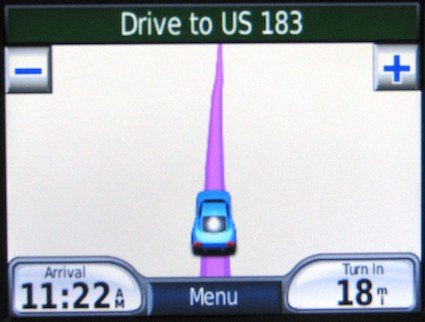
I’ve embraced modern navigating technology and obviously find onboard global positioning system tools indispensable. I’m partial to the Garmin Nüvi at the moment. I stick one to the windshield whenever I take an extended roadtrip or even when I’m trying to find the exact spot of a local landmark.
As an example, I programmed the longitude/latiutude coordinates into the Nüvi when I was trying to find the independent city highpoints last weekend. It certainly made the task simpler. I also selected simulation mode when I working on the U.S. Highway 183 entry for no particular reason other than natural curiosity, and you see the resulting image above. GPS is a great advance and its hard to remember how we managed without it, although certainly we did.
But With Limitations
I don’t like the limitations of a small screen. I also don’t like the prescribed nature of calculated routes. I deviate from what the Nüvi dictates frequently and for what I consider highly logical reasons. Unnatural reliance on a GPS device becomes a crutch that leads to stunningly bad driving choices. That screen on the dashboard doesn’t know which highways clog with traffic, which neighborhoods harbor petty criminals eying easy targets, or which secondary roads mask bone-jarring washboards. Follow that Nüvi blindly and you’ll experience all of those and more.
Plus there’s an annoying voice synthesizer that berates me when I choose a different driving option. She earned her nickname “yelling lady” when I entered a traffic circle (that’s a roundabout or rotary intersection for those of you in many parts of the world). She simply couldn’t deal with rapid changes in geographic direction. Try listening to “recalculating” about a dozen times in rapid-fire succession while your kids are laughing their tails off in the back seat. Then we’ll see if you’re not ready to chuck the device out the window.
And what’s up with the umlaut?
Some Other Tools
Real-time GPS is by no means the only tool available. Online mapping services provide a great service too, albeit with much of their usefulness coming before the journey begins. I developed the map above for instance as I prepared for my trip along Wisconsin’s portion of the Great River Road last summer. It was quick and easy.
The convergence between these mapping services and handheld devices evolves as GPS chips in mobile phones become a standard feature. This was apparent when I explored the implications more than a year ago and the trend only continues. The convergence offers some advantages. It’s easier to customize an exact route in Google Maps than with the clunky Nüvi interface. However, screen size limitations on a handheld unit continue to limit its usefulness. It is difficult to see the Big Picture – quite literally – and take that into account while making decisions on the fly. Road conditions change in a heartbeat and flexibility is not optional for me.
The Continuing Value of Print

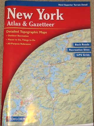
While I use and enjoy the technology I still need the dead tree equivalent. I will continue to pack a general paper map and often a more detailed special-purpose atlas until technology offers a complete and reliable alternative. It was a paper map that saved our hides on our recent trip up to Maine.
The AAA atlas offered the solution. It allowed us to select among the full set of possible alternative routes that were simply not visible on the tiny Nüvi screen. The Nüvi performed fine once we plotted the route and entered the proper landmarks into its memory. Nonetheless it kept wanting to route us back to the roadblock in the most efficient manner possible. We’d probably still be sitting on that highway outside of Boston if we’d relied entirely on the Nüvi.
I’ve talked myself into buying a new paper atlas even though its purpose has changed over the last few years. Now it’s an emergency backup rather than a primary navigation tool. I wonder if this will be the last time I replace it with paper. Perhaps in another eight years we’ll all have dash-mounted laptops with ubiquitous nationwide broadband connections. Maybe those will combine the advantages of the paper maps with the navigational abilities of GPS devices. Only then will I no longer need my paper maps.
I still have the problem of how to dispose of my current map properly, though.
Something Totally Unrelated
I wanted to let everyone know that I finally got around to claiming the domain twelvemilecircle.com. Right now it simply points to the longer URL you’ve come to expect. I’m not sure if I’m going to change all the pages over to the new domain or not. It might be more of a pain than it’s worth.
This won’t have any impact on viewers who subscribe to the RSS feed using various news readers. On the other hand it should be easier for those who go directly to the URL or who want to refer people to the site. Now it’s as easy as saying “go to twelvemilecircle.com.”

Leave a Reply