There are 5 Counties in Hawaii – “The Aloha State“
Also be sure to see my United States County Counting Page for the rest of the states.

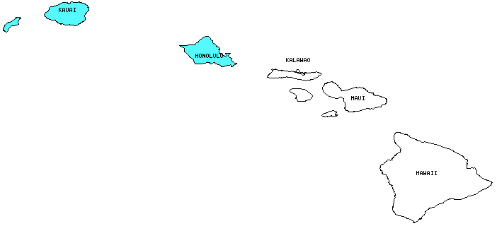
I have visited 2 Counties = 40% of Counties in Hawaii
Counties visited are colored-in; counties still needing to be visited are blank. Map created using Mob Rule.
Twelve Mile Circle Articles Featuring Places in Hawaii
Markers designate the Hawaii locations featured in Twelve Mile Circle articles.
Interesting Hawaii county trivia
- Most of the counties in Hawaii are composed of multiple islands.
- Kalawao County (which I have not visited) is the smallest county in the United States at 13 square miles. The U.S. Bureau of the Census estimated a population of only 126 inhabitants in 2004, down from an actual count of 147 in 2000. It is the site of a former leper colony and it does not have a separate county government per se. For an interesting overview, refer to my Kalawao County, Hawaii page.
- Hawaii is growing in size. When I was putting this page together I noticed the difference and I decided to find out why. As it turned out, eruptions of the Kilauea volcano over the last couple of decades have added a small amount of land to the State, County and Island of Hawaii. More information can be found in the U.S. Geological Survey’s Fact Sheet 144-02.
Counties in Hawaii

Below are the 5 counties in Hawaii. Although infrequent, counties sometimes do change so please let me know if any of this information is out of date and I will update it. Those counties that I have visited are highlighted in Red. Readers can also link to any articles manually in this section if the map isn’t working.
- Hawaii County: Largest county in Hawaii (4,028 square miles); Fewest County Borders – Part I: Hawaii County, HI; Hawaii is Closer than you Think; The Highest Island Elevation; Named for Captain Cook
- Honolulu County: Largest county population in Hawaii (876,156 people in 2000 Census); All Vowel Place Names (Aiea); Diamond Head; Diamond Head Lighthouse; Hawaii is Closer than you Think; Honolulu Lawn Bowls; Lanikai Beach; Makapuu Beach; Nu’uanu Pali Lookout; Palm Circle; The Lanai; Waikiki Beach; Sunset at Waikiki Beach; Smallest of Hawaii
- Kalawao County: Smallest county in Hawaii, Smallest County in the United States (13 square miles); Smallest county population in Hawaii (147 people in 2000 Census); Smallest County in the USA, Part 1.
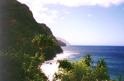
- Kauai County: Last Place in the U.S.; Barking Sands; My Travel Box; Na Pali Coast; Na Pali Plants and Surf; Kokee State Park; Wailua Falls
- Maui County: Middling
Quick Facts About Hawaii
- Location: Pacific Ocean Archipelago. See map above.
- Size(1): 6,423 square miles. Hawaii is the 47th largest state. The next larger state is New Jersey and the next smaller state is Connecticut.
- Population(2): 1,420,491 people. Hawaii is the 40th most populous state. The next more populous state is West Virginia and the next less populous state is New Hampshire.
- Population Density: 221.2 people per square mile. Hawaii is the 13th most densely populated state. The next more densely populated state is Illinois and the next less densely populated state is Virginia.
- Bordering States: As a state composed of a series of islands, Hawaii does not share a border with any other state.
- Admission to the Union: August 21, 1959. Hawaii was the 50th and final state admitted to the Union, just after Alaska.
- Capital: Honolulu.
- Highest Point: 13,796 feet at Mauna Kea on Hawaii’s Big Island. See SummitPost’s Mauna Kea page.
- Lowest Point: Sea level; Pacific Ocean.
- Government website: eHawaii.gov.
- Official Tourism website: Hawaii Travel.
- Still not enough? See Wikipedia’s Hawaii page.
Sources:
(1) Wikipedia: List of U.S. states and territories by area. Land area only.
(2) Wikipedia: List of states and territories of the United States by population. Estimated population on July 1, 2019.

Leave a Reply