The Twelve Mile Circle “Complete Index Map” has enough entries on it now that my mind wandered to the spots not yet covered. These tended to be remote, empty places bereft of many people or dramatic topography. That would appear to be an accurate description of central Kansas in particular, seemingly flat as a pancake and lacking much of a population. Nonetheless I drilled down onto the map, spied Interstate 70 and saw a town called Hays. I wondered what might be there.
Actually there wasn’t much there although that didn’t surprise or bother me. Every spot has a story. Hays was the biggest town for miles around with more than twenty thousand residents so I figured I’d find something interesting. It also had a fairly sizable university with twelve thousand students making it quite the college town.
Fort Hays University had a museum, The Sternberg Museum of Natural History, which featured numerous fossils from the time of dinosaurs all the way to the Ice Age. It seemed like a lot of these midsized towns of Middle America had fossil museums. I love that kind of stuff. I need to get out there and see a few.
Fort Hays

Many readers probably figured from the name of the university that the town of Hays may have had a connection to Fort Hays. That assumption would be correct. It began as Fort Fletcher in 1865 to protect wagon trains. Soon thereafter government authorities renamed it Fort Hays and shifted its purpose, as part of an effort to protect the new railroads from attack by Native inhabitants as tracks began to crisscross the Great Plains. A town grew around the fort. The Fort Hays Historic Site now occupies the original site.
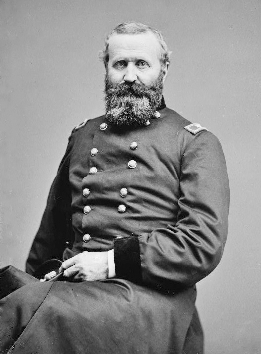
General Alexander Hays

Peeling back another layer of its etymological history, Fort Hays got its name from General Alexander Hays. He displayed abundant courage during his distinguished military career in the Civil War until his death at the Battle of the Wilderness in central Virginia. Hays was the type of General who led from the front of his troops, within the thick of the battle. He suffered several wounds during various campaigns until his luck finally ran out in 1864. He was shot through the head, not quite yet forty-five years old.
Hays was largely forgotten by history despite his bravery, having been overshadowed by much more famous military commanders on both sides of the Civil War. Very little was named for Hays other than the small fort on an expanding frontier that later blossomed into a town. Other than that there were a couple of monuments placed on battlefields as memorials and one small bland suburban road named in his honor, and that was about it.
Wilson

I noticed a town nearby to the east one level more obscure, called Wilson (map). It may be best known as the self-proclaimed “Czech Capital of Kansas.” I was amused by the title. How much Czech diaspora could be living in Kansas? It wasn’t like there would be an abundance of competition. Still, one needed to work with what had been granted in these remote places so Czech Capital of Kansas became its calling card.
The story became more interesting as I checked into it (pun intended). Apparently Czech immigrants arrived in Wilson from Bohemia in the 1870’s to help build the railroads. It must have been a welcoming place because they’ve remained in Wilson ever since. Residents even hold an annual Wilson After Harvest Czech Festival at the end of July (unfortunately 12MC just missed it this year; it was held July 23-25).
I couldn’t find the original Wilson who served as the namesake though. Clearly he was important person locally because Wilson was located in Wilson Township, which also had a Wilson Creek, Wilson Cemetery and an Old Wilson Cemetery.
Completely Unrelated
I got an email recently from Vexillographer who had just completed a video about the Jeddito time zone anomaly on the Navajo reservation in Arizona. I had discussed this awhile ago in USA Time Zone Anomalies, Part I
Vexillographer actually visited the anomaly in person and made this video about his experiences. Do check it out — the time zone weirdness found there is amazing. It also includes a nice shout-out to 12MC at the end. Thanks Vexillographer!

Leave a Reply