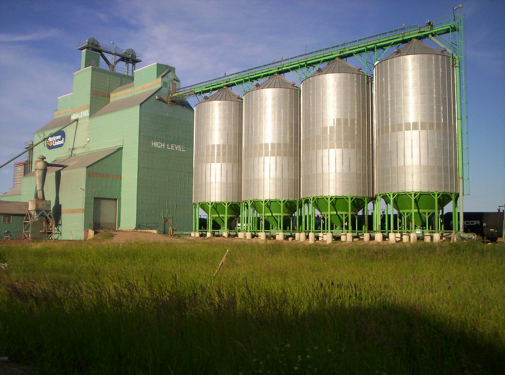
It began with High Level, in Alberta, Canada. I came across the name and wondered what made it so special. It didn’t seem to be all that high level. In fact it appeared to be downright flat at an elevation of 325 metres (1,066 feet) atop the Canadian Prairies. Well, being that far north I suppose it might be more boreal than prairie. Nonetheless commercial grains certainly seemed to be an important part of the local economy.

That didn’t answer the question, though. One would expect some kind of summit or promontory in High Level (map). However that didn’t seem to exist as I looked around.
Actually the height did exist although I wasn’t examining it closely enough. One needed to focus on the change in elevation one had at hand. It happened very subtlety way out there on the flat plains: “The name High Level described the height of the land that separates the Peace River and the Hay River.” Apparently it didn’t take much of a change to separate the two watersheds although that was enough to establish a good place for a town. That had to wait until 1947 when the Mackenzie Highway ran through the area. Now 3,500 people live at the slightly elevated land between the rivers.
That got me thinking about other places named High Something. What made certain locations “high” even if the reasons weren’t obvious? I could have selected plenty of other Canadian examples although I turned my attention south of the border.
High Point, North Carolina, USA
The occurrence that came to mind most quickly happened at High Point, North Carolina so I decided to check it out. This was a fairly significant place with about a hundred thousand residents. So I supposed the town of High Point would clearly mark and commemorate a significant promontory. Surprisingly, it did not. Historically, the North Carolina Railroad ran between between Charlotte and Goldsboro, and intersected here with a plank road called the Fayetteville-Western Road. Both were constructed in the 1850’s.
Becoming High Point
The intersection became High Point because it was at a relatively higher point of elevation than the surrounding terrain. A town of that same name sprang up around the crossing — a natural place for commerce — starting in 1859. The so-called high point wasn’t marked at all as far as I could determine. However an educated guess might be where Main St. crossed the railroad tracks today (map).
This commercial hub gained fame for furniture manufacturing. Thus the town called itself the “Furniture Capital of the World.” The local Chamber of Commerce even built the World’s Largest Chest of Drawers in the 1920’s to cement its claim.
A Real Estate Opportunity

I noticed a “for sale” sign on this image taken in August 2006. Google Street View showed it still for sale with a “Huge Price Reduction.” when the cameras passed through in June 2012. Some quick searching uncovered a listing for a:
“Unique and historical 2,245′ office building containing 1,800sf on main level. Partially unfinished basement. Parking in rear and extra lots for expansion!
The total assessed value for the property in 2014 was $140,000. This might be a perfect opportunity to purchase the World’s Largest Chest of Drawers if one were inclined to own such an object. I can’t guarantee how long this offer will last after publication of this article in January 2015 so act quickly!
United Kingdom
However, when it came to High Something examples, the title had to go to the United Kingdom. I found a huge cluster of examples in the Gazetteer of British Place Names. There were well over five hundred occurrences. They were so common that the Gazetteer alphabetized them by the Something rather than by the High, so the entries ran from Ackworth, High to Wycombe, High. That would be like specifying Level, High in Canada and Point, High in the United States.

Being the lazy creature that I am, I decided to examine that first entry on the list, High Ackworth or perhaps Ackworth, High if one preferred, in West Yorkshire. There was actually a single village of Ackworth. It consisted of four distinct parts: High Ackworth; Low Ackworth; Ackworth Moortop and Brackenhill. I’m not sure what Brackenhill did to escape an Ackworth appendage. However the rest of it traced an etymology back to ack (oak) and worth (enclosure), or a place where someone cleared oak trees to form an enclosed open space.
I figured there might be at least three potential explanations for the usage of “High” in British place names. Perhaps the usage referenced some kind of elite status or superiority for a particular plot of land granted the designation (e.g., as used in High Society or highbrow). Maybe it denoted a directional placement (e.g., high meaning north and low meaning south). Possibly it meant the same thing as the North American examples, a signifier of elevation.
I looked through a number of places and I’m pretty sure more of them fell into the third category. I’m not confident enough to say that all of them referenced relative elevation although the ones I examined appeared to support the theory.

Leave a Reply