Highpoint to Lowpoint

Twelve Mile Circle received an intriguing question from reader “Cary” a few days ago. Cary, a professional mapmaker, noticed something interesting while conducting research: the amazing proximity of Minnesota’s highest point of elevation to its lowest. This led to a natural question. Was this the shortest distance between a state highpoint and a lowpoint?

I’d touched on something within a similar vein way back in 2008 in “Highest and Lowest, Oh So Close” However, I’d discussed only the curious case of California with its astounding elevation difference between Mount Whitney at 14,494 feet (4,418 meters) and Death Valley at -282 ft (-86 m). The two points were separated by only 88 miles (142 kilometers).

That earlier article didn’t answer anything to determine if those 88 miles represented the absolute shortest distance between highpoints and lowpoints; it simply noted that the distance was very small. Fortunately numerous sources existed on the Intertubes so I could steal — with proper attribution of course — wonderful items such as this map that had already been prepared to assist with such a quest.
Map of USA elevations. Image by ChristopherM, CC BY-SA 3.0 via Wikimedia Commons.
Courtesy of Wikimedia Commons

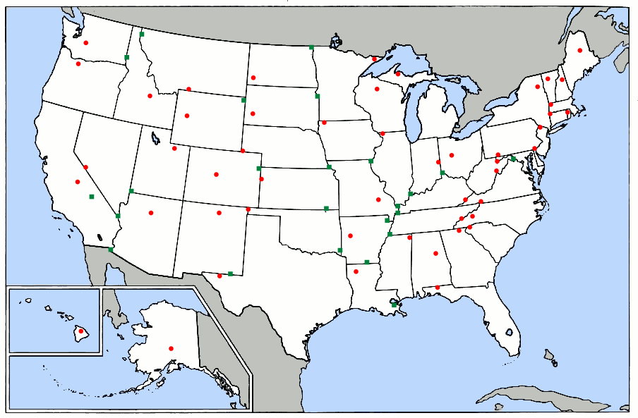
My quick eyeball assessment uncovered a few observations. The California distance was indeed very short. It wasn’t the shortest. Minnesota was shorter and a couple of east coast states might be viable too. There was also one other curious fact. With the exception of California and Louisiana with lowpoints below sea level, the lowest elevation in each state appeared to fall somewhere along its border where it abutted another state or a large body of water. I supposed that reflected water always seeking the lowest level as it flowed downhill.


Minnesota

Port of Duluth - Canal Park. My own photo.
Port of Duluth, Minnesota along the state’s lowpoint

The Minnesota highpoint mentioned by Cary was Eagle Mountain (map) at 2,301 ft (701 m). The elevation certainly didn’t rival California’s Mt. Whitney! However, the summit was only about 12.8 miles (20.6 km) from the state’s lowpoint on the shores of Lake Superior. The lake had a consistent elevation so it was only a matter of finding the closest line between mountain and shoreline.

I noticed that Michigan’s highpoint on its Upper Peninsula also fell remarkably close to Lake Superior. I felt a momentary sense of elation until I realized that Michigan touched several of the Great Lakes including Lake Erie way down at the southeastern corner of the Lower Peninsula. Lake Erie, being considerably downstream from Lake Superior, obviously had a lower elevation and thus the Michigan highpoint and lowpoint were separated by hundreds of miles.


Rhode Island

Newport Cliff Walk. My own photo.
Newport, Rhode Island cliff walk

When checking for diminutives, one should always examine the smallest of U.S. states, Rhode Island. Right? Little Rhody failed to reign supreme this time around. It’s highpoint was Jerimoth Hill (map). However that was located on the far western edge of the state almost all the way to Connecticut. That put it some distance from the nearest stretch of sea-level elevation, which even in this very tiny state measured 19.2 miles (30.9 km) by my rough estimation.


Delaware

Rehoboth Beach in the Winter. My own photo.
Rehoboth Beach, Delaware in the winter

Then came the geo-oddity magnet that was Delaware. I’ve mentioned repeatedly that I believe Delaware holds more geographic anomalies per square mile than any other place in the United States. And the streak continues!

Delaware’s highpoint occurred at Ebright Azimuth (12MC’s visit). Its lowpoint was at sea level which I’ve experienced many times along its wonderful Atlantic Ocean beaches. However the highpoint (map) was certainly too far away from the Atlantic coast to make it a top contender. The Delaware River, conversely, flowed quite close to the azimuth. Could the Delaware River along that stretch have an elevation of zero? I figured it might be possible. For instance, I knew that the Potomac River at Washington, DC, in an area of similar terrain was only about six inches above sea level considerably farther inland.

I thought 12MC might have to call out to the hydrologists in the audience to see if we could calculate the elevation of the Delaware River at the point closest to Ebright Azimuth. Then it dawned on me. I didn’t need to do anything of the sort. I simply needed to learn if the Pennsylvania lowpoint located farther upstream had an elevation at sea level or not. Many sources listed that statistic so it should be easy.

Bingo! Pennsylvania’s lowpoint was at sea level on the Delaware River at the Delaware border. Therefore the Delaware River flowing through Delaware, being downstream from Pennsylvania, had to have that same sea level elevation by definition. That qualified it as part of the state’s lowpoint.

A rough measurement generated a Delaware highpoint-to-lowpoint distance of approximately 4.3 miles (6.9 km).

Thank you Cary for the suggestion.

Comments

10 responses to “Highpoint to Lowpoint”

  1. Michael Avatar
    Michael

    One possibly interesting add-on would be to look at the average slope, determining the “steepest” state from top to bottom according to this one arbitrary metric. (And I know we’re all about arbitrary metrics.) Using the points featured in the article:
    – California rises 14,776 feet in 88 miles, for 168 feet/mile.
    – Minnesota rises 1,710 feet in 12.8 miles, for 134 feet/mile.
    – Rhode Island rises 811 feet in 19.2 miles, for 42 feet/mile.
    – Delaware rises 448 feet in 4.3 miles, for 104 feet/mile.

    Looking at the map I checked some other candidates as well. Florida, Maryland, West Virginia and Arizona all came out at 50 feet/mile or less. But then:
    – Washington: 14,411 feet, 40.0 miles to an inlet in Tacoma, 360 feet/mile. I thought this had to be it until I checked…
    – Hawaii: 13,803 feet, 17.5 miles roughly NNE to the coast, 789 feet/mile. We have a (likely) winner!

  2. Rob Avatar
    Rob

    I have always noticed how close Kansas’s highpoint (hilariously named Mount Sunflower) is to Colorado’s lowpoint. Looks about the same for Texas and New Mexico as well.

  3. Scott Avatar
    Scott

    Pretty sure the third “steepest” state is Vermont. It’s 18 miles from Mt Mansfield (4393 feet) to the shore of Lake Champlain at Malletts Bay (90 feet), for 239 feet/mile. That beats everybody except Hawaii and Washington.

  4. Peter Avatar

    Now to figure this out for countries.

    1. Michael Avatar
      Michael

      I looked at a number of countries. Nepal and Bhutan are both in the 300 foot/mile range. Liechtenstein is about 475. Monaco impressed at 1371.

      But the leaderboard is almost certainly full of volcanic islands. I can’t say I did an exhaustive search, but:
      – Cape Verde ~2700
      – Comoros ~1700
      – Sao Tome and Principe ~1600

      But if you’re willing to count non-countries, the winner is almost certainly Gibraltar. That rock gives you 426 meters in just 271 meters. Converting to (appropriately) Imperial units gives 8331 feet/mile.

    2. Scott Avatar
      Scott

      Portugal is up there. Mount Pico is 7713 feet tall, and the summit is ~4 miles from the coast.

      1. January First-of-May Avatar
        January First-of-May

        Wanted to post that same thing back in April, but forgot (well, more like planned to include more information and didn’t have time).
        Spain is also well in the running, for similar reasons (Mount Teide, 12198 feet, and a bit over 8 miles from the coast), but not quite as ludicrously high (~1450 feet/mile seems to put it out of the top 5).

        As for Portugal, actually, that’s less than 3 miles (I estimate 2.8-2.9 miles, which gives ~2700 feet/mile).
        This means, if I measured correctly, that it’s actually just above Cabo Verde (Michael, you measured from just where it said Pico, right? the actual HP is on the left side of the small caldera, making it a little bit farther from coast – my current best estimate is 3.51 miles and 2645 feet/mile).

  5. Jacob Avatar
    Jacob

    Another way to look at this data, without much extra effort, would be to find the farthest points. Also, adding on to what Michael said about the steepest state, it would be interesting to see the opposite and find the flattest state.

  6. Joel Avatar
    Joel

    I love the patterns this map makes clear: the use of the Appalachians and Ohio and Mississippi Rivers as borders in the east, the lack of same regarding the Rockies, and the very gradual rise of the plains from North Dakota to Oklahoma.

  7. David Avatar
    David

    I think it’s pretty amusing that despite California’s high and low points being in the same county, you can’t see one from the other, owing to the Panamint Range in between. Supposedly it’s possible to hike to the top of one of its peaks and be able to see Badwater and Whitney from the same spot.

Leave a Reply

Your email address will not be published. Required fields are marked *

Latest Comments

  1. I am in La Libertad, El Salvador. Was absolutely astonished to see the sun rise at one end of the…

  2. Thank you for this information. I was searching “closest distance between towns of opposite elevations” and reveals zero results, at…

  3. I agree with a two mile run with admission proceeds go to the local Hancock schools in maryland doing it…

  4. Rock Springs Campmeeting is not the only one in NC. There’s also Balls Creek Campground, McKenzie’s Grove, and Mott’s Grove;…