A park near my home sits above an interstate highway leading into Washington, DC. Here, builders tucked the roadway into a little valley leading downhill towards the Potomac River and put a concrete lid above it. Drivers on Interstate 66 enter a tunnel briefly before returning to daylight and crossing the Theodore Roosevelt Bridge into the city. Most people shoot through there so quickly they probably don’t even consider what they burrowed beneath (map).

Sometime during I-66’s construction someone had the grand idea of creating a three-acre ceiling above the motorway. So they christened it Arlington Gateway Park, a decent attempt at open space albeit a bit underused. The county did try to talk it up though, saying the park “…is the home of the annual Rosslyn Jazz Festival every September, is a great place to watch the 4th of July fireworks and provides a nice view of Georgetown from the Skywalk.” Little did I know that Gateway Park was well ahead of the times. They constructed it in the 1970’s. Now there’s quite a trend of undergrounding freeways in order to create open space. Sometimes city officials even obliterate roadways entirely.
I took a closer look at a few commonly noted instances of this trend in urban renewal, those often cited as positive examples.
Milwaukee, Wisconsin, USA
A familiar story of relentless highway construction supporting a prevailing automobile culture struck an axe blow through neighborhoods in Milwaukee during the middle of the last century. It reached an apex with the East Park Freeway. Activists eventually summoned enough political power to halt construction when the project was only partially complete.
The highway would have stretched from Interstate 43 to Milwaukee’s Lake Michigan shoreline. Instead it became an underused 1-mile spur. “The elevated freeway lowered the value of the surrounding land, so it was used primarily for surface parking, though some of it was right on the Milwaukee River“. Sensing the error of their ways, city officials demolished the East Park Freeway in 2002.
Renewal remains a work in progress in Milwaukee. Several empty parcels still sit along the old highway right-of-way in the satellite image, above. The route formerly ran along the southern edge of McKinley Avenue and the Milwaukee River. Three new neighborhoods began to rise on the newly-available land, the McKinley District, Lower Water Street District and Upper Water Street District. All of them will be redeveloped using New Urbanist elements over the next several years.
Seoul, South Korea

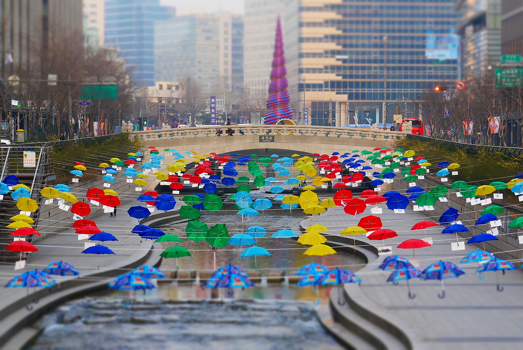
The Cheonggye Freeway rose from postwar South Korea in the 1950’s with active construction lasting into the 1970’s. War refugees settled in makeshift shacks along Gaecheon stream, turning it into a fetid cesspool. The neighborhood became an eyesore and an embarrassment to government officials. The natural solution for that period involved the forcible removal of residents, undergrounding the stream, building surface streets above it, and finally constructing an elevated freeway one level above that. The government considered this project sleek and modern, a symbol of South Korea’s recovery and industrial might.
It didn’t work quite as planned as the years passed. The neighborhood began to become a bit shabby, plus it had an elevated freeway running through the heart of it. The freeway itself became an annoying traffic choke point. It served more as a symbol of frustrated driving and grimy air pollution than a modern South Korea.
So Cheonggye Freeway had to go. In its place came Cheonggyecheon in 2005, a 10 kilometre restoration of Gaecheon stream along with accompanying landscaping and beautification (map). Now the area attracts residents and tourists alike instead of repelling them.
Madrid, Spain

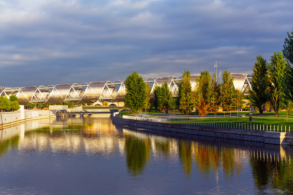
The final frequently cited example focused on Madrid, Spain. Here a river also had been undergrounded and replaced with a freeway. The M-30 motorway created a tight ring around Madrid beginning in the 1970’s, looping immediately west of the city center. Designers followed the path of least resistance. It traced the natural bed of the Manzanares River, with asphalt taking precedence at the surface. The freeway created two negative consequences; a visual blight on the landscape and disconnected neighborhoods.
Once again tastes changed. The layers reversed in a series of efforts between 2006 and 2011. The M-30 shifted underground and the Manzanares River returned to the surface. It formed Madrid Río, a 7 kilometer linear park (map). As the New York Times described the situation,
“The park here, called Madrid Río, has largely been finished. More than six miles long, it transforms a formerly neglected area in the middle of Spain’s capital. Its creation, in four years, atop a complex network of tunnels dug to bury an intrusive highway, also rejuvenates a long-lost stretch of the Manzanares River, and in so doing knits together neighborhoods that the highway had cut off from the city center… the park belongs to a larger transformation that includes the construction of dozens of new metro and light-rail stations that link far-flung, disconnected and often poor districts on Madrid’s outskirts to downtown.”
Madrid Río converted a bleak asphalt landscape into an enjoyable pedestrian zone.
Even More

There were many other examples I could have referenced if I’d had more space. Certainly Boston’s Rose Kennedy Greenway constructed as a result of the Big Dig fit the same theme. I already talked about that one in 2010’s Over the Road article. Another example would be The High Line in New York City where an abandoned elevated spur of the New York Central Railroad became a park. A final example would be the Embarcadero in San Francisco where a 1989 earthquake provided a perfect opportunity to remove an ugly freeway.

Leave a Reply