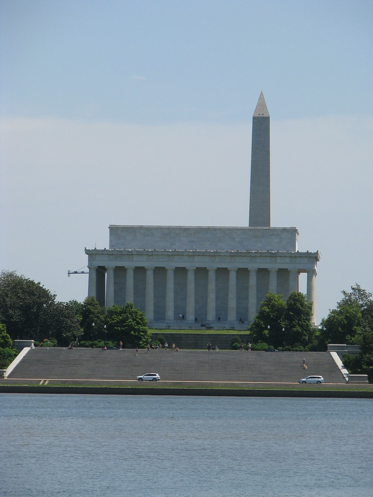
Who could ever grow tired of this view?

I haven’t although I do like a little scenic variation now-and-then. I have a pleasant 20-mile bicycle route I like to take that hugs the Potomac riverside, including this segment I described previously in Monumental Ride. From there I curve onto the former Washington & Old Dominion railroad bed, a paved rails-to-trails path, and eventually circle back home. This is great circuit and it’s my most common route. Sometimes I do like to take things a bit differently, though.
Every Whatever
That need for change led to and idea to combined two of my joys, Geography and History, with an activity that I know is important but requires a little more motivation on my part, my physical health.
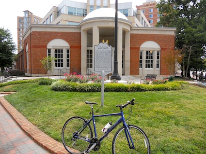
The “Every Whatever” concept influenced me. I came up with my own every whatever challenge, a quest to ride a bicycle to every historical marker in Arlington County, Virginia. There are more than 80 of these markers spread fairly evenly throughout the county, and they even provide a convenient list. Arlington is also rather compact, the smallest self-governing county in the United States at barely 26 square miles, so this is a completely feasible goal.
I hopped on my bike and completed several historical marker scavenger hunts to start the quest about a year ago. Then I fell back into my routine. Recently I started the adventure back up again. Now I think my progress is finally sufficient to share. I dare say I’ve just about completed this challenge. Only a handful remain, including those markers newly added by the county and those too stubborn to reveal themselves thus far. However I continue to search.
I also discovered four county markers apparently not included on the official list as I wandered the county randomly. There were an additional four markers placed by the Commonwealth and one placed by the National Council of State Garden Clubs (a Blue Star Memorial Highway sign) that I also recorded. My captures and misses are noted on the Google Map.
Exploration
These adventures provided an opportunity for me to explore obscure nooks and crevices of practically every neighborhood in the county. It’s so much different on a bicycle than by automobile. I always knew that Arlington fell on a geographic line between the coastal plain and the Piedmont. It’s one thing to understand that intellectually and another to experience it on the ground under my own power.
Sometimes I’d curse the continuously undulating hills. They were masked when I stuck to the flat terrain along the river and up the gradual incline of the old railroad bed that never exceeded a 2% grade. Away from the river, ever acre of the county seemed to be uphill or downhill, with very little flatness. I gained a much better appreciation of the terrain while getting an awesome workout.
Tricky Markers
This is a crazy spot for a marker!
Most of the historical markers were easily accessible and easy to find. Others were downright dangerous. The marker for Fort Cass, a part of the Civil War Defenses of Washington was probably the worst. It’s located on Arlington Boulevard, a major thoroughfare and commuter route leading directly into the District of Columbia skirting the western edge of the current Fort Myer. I timed my visit for an early Sunday morning and peddled furiously when a traffic light stopped the traffic flow. It provided an ever-brief window to reach the marker before three lanes of swiftly-moving vehicles caught up to me.
I do understand the need to place a marker with historical accuracy. However, how many people will ever stop to read this particular marker, other than someone with questionable judgment such as myself? [UPDATE: the county built a bike path along the road and now it’s easy to reach! — see image].
There is one marker I will probably never capture. It commemorates Fort Richardson, another part of the city’s Civil War defenses. Unfortunately the marker was located on the grounds of a private golf course that doesn’t appear to appreciate bicyclists. I’ll keep my eyes open and maybe someday they’ll have an open house or some other public event that I can attend just long enough to visit the marker.
The Joy of Wandering

I got “lost” a few times although that’s a bit of a misnomer. One can’t truly get lost here. It’s a small place and I’d hit a familiar road soon enough. That was part of the fun. I’d also get some weird stares from people who thought it odd for someone to pose a bicycle in front of a marker and snap a photo. Oh yes, I reveled in my geekery during those moments.
I’m not sure what comes next as this project nears its conclusion. I need a new geo-fitness challenge. I’m considering bicycling along every length of street in the county. That would keep me busy for quite awhile.

Leave a Reply