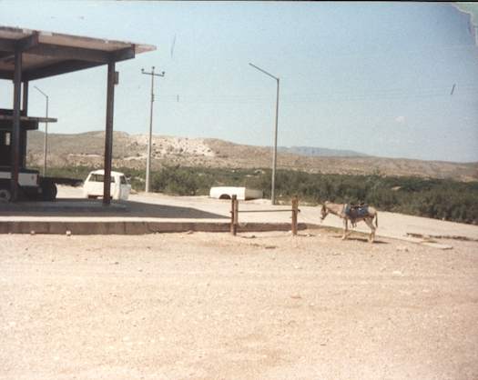
I crossed the Rio Grande into Mexico, bypassing all official border stations and every immigration or customs officer, and returned the same way. I suppose this was technically illegal although it was allowed with a wink and a nod on both sides of the boundary. After all, the nearest official crossing was more than a hundred miles away. That’s how things had always worked at this spot when I crossed here years before thoughts of 9-11 and the resulting fears of a porous border.
I mentioned my epic trip around the United States a couple of days ago. I also said I wouldn’t post much about that on Twelve Mile Circle unless I came across a geo-oddity. Well, I stumbled across this one as I leafed through my photos and it triggered a flood of memories.
The Big Bend of the Rio Grande
A snaking river cuts through unforgiving desert terrain to create the distinctive shape of southwestern Texas on a map. It also forms a long stretch of an international border between the United States and Mexico. People call it the Rio Grande on the northern side of the border and Río Bravo del Norte on the south. A large curve or crook appears along its length, and within that cradle sits an American nature preserve called Big Bend National Park. I crossed paths with that area on a sunny afternoon in May 1992 (map).
My companions all wanted to hike Emory Peak, the highest point in Big Bend at 7,832 feet. I declined. I’d noticed something odd, a little dotted line on the park map representing a “ferry,” leading across the border to a tiny town called Boquillas del Carmen in the Mexican state of Coahuila.
Boquillas del Carmen
Amazingly, even this insignificant town now appears in digital clarity on Google’s satellite view:
Even back then I had a thing for geo-oddities and ferries. All my friends headed towards the mountain. I set off alone for Mexico. I drove down to the ferry landing — and I use that term loosely — because it was just a guy with a battered aluminum skiff and oars. It didn’t bother me much that he had a one-gallon plastic milk jug with the top cut off, resting at his side to bail out the boat. The river wasn’t deep nor was it moving particularly swiftly so I felt the worst that might happen if we sank would be some wet clothes. I paid my small fare, maybe a couple dollars, and we crossed without incident.
The Visit
Then I faced a choice on the Mexican side. I could either walk the short, earthen path up to Boquillas or pay another buck or two and ride on the back of a burro. Of course I was going to ride the burro. When was I ever going to get another chance to hop on a burro?

Boquillas was a tiny village, alone in the desert. Nary a speck of greenery poked through the dust. I rummaged through the small market, haggled for one of those stereotypical Mexican blankets and probably paid too much. I sat on the patio, sipped a Tecate and snapped the photo you see above. That was my view. The only photo I took.
It was about that time that I realized I was the only gringo in all of Boquillas. It concerned me very briefly that everything I held dear, ever civil liberty I understood, every lawful recourse I might have was sitting on the other side of that river. I was an undocumented foreigner, an illegal alien, who couldn’t even speak the language. Anyone could do anything to me and I wouldn’t be able to do anything about it. Then I relaxed as I understood that the people who lived here would never allow that to occur. Their economy would collapse if bad things happened to tourists. I was right. It was perfectly safe.
Epilogue
In researching this, I’ve learned that the crossing to Boquillas has been completely locked down and closed by the American authorities. The population has plummeted from about 300 inhabitants to less than a hundred. There are no tourists anymore and the economy has collapsed, an unintended consequence of the War on Terror.
UPDATE: As noted in a comment, the border crossing to Boquillas del Carmen reopened. Furthermore, it is now legal for those with valid passports.

Leave a Reply