Plans change. I gamble when I choose to mull over a thought and allow it to percolate in my mind. Sometimes the delay results in a better article. Other times, events overtake ideas not completely formed yet.
Loyal reader “Rhodent” and I were communicating by email about a potential offshoot of “NOT as the Crow Flies.” The contest would have focused on the greatest time or distance differences between walking and driving to a common point, where walking would have provided a distinct advantage. Ariel Dybner posted a comment just as we were structuring the query.

Ariel found a location in Great Smoky Mountains National Park on the “one-way twisty Rich Mountain Road out of Cades Cove” (map). The drive would last 1 hour and 23 minutes. The walk would take 21 seconds. Checkmate. Abundant kudos to Ariel, and well played, and for being prescient enough to claim victory before we ever began. Now it’s back to the drawing board for 12MC though.
I decided to keep the pedestrians and ditch the automobiles. Where are places that motorized vehicles cannot go? Trails, certainly, although I’m on a bridge fixation at the moment. I’ll focus on some impressive pedestrian-only bridges, also commonly known as footbridges.
Now Onto the Revised Topic
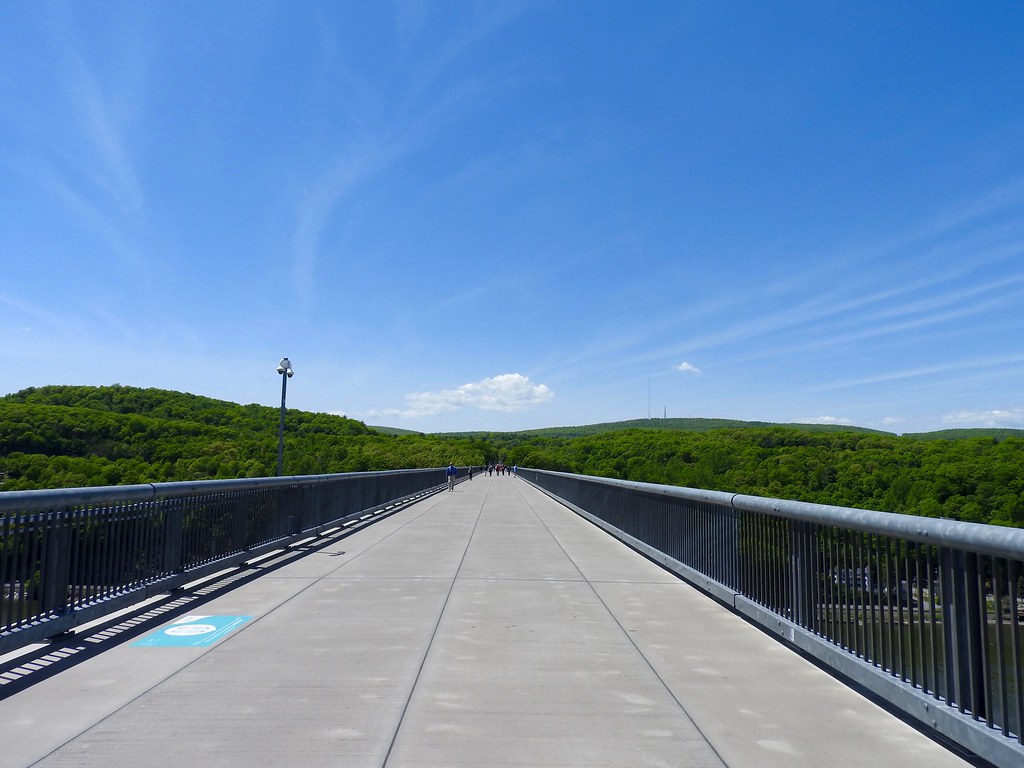
Notice that I didn’t use the title “longest” pedestrian bridges. Longest is surprisingly subjective and it abuts several definitional issues that I’m choosing to deflect. If one simply must put a fence around the topic then Guinness World Records probably suffices: “On 3 October 2009, the 2.06-km (6,767-ft, or 1.28-mile) Poughkeepsie Bridge (also known as the Walkway Over the Hudson State National Park) in New York, USA, was re-opened to the public as the world’s longest pedestrian bridge. Hornibrook Bridge across Bramble Bay in Queensland, Australia, was longer but demolition started in the summer of 2010.”
So let’s go there.
Walkway Over the Hudson; Poughkeepsie, New York, USA

Guinness mentioned the salient points. I’ll fill in some of the details.
Walkway Over the Hudson began its service as a railroad bridge spanning between Poughkeepsie and Lloyd in New York, crossing the Hudson River to connect with the larger rail network (map). Originally it carried a less romantic name, the Poughkeepsie-Highland Railroad Bridge. It opened to rail traffic in 1889, served as a major corridor for passengers and freight, and closed after a fire in 1974. I’m not sure how a steel and iron truss bridge catches fire. I’ll assume there were wooden elements — perhaps track ties that kept the rails at a proper gauge — and offer the civil engineering historians in the audience an opportunity to ponder likely scenarios. Anyway, it caught fire. Then it closed.
The bridge stood as a decaying hulk, a metaphor trapped in a post-industrial world, until a group of citizens reinvented it as a pedestrian park. They formed the nonprofit Walkway Over the Hudson to secure public and private funding for an adequate restoration. The bridge reopened in 2009 as the linear Walkway Over the Hudson State Historic Park, a dizzying 212 feet (65 m) above the Hudson River.
UPDATE: 12MC visited this bridge in 2016
Walnut Street Bridge; Chattanooga, Tennessee, USA

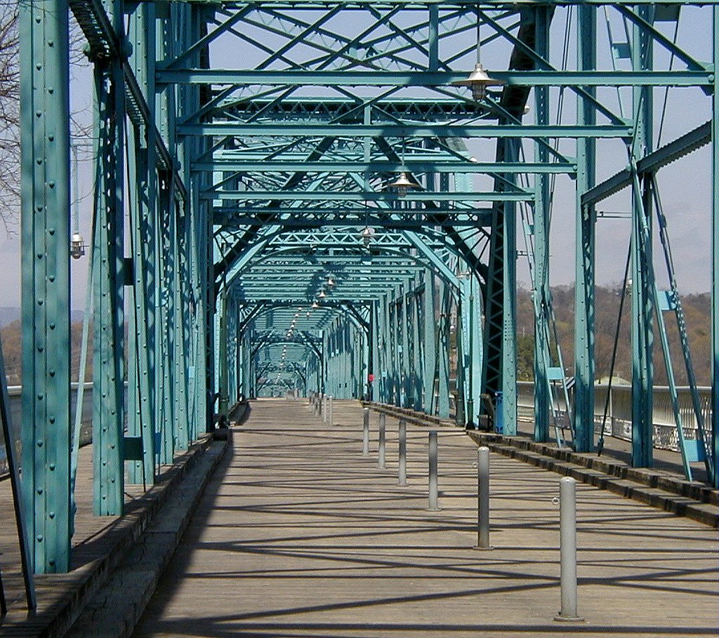
Check a search engine for the longest pedestrian bridges and the Walnut Street Bridge (map) will land near the top of the results. It spans 2,376 feet (724 m) with a deck 100 feet (30 m) above the Tennessee River. That’s quite impressive although it’s nowhere near the magnitude of the Walkway Over the Hudson.
A website with the creative name Tennessee River Valley Geotourism describes the history:
“The Walnut Street Bridge is Tennessee’s oldest non-military highway bridge still in use today, restored and revitalized as a pedestrian bridge and linear park. In only a generation, The Bridge has become the centerpiece, and a vital connector of Chattanooga’s riverfront renaissance… Since 1978, when it was closed to traffic for safety reasons after serving Chattanooga for 87 years, the Walnut Street Bridge sat disabled, deteriorating, dormant, and yet another reminder of the city’s decaying downtown. By the late 1980s, the city had taken steps to demolish the downtrodden bridge, but lacked the funding.”
Geotourism. I might have to steal that term.
A private organization, The Parks Foundation stepped-in and saved the structure. The 1890 relic reopened as a pedestrian-only bridge in 1993. They changed the deck from asphalt to wood planking in 2010, and added to the charm. Where would we be without private nonprofit groups and foundations to rescue our historic landmarks?
Bob Kerrey Pedestrian Bridge; Omaha, Nebraska – Council Bluffs, Iowa, USA

Aficionados of the Bob Kerrey Pedestrian Bridge remark that it’s the longest footbridge that spans between two states (map). One must find superlatives where one can find them, I suppose. Even so it spans 3,000 feet (914 m) across the Missouri River with a deck of 60 feet (18 m), and that’s mighty impressive.
There are two points that intrigue me. First, this is a modern bridge (opened 2008) designed specifically as a footbridge. It is only fifteen feet wide which is sufficient clearance for legs and bicycles. It will never carry motorized vehicles. In that sense it reminds me of the Sundial Bridge although it’s more than four times longer. Second, the builders constructed a marker on the state line so that visitors can show-off when they’re standing in two states at the same time.
There’s a third element and I have mixed feelings about it. They built the walkway with Federal dollars so it’s a shining example of an earmark, or should one prefer a more derogatory term, pork. They named it for the Senator who secured the funding.
I’m not pointing a finger at him personally because all politicians regardless of affiliation do the same thing.(1) I’ll simply note that this bridge cost on the order of $20 million footed by taxpayers living primarily outside of Nebraska and Iowa. I’d contrast that with the DIY approach used by nonprofits and foundations mentioned previously. It’s a beautiful structure that probably adds to the ambiance of the waterfront, maybe leading to economic growth and new tax revenues, so maybe it all works out in the end? Maybe.
SkyTrail; Outlook, Saskatchewan, Canada

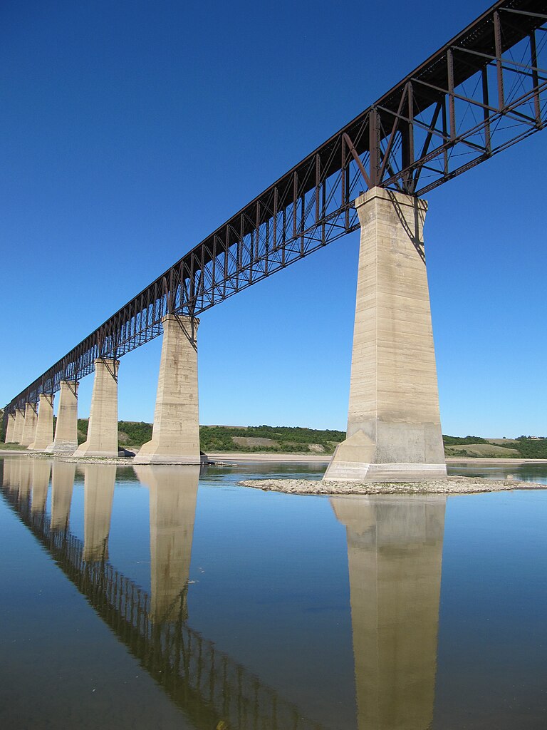
SkyTrail “Canada’s Longest Pedestrian Bridge” (map) represents another claim on the continuum of Internet glory. It began as a railway trestle, 3,000 feet (914 m) long and 150 feet (46 m) above the South Saskatchewan River. The first Canadian Pacific Railway trains rumbled over in 1912 and continued to use it until 1987. Then they converted it to pedestrian use in 2003 and now it forms part of the Great Trail of Canada.
I like the name of the town, Outlook. The Encyclopedia of Saskatchewan explains, “the railway named the location Outlook for its spectacular vantage over the river valley.”
I need to walk that bridge someday.
Hornibrook Bridge (R.I.P.), Brisbane, Queensland, Australia

I’m not even going to comment on the unusual name of the bridge. It reminds me of the old joke about the similarity between cheap beer and a canoe.
Once it was considered the longest pedestrian bridge in the world, longer even than the Walkway Over the Hudson. While it existed, it spanned 8,806 feet (1.67 miles, 2.684 kilometres) across Bramble Bay, a solid couple thousand feet longer than the current claimant (map). Authorities razed the Hornibrook Bridge recently so that’s all moot now. It had been a popular attraction for fitness and fishing from its 1979 closure to automotive traffic until its demolition. Alas, no more.
Pedestrians gained a convenient alternative and it always lacked a certain dramatic visual impact anyway. So that probably lessened the blow. The Houghton Highway runs immediately to the east and a second bridge joined it in 2010. It included a protected pedestrian lane separated from vehicular traffic by a concrete barrier.
Google Street View coverage features an interesting period during the timeline, January 2010 (view). Catch it while it lasts, they’ll overwrite it someday. Currently, as of the publication of this article, it shows Hornibrook prior to its demolition plus the new Houghton Highway lanes (the Ted Smout Memorial Bridge) under construction and nearly completed.
It’s easy to see why Brisbane added the new bridge — Street View shows two-way traffic on a three lane bridge, without any lane barriers to separate traffic coming from opposite directions and only an overhead crossbar with green and red lights to prevent head-on collisions.
Smout is amazingly close to Smoot. It must be a bridge thing.
12MC Loves Footnotes!
(1)Even 12MC’s possible secret admirer does that. Go back to the article that started it all if you’re unfamiliar with this long-running 12MC gag.

Leave a Reply