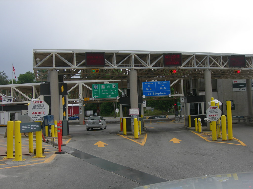
Twelve Mile Circle loves its borders, and probably none more than the border between Canada and the United States (for instance). The statistics are impressive: 119 border crossings; 39,254,000 trips by Canadians into the United States in 2009; and nearly $500 million in international trade passing every day on the Ambassador Bridge between Windsor, Ontario and Detroit, Michigan.
Those are great. Even so, I rather enjoy examining the other end of the spectrum. Not every crossing can be as popular as the Ambassador Bridge. What about some of the lesser-known ports of entry? Fortunately the U.S. Department of Transportation funds a Bureau of Transportation Statistics deep within the bowels of its bureaucracy, which offers a convenient Border Crossing/Entry Data website. Let’s take a peek.
First thing, I noticed that it’s difficult to determine which crossing might be the least popular. Should I count people, vehicles, cargo containers, or what? I decided to select a few choice categories and let them stand on their own rather than force apples-to-oranges scenarios. All figures were compiled from the perspective of the United States government for the year 2011.
It’s important to note that these are all the lowest non-zero values. Most ports of entry lack train traffic as an example. Zero values were excluded from my search.
Fewest Trains (25th place)

Calais, Maine International Avenue / New Brunswick. This border crossing recorded 77 trains (map). There are train tracks in the immediate area although I can’t seem to find where they cross the border. Does anyone know how this works? Does the train cross elsewhere and then check-in at Calais because that’s the closest location that’s staffed by border officials? Why did they record so few trains?
Fewest Train Passengers (25th place)
Laurier, Washington / Cascade, British Columbia. This is why it’s so difficult to draw comparisons between categories or in aggregate. One would expect a correlation between trains and train passengers, however that overlooks the simple fact that many trains haul freight exclusively. Thus the place with the fewest cross-border train passengers traversing the border takes place on the other side of the North American continent.
Fewest Trucks (79th place)

Ferry, Washington / Midway, British Columbia. A grand total of three trucks crossed there in 2011. That’s one truck every four months. I imagine that this would be a very poor choice for a smuggler. Trucks are so rare that it’s an event. I bet customs agents scrutinize them intensely just to have an opportunity to do something a little different. It’s not hard to see why trucks don’t generally pass through here. It’s a little out the way and several larger, more truck-friendly roads cross the border to the east and west.
Fewest Buses (3-way tie for 64th place)
Pinecreek, Minnesota / Piney Manitoba, Bridgewater, Maine / Centreville, New Brunswick, and Hannah, North Dakota / Snowflake, Manitoba. Each of these locations recorded a single bus. That’s right, only one bus passed each of these locations in all of 2011.
I wonder if this included a bus full of geo-oddity tourists on the way to see the bi-national airport runway at Pinecreek?
Fewest Pedestrians (43rd place)
Noonan, North Dakota / Estevan, Saskatchewan. Seriously, I’d love to know the story behind the single pedestrian who crossed here. Just look at the Street View image. It’s remote. It’s empty. Why would anyone be walking through here and where would they be going?
Fewest Personal Vehicles (85th place)
Whitlash, Montana / Aden, Alberta. This might be my favorite proxy measure for the least popular border crossing. Passenger vehicles are by far the most common way to cross between the two nations. Only 656 used Whitlash in an entire year. Two per day. Wow. I’d probably cross here if I were in the area just to inflate their statistics.
Foreshadowing. I’ll perform a similar exercise on the U.S. – Mexico border in the next installment.

Leave a Reply