We spent the first day getting down to our base at Elizabeth City, North Carolina. That set us up well for Day Two. Now we could focus squarely on capturing some unvisited counties. I decided to travel counter-clockwise (or anti-clockwise for the international 12MC audience). This map shows the actual coordinates I used to guide the drive:
All told, I expected this would take about three and a half hours of driving plus the stops. We would log five new counties: Bertie; Chowan; Gates; Hertford; and Perquimans. Something always manages to happen to change these kinds of plans. However this time, oddly enough, everything worked out fine. Not complaining.
The Great Dismal Swamp

Our first stop actually brought us on a detour back into Virginia for awhile. I’ve long wanted to travel through the Great Dismal Swamp. We targeted Lake Drummond (map), the largest natural lake in the state. Well, Virginia only has two natural lakes surprisingly enough. The other one — Mountain Lake — can be found in the state’s Appalachian region, although it exists only intermittently and covers barely 50 acres at its largest. Drummond, on the other hand, stretches something like 3,000 acres. Even so, it never gets deeper than about six feet.
The final part of the drive featured several miles of gravel road through a wildlife preserve. We didn’t see much wildlife although we spotted a bald eagle before we got into the park. The road took us to a viewing platform and boat launch on the western side of the lake.
We saw only one other person this chilly morning, a bicyclist who had the same basic idea.
High Cotton

I didn’t realize people grew cotton commercially as far north as Virginia. True, it made it only to the very bottom edge of the state although it most certainly crossed the border. Cotton fields ready for harvest looked like a thin blanket of snow. I needed to explore it closer. My poor rules-following son seemed horrified when I parked in front of a No Trespassing sign and got out. Nobody was around and it wasn’t like I walked through the field. I simply checked it out from the roadside just long enough to take a couple of pictures.
We continued for quite awhile through flat, rather unremarkable terrain. I think we stopped at Subway for lunch somewhere along the way. Eventually we returned to the northern shore of Albemarle Sound. There, I felt certain, we’d find something more exciting to see.
Roanoke River Lighthouse

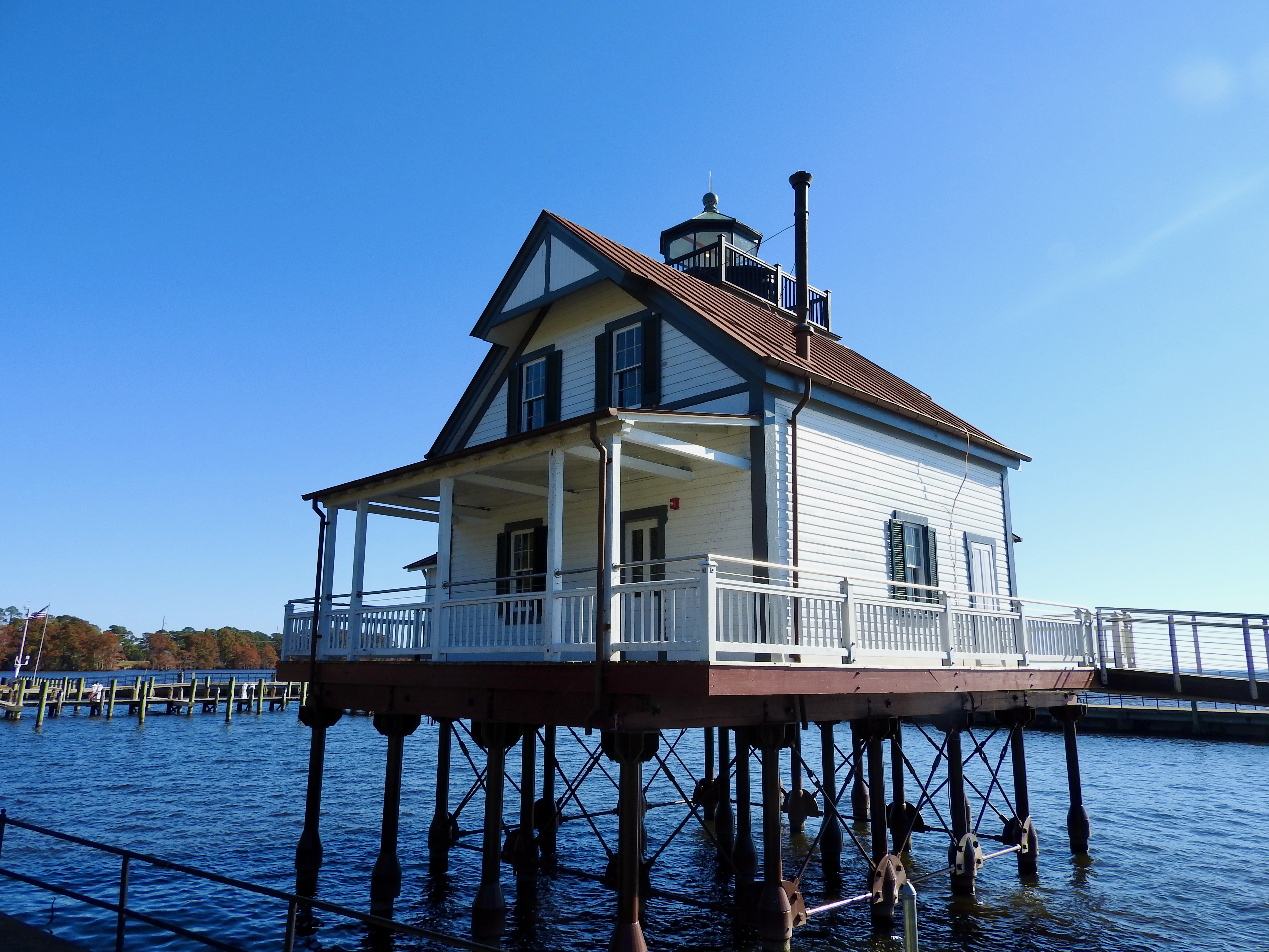
This route led us to Edenton, a place I would describe as “quaint.” I’m sure couples come here from Raleigh/Durham or the Hampton Roads area for romantic weekends. It all seemed rather boutiquish and bed-and-breakfasty, if those count as words. Really, I just wanted to see the lighthouse because I collect lighthouse visits Edenton had a particularly nice one. I haven’t gotten to visit a lot of river lighthouses before so this felt like a special treat. River lighthouses don’t require towering heights or massive lenses like ocean lights so they look distinctly different.
This one didn’t sit originally in Edenton, In fact, it didn’t occupy its current home until 2007 (map). It sat at the mouth of the Roanoke River from 1886, replacing earlier versions that war, fire and weather destroyed. Someone purchased it in the 1940’s after its decommissioning, moved it to dry land and used it as a private residence. Then it sat neglected for awhile and decayed. Finally the Edenton Historical society purchased the light, put it on screw-piles as originally designed, and lovingly restored it.
Thus the Roanoke River Lighthouse wasn’t the original, nor did it mark the Roanoke River, but it was still cute as a button.
Newbold-White House

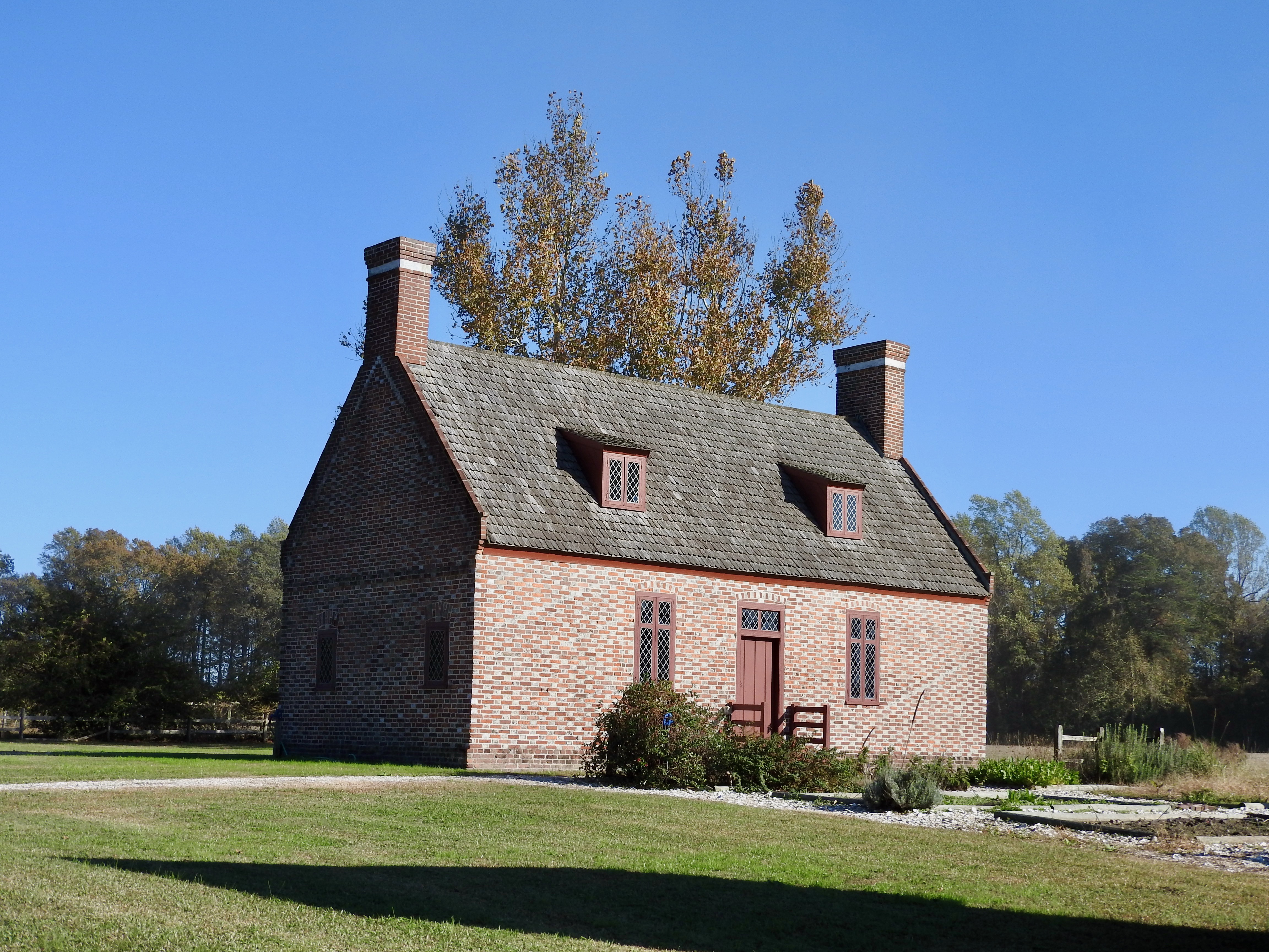
Our journey maybe went a little too smoothly. We found ourselves way ahead of schedule. Neither of us really wanted to sit around our hotel in Elizabeth City for the rest of the afternoon. Leaving Edenton and heading towards Hertford on U.S. 17, I spotted a billboard that seemed promising. It advertised “the oldest brick home in North Carolina.” I only had to turn right at the next light and go a mile. We figured we could detour for a mile to see an old brick home (map). Why not.
Technically, the Newbold-White House was closed for the day but we could still take the self-guided tour. Quakers built the home in the early 1700’s, a pretty stately estate for that time period. They placed the home on the Perquimans River, a tidal estuary of Albemarle Sound. What we would consider the front of the home today (in the foreground) would have been the rear door in the 18th Century. We drove up a road. Colonists used the river as their road.
We poked around the garden, peeked through the windows, took some photos and continued on our way.
Elizabeth City Waterfront

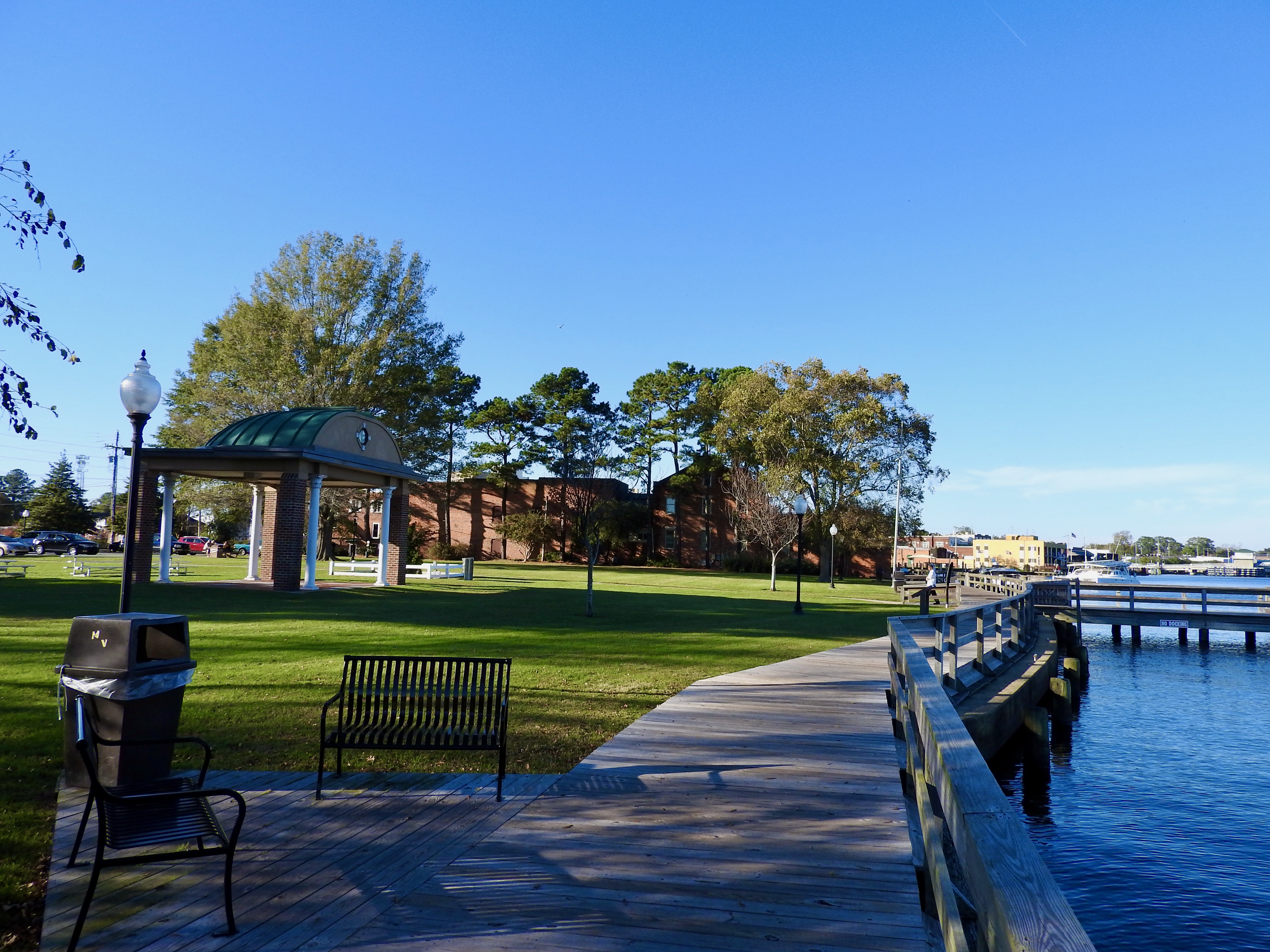
Well, we still had some time available. We returned to Elizabeth City and took a walk along the shore of waterfront park (map) on the Pasquotank River, another tidal estuary of Albemarle Sound. Then we had dinner at a local Mexican restaurant, because, I don’t really know why we chose Mexican. It really had no connection at all to the history or geography.
We returned home the next morning.
See Also: Day 1 and The Complete Photo Album on Flickr

Leave a Reply