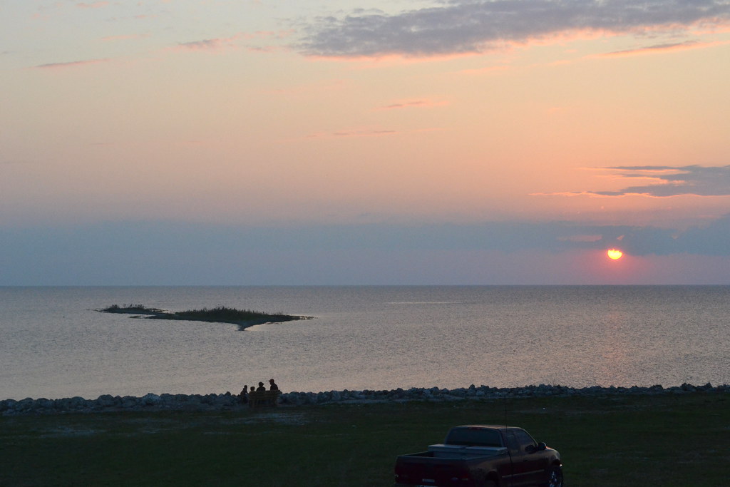
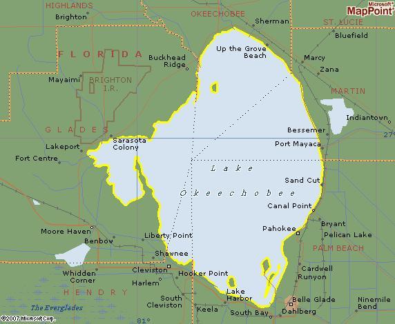
Lake Okeechobee (map) dominates South Florida’s landscape. It’s a massive liquid patch along a narrow peninsula. It’s as if some giant creature found the lower portion of the state a convenient coaster for the world’s largest mug. Additionally it is the second largest freshwater lake contained wholly within the United States. Only one of the Great Lakes — Lake Michigan is larger. Finally, it covers a whopping 730 square miles but averages a measly 9 feet deep.

Actually, Lake Okeechobee is merely an opening within the surrounding Everglades. Thus it’s a clearing in a much larger body of water camouflaged by swamp and sawgrass. This would generally interest me enough to cover it on the website just for that one fact. However, there is an even more unusual feature that has nothing to do with nature. It has everything to do with the unique way mankind carves out its little territories.
Geographic Distinction

Look at this Lake Okeechobee map. Clearly it shows a place where five different Florida counties come together at a single point: Glades; Hendry; Palm Beach, Martin and Okeechobee. There is no other spot in the United States where this occurs. So it forms the nation’s sole county quintipoint.
It’s fairly common to find a boundary where four political units come together. Obviously, this happens anytime two lines cross. It is much more unusual to find more than four coming together. It often signals that something of particular importance sits at that common point. In this case it’s the lake itself. More specifically, it’s the large reservoir of fresh water that is useful both for drinking and for agriculture.
How it Happened

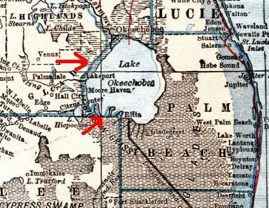
Neighboring counties didn’t always share Lake Okeechobee so equitably. The Palm Beach County government’s public affairs website [link no longer available] explains that the entire lake belonged to Palm Beach County until 1963. This prior ownership arrangement appears quite clearly in this detail from a 1921 L.L. Poates map available through the University of South Florida. Notice how the blue county boundary for Palm Beach marked by the red arrows wraps entirely around the lake.
As the population of South Florida and demands for fresh water grew, so did the demands of counties bordering on Lake Okeechobee. Eventually the State of Florida stepped in and divided ownership among the five. That is how the state ended up with five counties coming together at a common point.

Leave a Reply