What do Council Bluffs, Iowa, the Battle of Vicksburg and the Yellow River all have in common? Loess.
Loess comes from the German löß, and has a common root with the English word, loose. This geological term describes a light silty dust blown by the wind that accumulates into thick layers and hills. These deposits, often taking on a pale yellowish-brown or buff color, are capable of covering huge territories. They form a blanket of dust hundreds of feet thick, created over numerous repeated cycles of water and wind.
In the United States
I first became aware of loess at the appropriately named Loess Hills of western Iowa. It’s a particularly remarkable example of this type of formation. My in-laws lived in a suburb of Omaha, Nebraska at the time, on the Iowa side near Council Bluffs. Their home was located atop one of these hills. Loess contributed the “bluffs” of Council Bluffs, and the city even held an annual Loessfest.
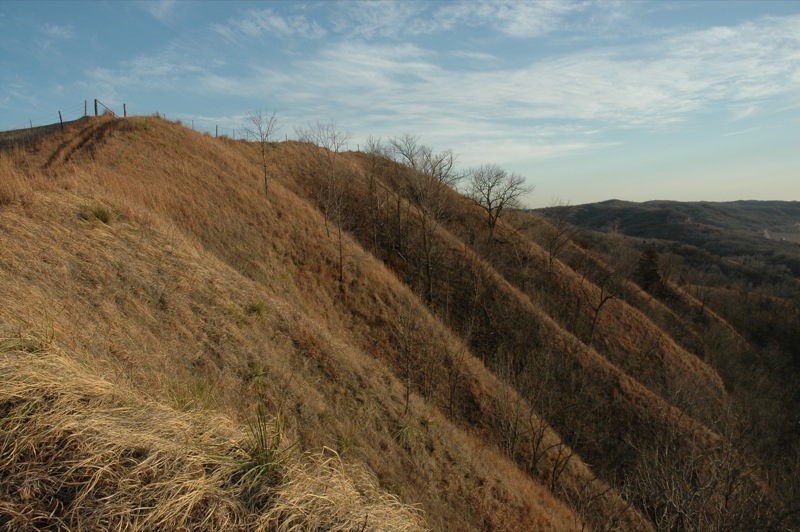
Notice the terrain east of the Missouri River floodplain. These are part of Iowa’s classic Loess Hills area. Anyone driving along Interstate 29 through there can look to the east and glimpse these unusual sedimentary hills at pretty much any random place. They may not seem terribly remarkable until one ponders their interesting geological history. Then compare them to the flatness of much of the rest of this part of North America.

As the Iowa Department of Natural Resources explained,
“The Loess Hills of western Iowa were formed from 20,000 to 10,000 years ago of finely ground windblown silt from the glacial deposits. As the Pleistocene glaciers melted, the Missouri Valley became a major channel for tremendous amounts of water. Each winter season, as the quantity of melt water was reduced, large areas of flood-deposited sediments were left exposed to the wind. Silt, clay and fine sand were lifted by the wind, carried to the east and deposited.”
Properties
Particles of loess display some interesting and unusual properties. They have an angular structure that exhibits a propensity for extreme crumbliness and quick erosion. This results in characteristic bluffs with steep ridges and and rapid drop offs, as displayed in the photograph. Yet, loess is extremely stable when dry and held in place by prairie grasses.
The Loess Hills of western Iowa tower up to 250 feet (75 metres) above the Missouri River floodplain. They existed quite contently until people cut into the hills for their own purposes. Any soil exposed directly to the elements quickly crumbles and erodes away.
Unusual Although Not Unique
I would hear residents remark about the uniqueness of their Loess Hills whenever I visited the area. However, “unique” isn’t completely correct. They’d always append a qualifier to their description, “except for some place in China”. The place in China always remained unnamed. Even so, to their credit they recognized the unusual nature of loess formations.
They were on the right track. The two most significant deposits of loess happen in western Iowa and in China. Additionally, the phenomenon exists to lesser degrees in many other parts of the world. For example, geologists call it loess rather than loose (or some variation in a Chinese dialect) because of deposits that formed in Germany’s Rhine Valley.
There are even other places in the United States with loess. For instance, it exists along the eastern bank of the Mississippi River at Vicksburg, Mississippi. A vital element of the 1863 Battle of Vicksburg during the U.S. Civil War — the siege of Vicksburg — hinged on this. The battle took place when Union troops could not dislodge Confederate forces dug-in securely atop the steep loess bluffs along the river. The siege lasted more than a month until Confederate troops exhausted their supplies and had to surrender.
What about China, though?
Eurocentric geologists named China’s equivalent of the Loess Hills the Loess Plateau. As noted by Wikipedia, it covers 640,000 square kilometres (250,000 square miles)… “almost all of Shanxi and Shaanxi provinces, as well as parts of Gansu province, the Ningxia Hui Autonomous Region, and the Inner Mongolia Autonomous Region.” That’s about the same size as the U.S. state of Texas, or the Canadian Provinces of Alberta or Saskatchewan!

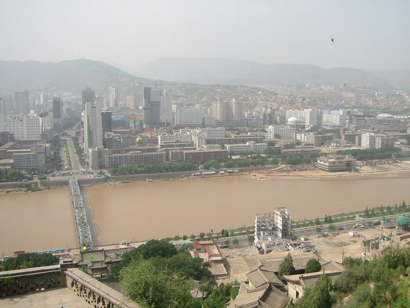
It’s particularly prevalent along the upper and middle Yellow River watershed. It is eroding loess that creates the characteristic yellow color of the Yellow River (map).

Leave a Reply