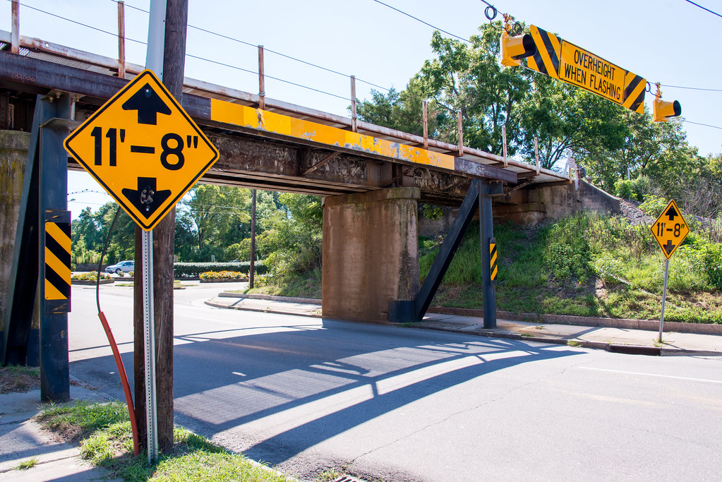
I’ve seen an unusual website mentioned on several aggregator and blogging websites called 11foot8.com. I’m sure that some of you’ve seen it too and it probably doesn’t need much introduction. It features an 11 foot 8 inch (3.56 metre) overpass on Gregson Street in Durham, North Carolina that has the propensity to peel the tops off trucks when unsuspecting drivers underestimate the clearance (map). It’s quite entertaining.

The situation in Durham inspired me to wonder about extremely low road clearances. Is it a common phenomenon? How does it arise typically? Is the instance in Durham particularly remarkable?
The Search
I wouldn’t say it’s a common situation but it’s certainly not rare. I found a wonderful resource from AITA Online, America’s Independent Truckers’ Association, that’s targeted at owner-operator, independent operator, and small-fleet truckers. They provide a list of “Low Clearances, Bridge Heights and below normal bridge clearances.” They admit it’s not a definitive list. However, it’s a great starting point for anyone who needs to know about such things, all categorized neatly by state.
My unscientific semi-random sample demonstrated some interesting characteristics. Low clearances tended to happen in urban areas where transportation infrastructure gets bunched together tightly or in rural areas where there’s little traffic. I didn’t see much at all in the suburbs.
Some instanced involved covered bridges and tunnels through hillsides. But a much larger number seemed to involve railroad overpasses. That appeared to be true whether urban or rural and I don’t have a good explanation for it. Maybe these railroads predate trucks and back then they only required sufficient clearance for horse and rider?
Starting with the AITA list, I compiled the lowest of the low clearances. The Durham example does not make the cut. It doesn’t even come close. There are plenty of clearances in the 9-foot (2.74 m) range and lower. Gregson Street gets all the attention because it occurs in a highly visible area that happens to be near someone with an intense interest and a camera.
A Nice Sampling
Lets look at a few of the more noteworthy examples.
Henning, Tennessee

McFarlin Avenue, east of Main Street in Henning, Tennessee has a listed height of 8’0″ (2.44 m) below this railroad track (map). I’m not sure of the vertical clearance of the Google Street View car and the driver probably had a similar concern. If you open the image on a separate page and check the Street View coverage you’ll notice that the images stop right before the bridge and then starts back up again on the other side. There is a similar bridge on the next road crossing Main Street just a but further north so Henning is a remarkable place for low clearances.
UPDATE: I visited this overpass in 2014!
Railroad, Pennsylvania
The small town of Railroad, Pennsylvania provides another wonderful instance heading north out of town on Main Street, Route 616. AITA listed this as 8’1″ (2.46 m) but the sign along the road clearly says 10’0″ (3.05 m). I found those kinds of exaggerations frequently in my small sample. I’m guessing that it’s better to underestimate the clearance height for the sake of safety. I also love the way the utility wires strung between poles on either side dip down and run through the tunnel rather than over it.
Once again it’s a railroad that creates the low clearance. While the tracks remain active it shares a right of way with the Heritage Rail Trail County Park.
Jacksonville, Florida
I found a great urban instance in Jacksonville, Florida. Look at this 3-layered mess! The top is Interstate 95. The middle is a railroad bridge. The bottom is N. Myrtle Avenue, with a marked clearance of only 9’0″ (2.74 m). I’d love to drive that road!
Logan, West Virginia
Finally, travel to Route 17 in Logan, West Virginia. This one is also 9’0″ (2.74 m) and covers a particularly long distance. There’s plenty of room for cars but I don’t see any trucks waiting at the intersection for good reason.
Do you have a favorite low clearance road? Please feel free to include map links in the comments.

Leave a Reply