I’ve gone Mac! Actually it happened a few weeks ago but it took me a little while to feel proficient. Even so, I don’t want to turn this into a Mac versus PC discussion. People make choices based on personal preferences and that’s fine. Instead, I’ll focus on a couple of different mapping features I’ve enjoyed that I’d like to share.
iMovie
Longtime readers know that I like to throw little video clips onto these entries from time-to-time. I store them all on the world’s lamest YouTube channel (voted least likely to go viral). I’m no professional, in fact I’m pretty sure I’m about as opposite of that as humanly possible.
It doesn’t help that my equipment consists of a point and shoot camera combined with a shaky hand. It’s one step up from a cellphone video but not by much. I’m never going to win an Oscar for cinematography just like I’m never going to be an Olympic athlete or a Nobel Laureate. That’s OK. I’ve reconciled with those shortcomings and I still manage to lead a happy life.
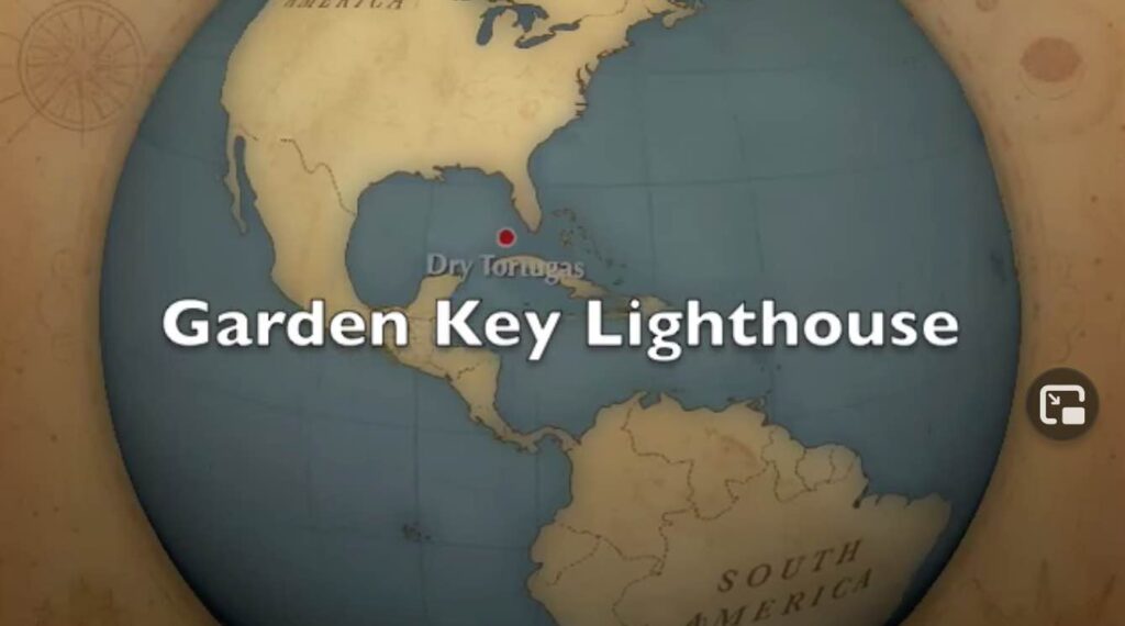
Anything that might enhance or improve my crappy raw video footage would have to be a good thing. Thus, iMovie delivers. This is a geo-Blog so I’m going to totally ignore every aspect of iMovie except for one. There is a feature that allows a user to embed a map, complete with custom long/lat coordinates and labeling, within the video during the editing process. Check out this screen shot from my most recent video:

I’d advise you to not click on it unless you really like lighthouses on windy days. Or at least put it on mute. However, I didn’t create the video for Twelve Mile Circle per se. I actually designed it for my lighthouse page. You see, I have a lighthouse thing along with other bizarre fixations that you’ll learn about as you follow this site over time. There’s room for that later. What’s important for today is the map not the cheezy video. But if you really do want the video, here you go.
iPhoto
There’s a whole host of ways to sort photos in iPhoto including criteria such as event, date and person (facial recognition). However, I have to say I’m really loving the ability to sort by location. This goes way beyond the name of a town or a neighborhood and straight down to the specific long/lat coordinate at several decimal places.
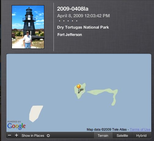
There’s an option to decrease the precision, say if someone wants to tag all of his photos to a park rather than to every spot visited in the park. I’m much too literal for that. You know I’m marking things down to a gnat’s eyelash. I’d take it down to the molecular level if indeed that were possible. Here’s a screenshot that provides a good example:

Notice that iPhoto includes an interface directly into Google Maps. The user can drop or move the marker at will. The user doesn’t have to know a thing about longitude or latitude. Plus the software also remembers locations. That way a user doesn’t have to go through this exercise multiple times if several photographs track to the same spot.
By the way, I featured the same lighthouse that appeared in the video in this section. It’s called the Garden Key or Tortuga Harbor Light, and you can visit a dedicated page if you want to know more about it. It’s way in the middle of nowhere; seventy miles west of Key West.
I do have a special request for the 17.2% of you who visit the Twelve Mile Circle using a Mac: if you know of other mapping features that come standard with a Mac… could you let me know about them? I’ll find them eventually but I sure don’t mind being clued-in early.

Leave a Reply