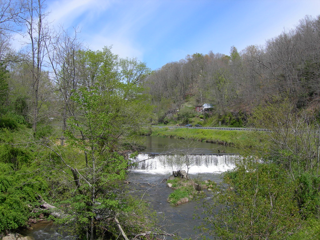
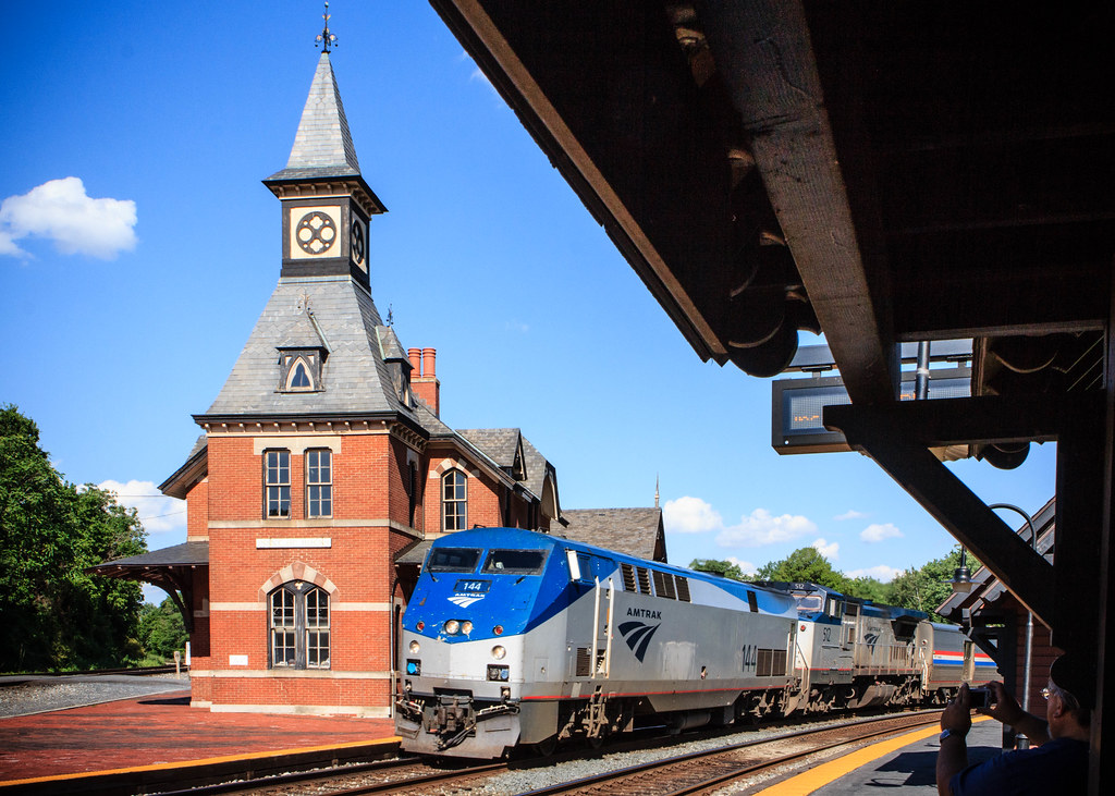
Mouth of Wilson. I used it as a waypoint during my recent county counting quest. Otherwise I put it out of mind as I drove through an expansive rural corner of Virginia. It came to mind again a little later. I passed a sign for another town about an hour farther north and east, Meadows of Dan. How unusual, I thought, to encounter two locations in relatively close proximity to each other with the word “of” embedded in their names.
I remembered a similarly concocted town a few miles away from my childhood home called Point of Rocks. It sat just across the Potomac River from me in Maryland. At that point I tucked the notion away until my return. Interestingly, each of them became known predominantly for something other than the piece-parts of their oddly constructed names.
Mouth of Wilson

Mouth of Wilson presented a couple of obvious questions. Why Wilson and why the preoccupation with his mouth? Fortunately answers revealed themselves quite conveniently in Grayson County: A History in Words and Pictures.
“When the Frye [sic.]-Jefferson party surveyed the line between Virginia and North Carolina in 1749, a young surveyor named Wilson died. His body was carried to the bank of a nearby creek for burial, hence the name Wilson’s Creek.”
Joshua Fry and Peter Jefferson surveyed uncharted corners of Virginia. This included its border with North Carolina, resulting in the definitive map of the colony from that era. Apparently Wilson never saw the fruits of his labor. However, he lived-on in a way many years later. A town grew at the confluence of Wilson’s Creek and the New River. That spot marked the mouth of Wilson’s Creek and the name shortened nicely to Mouth of Wilson.
Basketball?
Nobody much remembered Fry or Jefferson or especially Wilson. Many people heard of Peter’s son though, Thomas Jefferson. If by chance anyone ever heard of Mouth of Wilson it probably had nothing to do with 18th century cartographers. Oddly, basketball became its claim to fame. Here, nearby Oak Hill Academy (map) built a basketball dynasty over three decades.
The school never included more than about 150 students at a time. Yet it produced a crazy number of professional basketball players. The school’s utter domination of the sport at the high school level continues today.
Meadows of Dan

Flowing waters also underpinned the etymology of Meadows of Dan. Nobody named Dan inspired it or ever lived there. However, the beautiful meadows did exist near the upper reaches of the Dan River. One part of the name derived from a 1728 expedition mapping the boundary between Virginia and North Carolina. This took place prior to Fry and Jefferson who improved and extended the line. That earlier expedition came under the direction of William Byrd.
From Whence Dan?
According to the Danville Historical Society,
“The surveying party began marking the line at the mouth of the Currituck River on the coast of Virginia, and went westward toward the mountains. When they reached this area, Colonel Byrd and his party encountered ‘the South Branch of the Roanoak River the first time, which we call’d the Dan.’… Colonel Byrd never explained his choice of name for the river. However, the biblical limits of Canaan were “From the Dan to Beersheba.” Because the northern limit of North Carolina was in question, “Dan” seemed to be an appropriate name for the river which at that time fixed the boundary in this area between the two colonies.”
So that likely explained Dan.
What About the Meadows?
The meadows portion joined the name much later, as explained by the community of Meadows of Dan [link no longer works]
“This broad high mountainous area was settled in the early 1800s, mostly by German and Scotch-Irish settlers that traveled down from Pennsylvania… The Langhorne family, one of the few of English descent in the community, held a land grant that contained much of what is now considered Meadows of Dan… The Langhorne patriarch is credited with giving the area the name “Meadows of Dan”. He settled on the headwaters of the Dan River, and grist mills in the Langhorne name were built along the stream.”
Few people would know much about Meadows of Dan if it weren’t for two fortunate happenstances. First, Edwin Boston Mabry, a local resident built a wonderfully iconic mill in 1903 (map). Second, the Blue Ridge Parkway ran directly past the mill after its construction as a Depression-era jobs project in the 1930’s. Maybry’s Mill quickly became one of the most heavily visited and photographed spots along the entire parkway.
Point of Rocks

I didn’t need to conduct any research to determine the source of the rocky point inspiring a town called Point of Rocks in Maryland. Literally, just west of town stood a point of rocks that I’d seen many times with my own eyes. The cliff might be a notable landmark for bikers on the C&O Canal trail, or to boaters on the Potomac River. Most everyone else would remember Point of Rocks for its nostalgic train station (map), built in 1873. It provided an important junction where trains routed either to Baltimore or to Washington. Of course I’ll always remember Point of Rocks more for the drive-through liquor store of my youth.
Upon Further Consideration
It occurred to me that there may be many more “of” towns. Yet, I couldn’t find them using my usual search techniques and I couldn’t recall any others from memory. Sure, there were a billion examples tied to geographic units, for instance the City of London, District of Columbia, Commonwealth of Virginia, United States of America and the like. Those were all too mundane even to mention. I wasn’t interested in finding more of those. No, I wanted additional mouths and meadows and points and other strange yet appropriate descriptions of things. I imagined there were probably many very obvious instance that somehow fell into my mental blind spot. What am I missing?

Leave a Reply