Over the Road

An image posted by reader Katy in a comment on my recent Tunnels, Bridges, Lifts and Inclines article completely captivated me. It shows a canal going over a road in the Netherlands. The interesting aspect, to me, is that a viewer can determine the actual depth of the canal. Highway engineers were kind enough to paint the canal enclosure in a black-and-white checkerboard pattern.

I’m not sure why a massive concrete half-pipe filled with boats stirs my imagination. It does. It also got me thinking about other structures extending above roads. There are literally thousands of examples. Please feel free to suggest your own local favorites.


Restaurant

Toll roads hold a captive audience. Nonetheless, highway authorities have to meet certain basic driver needs to keep the meter running. It’s more cost effective to provide a single service area within the highway median, for traffic moving in both directions. That’s easier in a rural area where land is cheap and plentiful. Unfortunately it becomes a bit more difficult in an urban environment. The Illinois Tollway solved this problem by putting travel plazas above the motorway. In this example it involves the Tri-State Tollway’s O’Hare Oasis near Chicago.

It’s not exactly fine dining but I can see a Starbucks and an Auntie Anne’s through the window. I also see some tables and chairs (and is that someone sitting there?). Maybe this is more properly a food court but I’ve noticed others in my journeys that are closer to traditional restaurants.

I selected this image because I’ve actually stopped here. I also like that they call it an Oasis. My mind wanders to images of camels, sand dunes and palm trees. Contrast that with the actual artifacts of that site. We should celebrate rare examples of bureaucratic creativity like this.


Shopping Mall

Head over to Cheltenham (near Melbourne) in Victoria, Australia, and one can experience a shopping mall built across the Nepean Highway. This is the Westfield Southland Shopping Centre. The Intertubes imply that the eastern portion came first and the western portion arrived later as an annex.
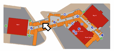
Westfield Southland Cheltenham
Westfield Southland’s highway overpass

Oh look, here are shops located directly above the roadway. Have any of our Australian readers from the Melbourne area experienced this shopping centre in person?


Museum
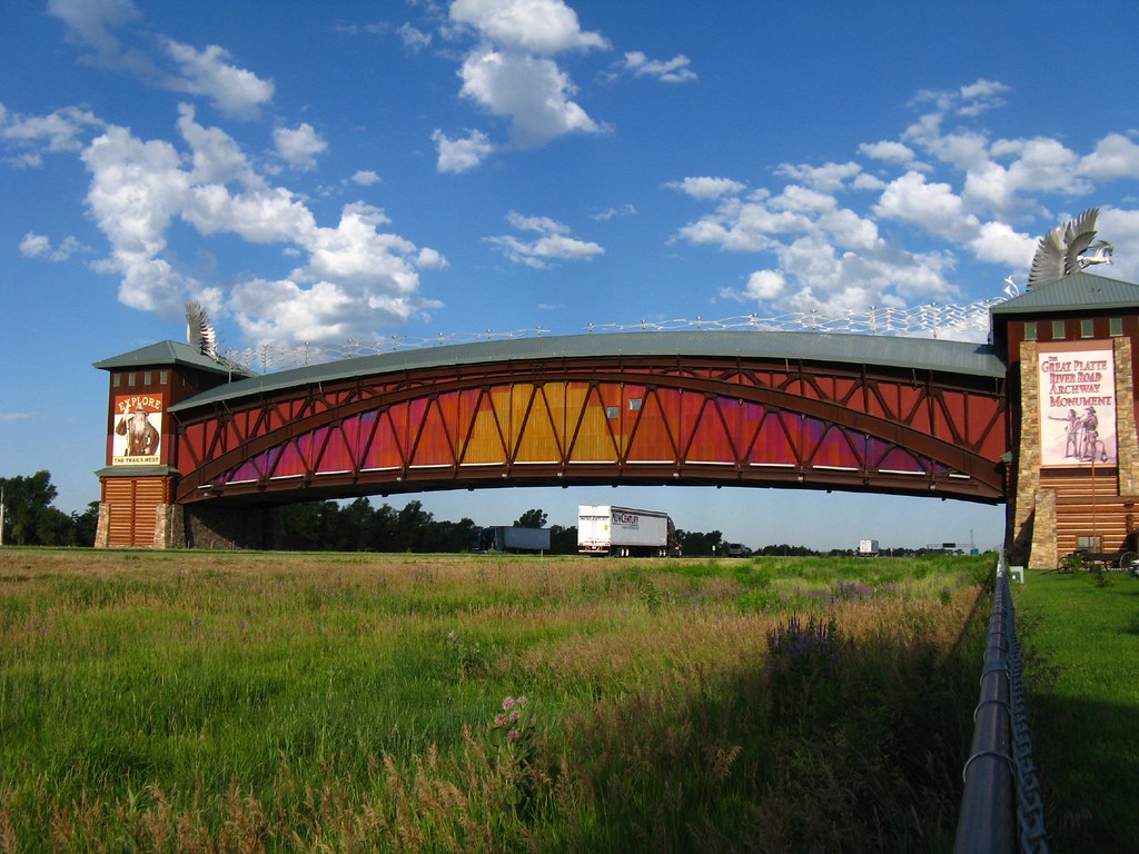
Kearney, Nebraska. Photo by Jasperdo; (CC BY-NC-ND 2.0)
Interstate 80 in Kearney, Nebraska

The Great Platte River Road Archway Museum in Kearney, Nebraska may be the only museum built over a roadway (map). That means I’m too lazy to look for other examples. Even so, it sounds plausible and I’ve offset it with a qualifier. I was in Nebraska when this monument to frontier culture opened in 2000 although I didn’t have an opportunity to visit.

It’s not exactly located conveniently unless one happens to be driving through a vast empty expanse along Interstate 80. Actually, that’s the point. The state designed this attraction to tempt long-distance travelers. It gives them an excuse to stop in Kearney and leave a little money behind for the local economy. Frankly, there aren’t many economic opportunities way out in the wide open spaces of the Great Plains.


Park

Rose Kennedy Greenway. Photo by Paul Geffen; (CC BY-NC 2.0)
Rose Kennedy Greenway; Boston, Massachusetts

I could have chosen hundreds of examples of parks over roadways. It seems to be in vogue with urban planners at the moment along with everything “green.” I selected parklands created by the monumental Big Dig undergrounding of the Interstate 93 Central Artery in Boston, Massachusetts (map).

Everything associated with the Big Dig happened on an epic scale including the creation of green space right at city center, where an ugly elevated motorway once stood. The 15 acres of new parkland became the Rose Kennedy Greenway and represents the final phase of the project:

“When Boston’s Big Dig project plunged previously elevated roadways underground, the city found itself rich in prime urban land. Community and political leaders seized the opportunity to enhance Boston’s city life by providing additional parks and gardens to connect some of its oldest, most diverse and vibrant neighborhoods.”


Office Building

A Road Runs Through It. Photo by caribb; (CC BY-NC-ND 2.0)
A Road Runs Through It

The Gate Tower Building in Osaka, Japan received significant Internet fanfare a couple of years ago to the point where it became a bit of a cliché. Nonetheless I still love the notion of a freeway ramp barreling directly through the gut of an office building (map). Lots of other sources cover this situation already so let’s move along. Nonetheless, I’d love to work in a building like that.


Runway

A surprising number of airports have roads that run beneath them. Logically, it makes sense: passengers want convenient locations but airports require lots of land. I selected the Manchester Airport in the United Kingdom in this instance. As noted in Airliners.net, it has “a road (the A538 Wilmslow Road) that passes under both runway 23R/05L (and its parallel taxiway) and 23L/05R,” which makes it a particularly remarkable example.

Comments

16 responses to “Over the Road”

  1. Greg Avatar
    Greg

    In my hometown of Cleveland, here’s an example of a bridge spanning another bridge:


    It happened when the larger Detroit/Superior bridge was built over the older Flats neighborhood and its existing Center St. bridge. Granted, the actual crossing looks to happen somewhat over land, but it’s still pretty rare. Or is it?

  2. Richard Avatar
    Richard

    Boston (well, Newton) has a couple of others, as the now-defunct Massachusetts Turnpike Authority used to have a practice of selling air rights over the freeway for supplemental income. Supermarket:


    Hotel:


    The picture isn’t great, but I think it was taken back when the hotel was a Sheraton; it became a Holiday Inn Crowne Plaza a couple of years ago. Also, you can’t really tell from the picture, but train tracks (used for MBTA commuter rail and CSX freight) run underneath the parking garage on the right side of the picture.

    Farther east, I-90 and the same train tracks go under the Prudential Center, but you already covered shopping malls.

  3. Richard Avatar
    Richard

    Another example:
    In the Netherlands this is called an “Ecoduct”. It is designed to allow wildlife to cross highways.


  4. Matthias Avatar
    Matthias

    How about a supermarket?

    http://maps.google.com/maps?f=q&source=s_q&hl=en&geocode=&q=newtonville,+newton,+ma&sll=42.347083,-71.151743&sspn=0.137528,0.308647&ie=UTF8&hq=&hnear=Newtonville,+Newton,+Middlesex,+Massachusetts&ll=42.351028,-71.208451&spn=0.008595,0.01929&z=16&layer=c&cbll=42.351048,-71.208327&panoid=SwO6iHQSOaegmV8UbC3tcw&cbp=12,246.3,,0,1.4

    This is the Shaw’s (formerly Star Market) in Newtonville, MA. It was the local grocery store where I grew up. I think the original store was demolished to make room for the Mass Turnpike, and they were granted air rights to rebuild part of the store over the roadway.

    1. Twelve Mile Circle Avatar

      I should have cleaned out the moderation queue a little quicker. Matthias and Richard had the same excellent thought but it was impossible for them to know as I hadn’t pushed their comments into public view yet. You both get a gold star for the great example.

  5. Bill Harris Avatar
    Bill Harris

    Although it’s not clear in this photo, here is a bridge for horses using the Fair Hill, Maryland Natural Resources Center:

    http://maps.google.com/maps?q=fair+hill+maryland&oe=utf-8&rls=org.mozilla:en-US:official&client=firefox-a&um=1&ie=UTF-8&sa=N&hl=en&tab=wl

  6. The Basement Geographer Avatar

    A shopping mall in Rovaniemi, Finland:


    The Canadian Pacific Railway headquarters in Calgary, Alberta:


  7. Katy Avatar
    Katy

    Two more:

    The Hinsdale Oasis, along The Tristate, I-294 in IL:


    The old post office building where the Eisenhower, I-290 ends in Chicago:


    There is also another oasis-type rest stop along the Will Rogers Turnpike, I-44 in NE Oklahoma but I can’t remember the nearest town.

  8. jlumsden Avatar
    jlumsden

    The Dale Chihuly Museum of Glass in Tacoma has a pedestrian bridge over I=705. While there are many bridges over freeways, this one is an impressive extension of the museum. Here’s a link:

    http://www.chihuly.com/bridge-description.aspx

  9. Marc Avatar
    Marc

    The science museum in St. Louis has an extension with museum exhibits over highway 64.

  10. Joshua Avatar
    Joshua

    No one yet has mentioned one type of building….a school

    http://goo.gl/maps/oHJq

    Here’s Lehman High School in the Bronx, NY hovering over the Hutchinson River Parkway. This and the overpass following it are infamously reported every once in a while. South of this location about 2 miles is the Bronx-Whitestone Bridge (I-678). Where I-678 ends and the Hutchinson River Parkway begins, there is a junction with I-95 (Cross Bronx Expressway/Bruckner Expressway). As parkways in New York City exclude commercial vehicles, tractor trailers are prohibited from them, such as the Hutchinson River Parkway. Alas, occasionally on traffic reports it is reported that one missed the exit for I-95 and wandered onto the parkway. Once or twice I’ve seen the roof of a trailer ripped off like a tin can.

  11. Calgully Avatar
    Calgully

    You asked whether anyone in Melbourne has been to Southland Shopping Centre. Well, yes I have, but it’s one of those inward facing shopping centres without external windows so when inside you are not aware of where you are, and there is no sensation of being above a highway.

    Southland is much more famous as being a frequently used on-site filming location for the TV series “Kath and Kim”. http://www.imdb.com/search/title?locations=Southland%20Shopping%20Centre,%20Cheltenham,%20Melbourne,%20Victoria,%20Australia

    Southland plays the role of “Fountain Lakes” which in Australia is now because of this series synonymous with Bogans. If you are not Australian you wont know what a Bogan is – the best I can do is point you to wikipedia http://en.wikipedia.org/wiki/Bogan enjoy.

  12. Ariel Avatar
    Ariel

    Building on Joshua’s post, in Manhattan I-95 crosses under a bus terminal and an apartment building (referred to as “the apartments”) on the local traffic reports. Here is a link to picture.

    http://en.wikipedia.org/wiki/File:TMX_apartments_jeh.JPG

  13. Jondar Avatar
    Jondar

    While I am Australian, I haven’t been to Melbourne, so I can’t say I’ve been to Westfield Southland. However, it seems extremely common here for shopping centres to span across roads (usually not highways though). I can think of at least five off the top of my head in the Sydney metro area alone, but my favourite has to be what they did in the Sydney suburb of Hornsby: it’s two sections of a shopping centre built on diagonally opposite corners of an intersection (which is now a plaza). Westfield wanted to connect the two sections with a overhead pedestrian walkway. Problem is: the plaza intersection has a (rather cool) fountain in the middle of it. The solution: build a semi-circular walkway.

    Google Street View doesn’t show good images of the walkway (and fountain) but I found a couple of photos showing the walkway:

    http://picasaweb.google.com/lh/photo/VxScEeXGXDtFTlSHsLohvg

    and

    http://www.flickr.com/photos/19132792@N00/2078017862

    It may not be as impressive as the others in this article, but I always enjoy visiting it when I can 🙂

    1. ausfi Avatar
      ausfi

      I have only been there once, when I took the photo of the walkway, but I enjoyed them both.

  14. Rhodent Avatar
    Rhodent

    I’m a little surprised to not see any mention of some examples in Washington, D.C. Both 3rd Street NW and Interstate 395 pass under the Department of Labor Building (395 is a tunnel, but 3rd Street is a surface street). Northbound 395 also passes under the reflecting pool in front of the Capitol. Thee are also a couple of cases of a traffic circle over a road (Dupont Circle and Washington Circle), and a couple of tunnels running under the National Mall.

Leave a Reply

Your email address will not be published. Required fields are marked *

Latest Comments

  1. Hi Mr. Howder — Just going from memory, I recall that your “rule” for counting a nation/state/county is “if I’m…

  2. Does anyone have actual music to the song – Tanaha ,Timpson. Bobo and Blair ?? It was recorded by Tex…