The United States Geological Survey is a Federal government agency. It has been impacted by the government budget impasse that exists as I write this article in October 2013. Guess what? It also means that the Geographical Names Information System was turned off. Only websites “necessary to protect lives and property” are running at the moment; you know, things like earthquake information and disease maps. A database of weird town names intended to seed 12MC articles apparently didn’t make the cut.(¹)
That’s fine, I’m flexible. I turned my attention northward and focused my geo-oddity love entirely upon Canada instead, where they’ve managed to establish a functional government. The Canadian geographical names search worked just fine. That allowed me to get back to my current target of curiosity, the actual portages referenced by places named Portage.
Numerous examples existed in Canada, neatly categorized by the geographical database, with a city, a town, a village and a hamlet. I’ll deal with them in order. It also generated a large pile of “unincorporated areas” that I didn’t have time to explore.
Portage la Prairie, Manitoba

Portage la Prairie was the city, and rightly so with nearly 13,000 residents. The portage referenced an overland route connecting Lake Manitoba to the Assiniboine River. The portage cut across the prairie and in turn an appropriately-named town formed at this vital crossroad.
I’ll sidestep the city’s abundant history and focus on current curiosities instead. First, notice the body of water that the city calls Crescent Lake (map). That’s no simple crescent of course, it’s an oxbow. Longtime 12MC readers know how much I enjoy oxbow lakes and this one is a particularly fine specimen.
Next, Portage la Prairie was reputed to have the world’s largest Coca-Cola can. I don’t make this stuff up. Readers can confirm its existence in Street View. I can’t promise this is truly the largest coke or why it would happen to be located in Portage la Prairie, but whatever. It seemed to be a convenient way to recycle an old water tower.
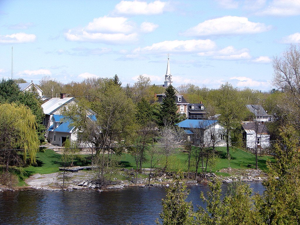
Portage-du-Fort, Québec

Following the same logic, would Portage-du-Fort be the portage of the fort (map)? That portage wasn’t in question; it was a path around a series of rapids on the Ottawa River. The fort, well, that was a different issue. Outaouais Heritage claimed,
“In 1611, Nicolas Vignau, a white scout, landed at what is now Portage du Fort with a party of Algonquins. On their way to tribal headquarters at Allumettes Island, they had to portage overland for the first of a series of five difficult cataracts. In 1694, the famous military engineer Louis d’Ailleboust, Sieur de Coulonge, established a fur trading post near the mouth of the Coulonge River. The stretch of cataracts that led to Fort Coulonge became known as ‘le portage du fort’ and this is how the settlement at the foot of the rapids got its name.”
Competing theories also existed so nobody really knows.
Notre-Dame-du-Portage, Québec
Our Lady of the Portage (map) sounds odd. It makes more sense after one reviews the Notre-Dame-du-Portage Histoire de la municipalité. Let’s start by identifying this portage from its French description, in typical mangled translation:
“For thousands of years before the arrival of Europeans in North America, Indians (Maliseet, Mi’kmaq, Abenaki and Montagnais) borrowed the ‘portage boaters.’ This ancient way of communication, made of water paths and dirt roads, allowing them to move between the St. Lawrence and the St. John River Témiscouata… To communicate between Acadia and Quebec, the capital of New France, the French borrowed this portage. A few years before the conquest of England, they decided to establish a permanent channel of communication by land between the St. Lawrence and Acadia. In 1746, construction began on the ‘path of the Grand Portage,’ a path three feet (, 91 m) wide starting at the same place as the old port.”
So the portage extended between the St.Lawrence River and Lac Témiscouata. From there a waterway extended down the St. John River and all the way to the Bay of Fundy.
The Notre Dame part came much later. It was a parish established in 1856, and a church of the same name grew soon thereafter.
Camsell Portage, Saskatchewan

I found very little on Camsell Portage other than it was located about as far north in Saskatchewan as one could possibly travel (map). One can’t simply drive to Camsell Portage either, it’s a fly-in community, and barely a handful of people live there anymore.
I wondered what the portage might be. The hamlet sits at the northernmost extreme of Lake Athabasca so that would be a starting point, but to where? Tazin Lake? Some other body of water? The nearby Alberta-Northwest Territories-Saskatchewan tripoint?
It took some persistence and I finally found my answer in a book, “Our Towns: Saskatchewan Communities from Abbey to Zenon Park“
“The community developed as a trappers’ settlement in the early 1900’s and is named for a nearby historic portage which connects Lake Athabasca to the great lakes of the Northwest Territories. The portage itself was named after Dr. Charles Camsell (1875-1958), the son of a Hudson Bay Company factor who became recognized as a visionary geologist, map-maker and explorer.”
Mystery solved.
12MC Loves Footnotes!
(¹) Sure I could use any of several Internet search engines instead. However the USGS database makes it a lot easier to uncover the true oddities without the clutter. Maybe I’ll create a U.S.-centric version of this article after the current fiscal mess dissipates.

Leave a Reply