I noticed that OpenStreetMap included “Tag:highway=bridleway” along with “designation=public_bridleway.” That’s awesome! A bridleway is an equestrian trail or a horse-friendly road. Perhaps it might even be considered a highway for horses according to the OpenStreeMap tag. Some of them trace back to ancient transit corridors. However, others are of more modern vintage having been developed purely for recreational purposes.
So Let’s Examine a Bridleway
Pennine Bridleway, Hayfield, Derbyshire, England
A bridleway appears as a green dashed line on OpenStreetMap, as with this example I found near Hayfield in Derbyshire, England (map). So this particular occurrence was a brief segment of the Pennine Bridleway, a designated National Trail (“long distance routes for walking, cycling and horse riding through the finest landscapes in England and Wales”). It extended for 205 miles through the Pennines, a range of scenic hills separating northwestern England from the northeast.

I selected an example from England for a specific purpose. England and Wales define public bridleways by statute and grant them a specific legal meaning. Thus, people have a right to travel by horseback or by foot unimpeded in corridors designated public bridleways in those areas. They may also travel by bicycle although absent any guarantees that it’s a suitable track for comfortable biking, and cyclists must cede the right of way to any riders on horseback or pedestrians on foot. Public Bridleways fitting the legal definition are often marked by blue blazes as in the example, above.
Resources
Fortunately there are plenty of resources on the Intertubes for anyone contemplating an equestrian excursion through the bucolic English or Welsh countryside. For example, the British Horse Society offered numerous resources, as one might infer from its name. This included a handy Bridleways and Routes FAQ too.
The situation was more complicated than I’d imagined. There were even provisions for carriage driving. Yes, for those who may want to imagine themselves living in centuries past, there are legal provisions that allow one to travel by horse and carriage into the hinterland.
Mapping
So the Equestrian Access Mapping page was probably the most fascinating site for geo-geeks.

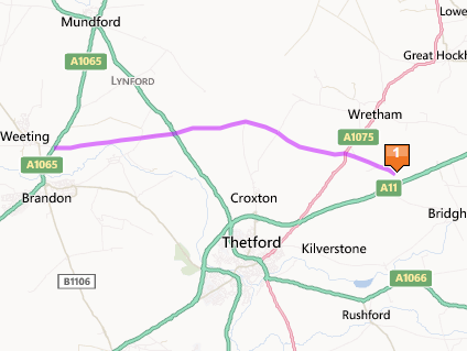
Suppose I owned a horse, lived in England and wished to explore rural trails in the vicinity of Thetford in Norfolk. But how did I select that seemingly random location, you ask? Naturally, I examined my Complete Index, noticed a relatively empty quadrant and decided it needed a push-pin.
Equestrian Access Mapping offered several options immediately and I needed to make a choice. Then I selected what seemed to be a promising and not too daunting path, Harling Drove. A drove, or more precisely a drover’s road, is a route for herding (or driving) livestock between locations. Think about that the next time you “drive” an automobile. Essentially you’re directing your horseless carriage to move forward to your desired endpoint. I’m not sure how much droving takes place around here anymore or whether Harling Drove continues to serve its original purpose. However, one must admit that the pathway looked lovely on Google Street View (image). I think I chose randomly well.
Bonus!
Then a couple of categories on Equestrian Access Mapping caught my attention: Horses welcome bed-and-breakfast inns and Horse-friendly pubs. So sure enough I found a place to stay with my theoretical horse practically adjacent to Harling Drove. Now all I need to do is find a horse-friendly pub and my hypothetical journey will be complete.

Leave a Reply