Salt Lake City, Utah, USA (July 2011)

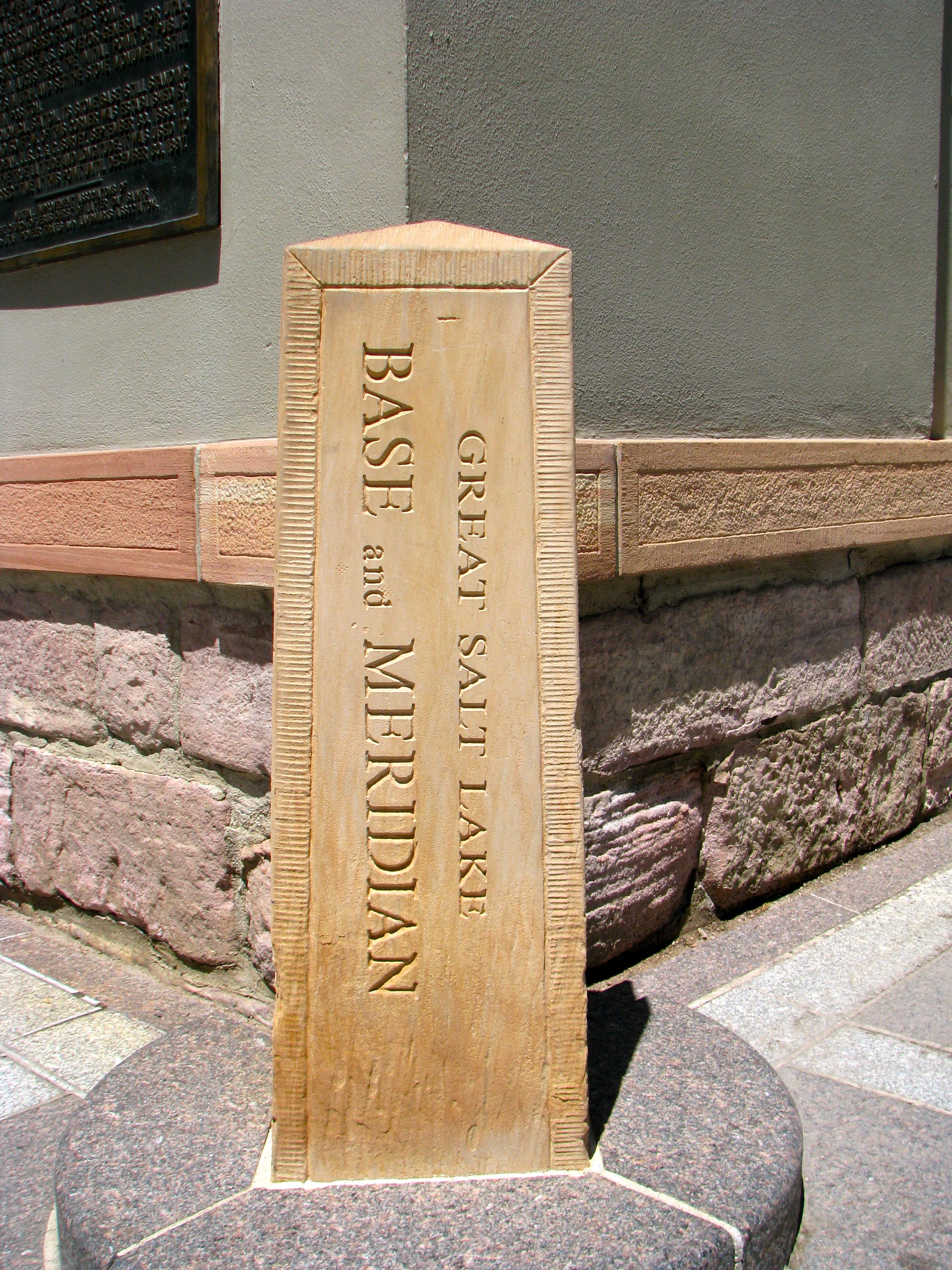
There is so much to see and do at Salt Lake City’s Temple Square and the headquarters of The Church of Jesus Christ of Latter-day Saints. It is the home of the Salt Lake Temple and the Mormon Tabernacle Choir. It boast inspirational architecture on an epic scale, various monuments and memorials, visitor centers, and the largest genealogy library in the world. Oh, and it contains a small obelisk at the northwest corner where S. Main Street meets W. South Temple (map).
What is this all about? Recognize first its significance to the LDS Church. When the Mormon pioneers arrived in the Salt Lake Valley after their epic journey across the continent, and Brigham Young proclaimed that “Here we will build a temple to our God” in 1847, it was at this exact spot. A stake was placed into the ground immediately and it became the anchor for the LDS headquarters and all of their activities thereafter.
Secularization

The LDS Church and the State of Utah are inextricably intertwined so it is no surprise that it also took on a secular purpose. Street within Salt Lake City and many of the surrounding towns take their numbering from this point. It uses an interesting X-Y coordinate naming convention. As an example, Rice-Eccles Stadium is on the campus of the University of Utah and is where the Utah Utes play football. The address is 451 South 1400 East, which looks odd to an outsider until one realizes is should be read in two distinct parts, 451 South AND 1400 East. This means, starting from the marker on Temple Square, one should travel four-and-a-half blocks south and then 14 blocks east. The system makes any location very easy to find once you understand it.
It goes well beyond this, though. The marker also serves as the base and principal meridian for land surveying for all but a small corner of Utah. A baseline runs east-west (latitude) and a Meridian run north-south (longitude). Thus, the marker serves as a starting point and basis of measurement for every property throughout most of Utah. It is quite unusual to find a point such as this in a highly urbanized area, and it exists here solely due to the historical nature and importance of the Temple Square to the LDS Church and the State of Utah.
It’s probably also worth noting that the marker is in remarkable condition. That’s because it’s a replica of the original and was placed here in 1989. The original marker hadn’t fared well over the years and was moved indoors to preserve it. I believe it’s in the nearby visitors center although I didn’t happen to spot it as I toured through the building.
The Plaque

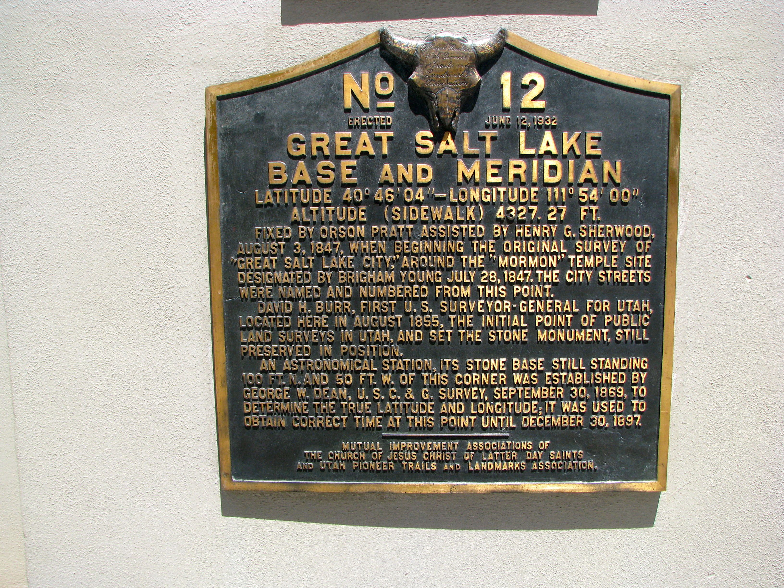
There is a nicely descriptive plaque on the wall diagonally upward and to the left of the marker. I think this photograph does a pretty good job of capturing the text, but recognizing that some visitors may be using enabling devices such as text readers, I will do my best to repeat the verbiage from the marker below:
No. 12
Erected June 12, 1932
GREAT SALT LAKE
BASE AND MERIDIAN
Latitude 40° 46’04” – Longitude 111° 54’00”
Altitude (Sidewalk) 4327.25 ft.
Fixed by Orson Pratt assisted by Henry G. Sherwood, August 3, 1847, when beginning the original survey of “Great Salt Lake City,” around the “Mormon” temple site designated by Brigham Young July 28, 1847. The city streets were named and numbered from this point. David H. Burr, first U.S. Surveyor-General for Utah, located here in August 1855, the initial point of public land surveys in Utah, and set the stone monument, still preserved in position. An astronomical station, its stone base still standing 100 ft. N. and 50 ft. W. of this corner was established by George W. Dean, U.S.C & G. Survey, September 30, 1869, to determine the true latitude and longitude; it was used to obtain correct time at this point until December 30, 1897.
Mutual Improvement Association of the Church of Jesus Christ of Latter Day Saints and Utah Pioneer Trails and Landmark Association.
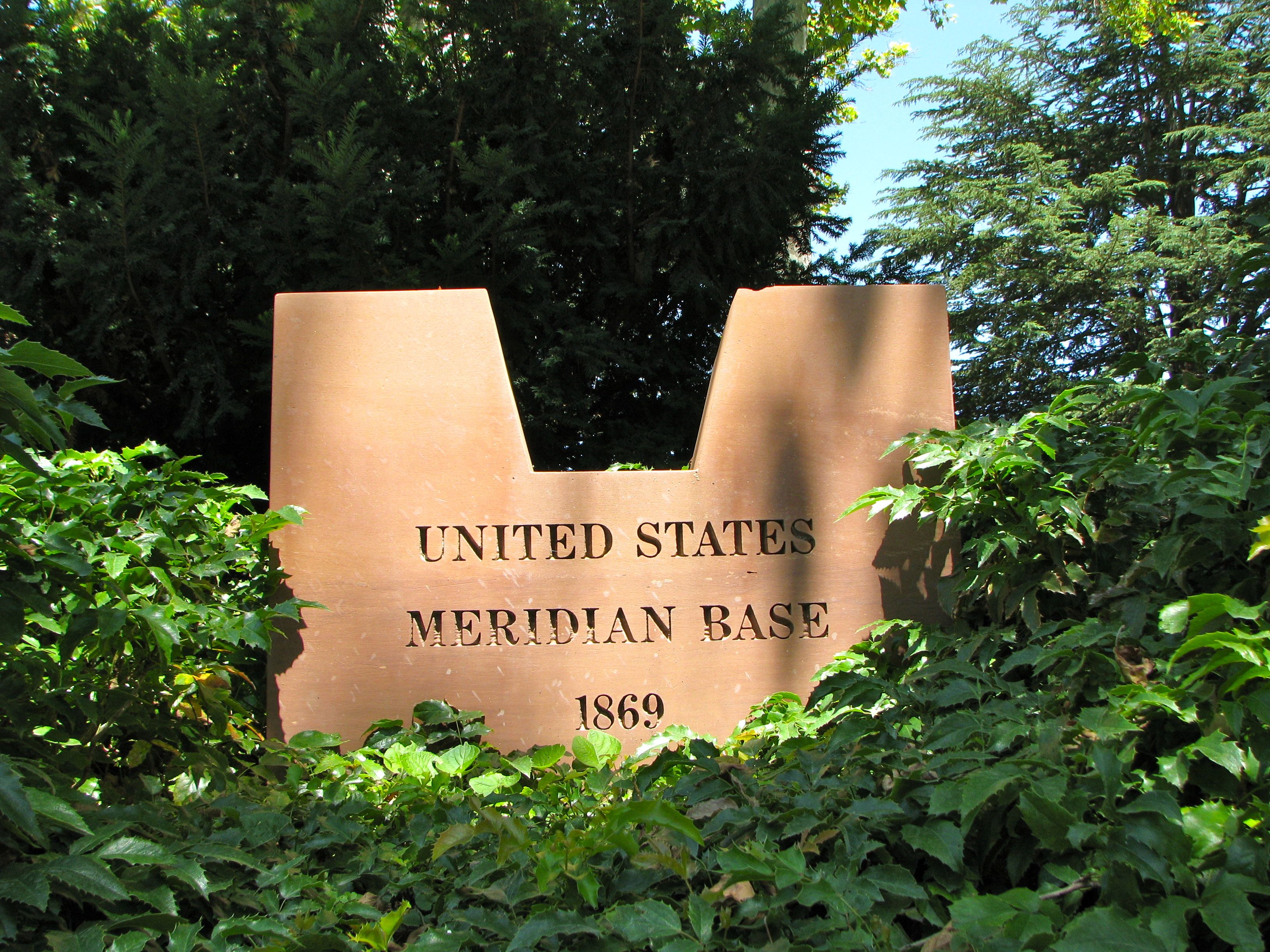
U.S. Meridian Base

The plaque mentions another geographical feature of interest, the stone base of an astronomical station. It’s not too hard to find although “100 ft. N. and 50 ft. W. of this corner” isn’t all that descriptive. Here’s what that means in the real world: walk north briefly — into the Temple Square property — and turn left at the first point where there is an opening along the courtyard wall. Then cut towards the left again and walk in the direction of the visitor’s center. The marker can be seen easily from the doorway of the visitor’s center, in the bushes. The other option is to ask the very nice and helpful LDS volunteers who are standing practically next to the monument and they will gladly point you in the proper direction.
The observatory telescope would have rested in a U-shaped base very much like this one because, once again, it is not the original. As with the Meridian and Base marker, the original telescope base has been moved indoors as a protective measure and has been replaced with a replica. There also seems to be some confusion regarding the object as originally designed: this was not a tool for measuring latitude, longitude and time. It was the base that held the telescope that was used for those purposes. Thus it’s marking the spot where the observatory once stood rather than presenting an actual historical artifact.
Nonetheless I enjoyed my trip to the Temple Square, both for the usual tourist destinations as well as to points a bit more obscure.

Leave a Reply