Serra do Cume

Terceira, The Azores (Açores), Portugal (March 2001)

View South from Serra do Cume. My own photo.
Serra do Cume, Looking South

Serra do Cume is a mountain in eastern Terceira. It quickly rises to 545 meters (1,788 feet) from the relatively flatter terrain that surrounds it. However, the summit is actually quite accessible. Visitors can drive right up to a viewpoint, the Miradouro da Serra do Cume (map).

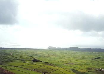
This view is nearly due south. The small islets known as Ilhéus das Cabras appear just off the coastline in the center of this photograph.


Fertile Fields

View West Southwest from Serra do Cume. My own photo.
Serra do Cume, Looking West-Southwest

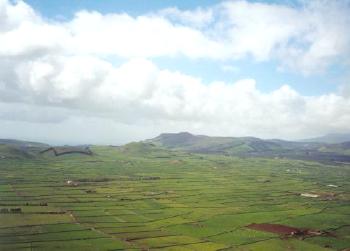
This view from Serra do Cume is approximately west-southwest. The plain below is distinctly agricultural. This is cattle country. The central ridge of Terceira’s mountains appears on the horizon. On the very farthest right appears an even more distant mountain on the western side of the island.


Praia da Vitória

View towards Praia da Vitória from Serra do Cume. My own photo.
Serra do Cume, looking towards Praia da Vitória

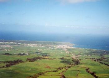
Terceira’s second largest town is Praia da Vitória. It can be seen to the northeast of the viewpoint. This image shows the arcing shape of the natural harbor chosen for the settlement.


Articles in the Azores Series

Comments

Leave a Reply

Your email address will not be published. Required fields are marked *

Latest Comments

  1. But Yugoslavia was not part of the Soviet bloc, so the border between Slovenia and Croatia had nothing to do…

  2. Indiana has signs for entering/leaving counties. The signs for this county crossing also only placed once rather than three times,…

  3. I am in La Libertad, El Salvador. Was absolutely astonished to see the sun rise at one end of the…

  4. Thank you for this information. I was searching “closest distance between towns of opposite elevations” and reveals zero results, at…

  5. I agree with a two mile run with admission proceeds go to the local Hancock schools in maryland doing it…