
We drove towards a rather obscure spot during our travels around southern Wisconsin this week. I’ve had a fascination with artificial points of significance for some time. So naturally I wanted to add another one to my growing list of accomplishments.
Some people like to climb mountains. I like to stand at places of no particular importance other than someone decided that they should be important. Regular readers may remember some of these earlier encounters:
Significance
This was no exception, but this one may have been the most unusual. Wisconsin called it the state’s Point of Beginning (map). My wife coined another name, “your dumbest adventure ever”. However, I don’t think the government quite recognizes that one yet.
The historical marker explains why this place is important much better than I. Please feel free to read it directly from the sign if you like. Essentially, surveyors measure all land in the state of Wisconsin from this single spot.
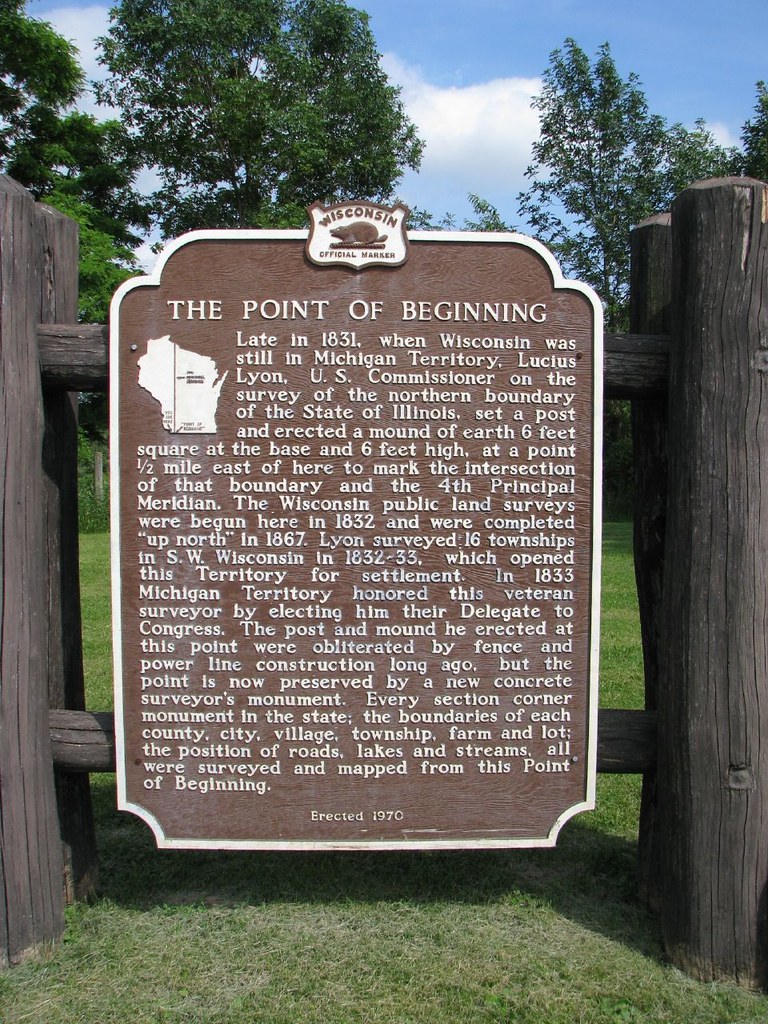
So that pretty clearly describes the significance but how does one get to it? Obviously, as the sign explains, it sits 1/2 mile to the east of here.
My Visit

Yes, it sits right on the shared border between Wisconsin and Illinois. So if you travel south from Hazel Green (map) and pass the border sign then you’ve gone too far.
Of course I had to find the exact spot and the trick was to find a way due east.
A narrow gravel farm road cut in the proper direction. The correct way to do this would be to park at the roadside marker, take out a reliable handheld GPS device, and walk ten minutes down the road to the exact spot. I did it the wrong way.
I have a lot of experience driving on country roads so I was feeling pretty confident. However, this one soon deteriorated into a footpath without turnarounds. It was no place for a small car. I’m sure I came within feet of the actual marker but I never did find it. That’s probably because I was too busy trying to back-up for half a mile, worried that I’d fall into one of the steep ruts and get stuck. The grass was overgrown along the roadway which I’m sure further obscured the marker. So again, learn from my mistake and try it on foot.
I didn’t reach the actual marker but frankly I was happy to have my car intact. I think I’ll write this one off as “close enough.”
Leave a Reply