Our first day in Huntingdon County, Pennsylvania went so well that I wondered how I would top it. Its neighbor, Blair County gave it a good run for the money though. I came up with a really good one-day itinerary too, all aligned with a railroad theme. On top of that it followed a leisurely route, covering just thirty miles (fifty kilometres) in its entirety.
I warned the kids they’d probably get tired of trains by the end of the day although they seemed to enjoy it. Well, not the last stop. We dropped them off at the hotel before that one.
Allegheny Portage Railroad

I talked enough about the Allegheny Portage Railroad recently so I’ll just summarize things briefly. Canals on opposing sides of the Allegheny Mountains faced a dilemma. Quite simply, water doesn’t flow uphill. Entrepreneurs developed an inventive solution though. They loaded canal boats onto rail cars and tugged them up and over the hills with pulleys similar to tow ropes found on modern ski slopes (map). Primitive railroad engines (photo) pulled the loaded cars between inclines. This inventive portage across the gap measured nearly 37 miles (60 km) between Hollidaysburg and Johnstown.
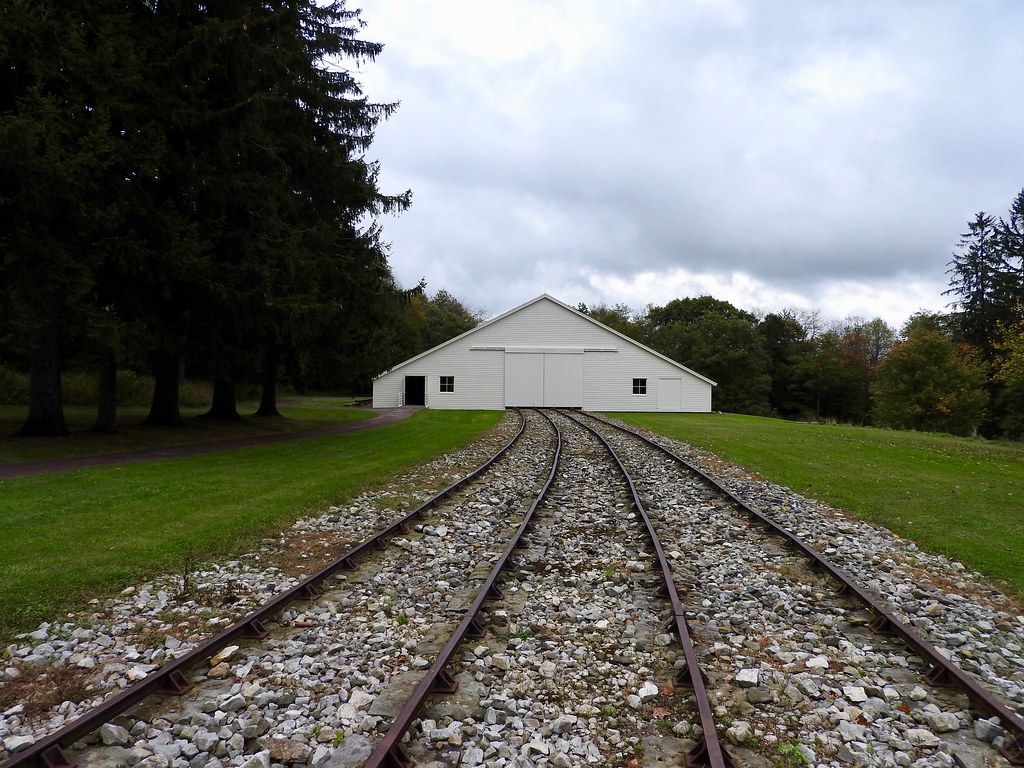
The Allegheny Portage Railroad National Historic Site preserved the remains of Incline 6, at the system’s elevation summit right on the Eastern Continental Divide. This included a reconstruction of an Engine House that powered a rope (later a wire) on a loop. Cars attached to the rope so they could travel uphill or downhill depending on where they were heading.
Then we walked down a wide grassy path along where the railroad once ran. This led down to the Skew Arch Bridge (photo). Here, the Huntington, Cambria and Indiana Turnpike used to cross above the railroad. Teamsters pulling wagons on the turnpike had trouble making 90 degree turns so builders placed a bridge at an oblique angle. That skew provided the bridge’s name.
Back uphill, we walked a short distance past the Engine House to a home built by Samuel Lemon in the early 1830’s (photo). There he operated a popular tavern catering to travelers on the portage. County lines followed the summit so I claimed a bonus county — Cambria! — simply by walking to the Lemon House.
An Optional Site
We passed one more site soon after we left the park, a turnoff for the Gallitzin Tunnels Park & Museum. I didn’t know about it ahead of time so we’d already passed it before it dawned on me. It would have been a good stop. The original tunnel built there in 1854 spelled the end of the Allegheny Portage Railroad and its canals. Nobody needed them once a train could cover the same territory a lot quicker.
Horseshoe Curve

Next came Horseshoe Curve. All of the promotional material described the curve (map) as “World Famous” so I took them at their word. It did impress me.
Here, three tracks hugged the hillside, providing a manageable grade all the way to the Allegheny summit a few miles away. This became one of the most heavily used tracks in the United States when it opened, a position it still held more than a century and a half later. There simply weren’t that many good places to cross the mountains.
A visitor center included a small museum although the curve itself was the main attraction. Railfans came out in force. They sat in lawn chairs with their cameras and video equipment, waiting for each train to rumble along. It truly was an impressive spectacle. I felt surrounded by trains as they wrapped around the curve. We even got to experience two trains descending simultaneously, a coal train moving slowly as an intermodal train passed it.
A Funicular Too!

The visitor center rested at the base of the hill while the train spotting area sat farther uphill next to the tracks. People could either walk up a long flight of stairs or take the funicular. This offered a nice little attraction while making the park handicapped accessible. Who wouldn’t want to ride the funicular, anyway? It didn’t compare to my adventures on the Monongahela Incline in Pittsburgh although it seemed to fit nicely within the rail theme of the day. This one featured a single set of tracks that split apart as the counter-weighted cars passed each other.
Altoona Railroaders Memorial Museum

The same group that managed the Horseshoe Curve viewing area also managed the Altoona Railroaders Memorial Museum in town. We got the combo ticket for both and saved a few bucks. Until I toured the museum (map) I didn’t truly appreciate the importance of the Pennsylvania Railroad to the city of Altoona. Essentially, Altoona wouldn’t have existed otherwise.
The railroad founded Altoona at a strategic point at the base of the Allegheny crossing. It later built the Altoona Works there, a massive facility used to build, test, repair and maintain locomotives. More than 16,000 people labored at the Altoona Works during its highpoint in the 1920’s.
The Pennsy influenced practically every facet of Altoona, about as close to a company town as one could imagine. However Altoona began its decline earlier than many Rust Belt cities. First came the Great Depression. Then came the railroad’s switch from steam power to diesel locomotives. The new locomotives required much less maintenance and many fewer laborers at the Altoona Works. Finally came a general decline in railroading altogether. Altoona reached a peak population in 1930 when 83,000 people lived there. It dropped residents in every Census thereafter, leaving an estimated population of 45,000 by 2016.
Railroad City Brewing Company

We wrapped up the day, continuing the railroad theme, with a visit to Railroad City Brewing Company in downtown Altoona (map). Somehow that seemed appropriate.
We called our visit to Blair County a success.

Leave a Reply