Google Street View finally arrived in Belgium. This offered an opportunity to revisit a topic that’s been sitting in my queue unaddressed for the longest time. I figured that most of us were familiar with the Belgian portion of the Vennbahn railroad line. This is the line that created several small German enclaves within Belgium south of Aachen. I wanted to talk about it without rehashing the same set of facts discussed on many different websites. But I needed a hook. So Street View’s arrival in Belgium seemed to be the ticket.
Google does a decent job of showing the five German enclaves hemmed-in by a narrow strip of Belgium. Drill in further to get a better view if you like. Indeed, the width of Belgian land pushing through much of this area is scarcely sufficient to include a rail line. A good static map appears on Jan S. Krogh’s GeoSite complete with links to detailed topographic maps. These barely-enclaves are Munsterbildchen, Rötgener Wald, Rückschlag, Mützenich and Ruitzhof.
The exact number of enclaves is debatable. While, unquestionably, the track bed belongs to Belgium it’s not entirely clear if territorial ownership extends below the surface.
For example, a road absolutely goes beneath the track bed here at the southern edge of the Mützenich enclave. Thus, is Mützenich an enclave within the confines of Belgium or does it connected to the rest of Germany? People actually worry about this stuff.
History
This situation traces its roots to the late 19th Century when Kaiser Wilhelm I first authorized a railway through the area to carry coal and iron. The Germans later used the line extensively during the First World War to transport troops and war materiel, a fact not lost on the victors as they sought their various spoils. Interpretations of the Treaty of Versailles led to this odd strip of Belgium slicing through a tiny corner of Germany:
“From 23 January 1920 to 4 January 1923 the commission laboured, particularly over the problem of one section of railway: Raeren – Roetgen – Lammersdorf – Konzen – Monschau – Kalterherberg. Even though some of the lands to the west of the line were part of Kreis Monschau, which was to remain in Germany, Belgium claimed sovereignty over the trackbed of this part of the Vennbahn. The Belgians reckoned that the line was at the time an essential communication route for the eastern territory given them by the Treaty, inasmuch as it linked the ceded districts from north to south, and they argued that the line was therefore Belgian property. The commission agreed…”

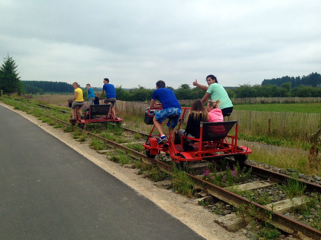
The Germans took control of the railway again during the Second World War, which reverted back to Belgian upon its conclusion, only to decrease in traffic and importance over ensuing decades. It declined to the point where it became a tourist line for people who wanted an interesting excursion, some of it on antique steam trains. Even that ceased by 2001. Portions of the corridor are now used for recreational railbikes. Others are bereft of track entirely, perhaps to become a rails-to-trails corridor eventually.
Nonetheless, even with its original purpose completely erased, the narrow strip continues to remain a part of Belgium.
More Views
Now that you understand the story a little better, let’s take a look at what Street View has to offer.
The best image looks into the southern edge of Ruitzhof and clearly shows the Belgian strip extending into the distance. This was the only Street View image I could find of the actual strip. Street View may have arrived in Belgium but its coverage still lags in rural areas.
Here we gaze into the western edge of Mützenich from Belgium N67 (Monschauer Strasse) where it turns into German L214 (Eupener Straße.
Finally, we can take a peek along the edge of Munsterbildchen. There are several other places where Street View goes up to the edge of Munsterbildchen and Rötgener Wald in this general vicinity.
Maybe I’ll come back again someday when Google Maps updates its imagery.

Leave a Reply