Here I explore a mashup of two wonderful topics covered in previous posts. I’ll combine the County Highpointers Association and the epilogue to my Smallest County Series. I decided to see whether I could reach the highpoints of both the smallest self-governing county in the United States and the smallest “county equivalent” location recognized by the Census Bureau.
First this is not a difficult accomplishment. In fact it’s quite simple. They’re both located just outside of Washington, DC, on the Virginia side of the Potomac River. Arlington County (the smallest self-governing county) shares a border with the independent City of Falls Church (the smallest county-equivalent Census unit). Their highpoints land a mere three miles apart.
Highpoint of the Smallest Self-Governing County
I drove up Minor’s Hill in western Arlington in search of the first highpoint. As I gained elevation, I caught my first clue as I came across a historical marker.
“MINOR’S HILL
To the Northwest is Minor’s Hill, so called for George Minor who lived on the far side at the time of the revolution. It is the highest elevation in the county. In the fall of 1861, it was the site of a Confederate outpost, afterwards there was a federal signal station at the top of the hill. Here at the foot of the hill was a large cantonment housing the reserve force supporting the Federal outposts in Fairfax County.”
One can hardly travel more than a few feet in Virginia without stumbling across something of historical or cultural significance. Thus it didn’t surprise me to learn that this promontory figured into the strategies of both sides during the Civil War.
I also learned a new word: “Cantonment”. That’s a term used to describe a temporary or semi-permanent military quarters. I tucked those facts away so I’d retain at least something of value should my trip become a bust. I could always write it off as an educational opportunity. At the same time I took slight exception with the sign. It appeared that the true peak lay due north rather than northwest. Nonetheless, I continued to trudge towards the summit.

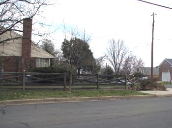
The highpoint wasn’t that remarkable of a place, in fact it was just a quiet, nondescript suburban street corner. There would be nothing of significance at all if it didn’t happen to be the highpoint. It sits somewhere near the fence post that’s closest to the end of the sidewalk in the photo above. At 464 feet above sea level, Mount Everest, it is not.
Highpoint of the Smallest County Equivalent

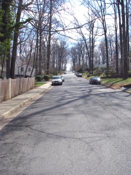
I then veered over to the independent City of Falls Church highpoint. Of course I arrived at my target destination less than ten minutes later. Falls Church is only about two square miles so it’s not like I was facing an extended search. I could see a hill rise visibly in front of me as I motored down Poplar Drive.

Once again a wooded suburban street was the only obstacle I needed to mount. Then I reached the distinguished summit. The highpoint itself appeared to be sitting in the back yard of a white, two story home set back slightly from the street, this time at 440 feet above sea level. That point also marked the boundary between the City of Falls Church and its other neighbor, Fairfax County.
So those were my two county highpoint adventures. They weren’t quite as remarkable as visits I’ve made to the New Hampshire state highpoint and the Wisconsin state highpoint. However, they were memorable enough because of the odd geographic distinctions associated with Arlington County and the City of Falls Church.
If you would ever like to replicate this journey, explicit driving instructions are provided on the County Highpointers Association visit reports for Arlington and Falls Church.

Leave a Reply