The second day-trip loop from Asheville plowed nearly due west onto the domain of the Eastern Band of the Cherokee Nation. Then we continued into Great Smoky Mountains National Park for another easy U.S. state highpoint capture. I guess it was actually more of an out-and-back. Technically, one could cut the corner just a bit on the return trip with a brief yet scenic jaunt down the Blue Ridge Parkway.
The Out-of-Place Scene

We rolled through pleasant countryside along serpentine roads, over hills and dipped into hollows as we followed U.S. Route 19 into the town of Cherokee. Something completely out of place loomed suddenly from the valley floor. It wasn’t a mountain. Rather, a massive multi-story building with a huge parking garage appeared. It was a resort hotel casino (map). I doubt there was a taller building anywhere closer than an hour away in Asheville. Here it stood probably fifteen stories high, an urban structure without a downtown.
I’m not a gambler so such things don’t tempt me. To me the most fascinating feature was the casino’s complete lack of context with all that surrounded it. The monolith seemed like a giant middle finger to those who had mistreated the tribe since Europeans first landed on the continent and pushed into the mountains.
So North Carolina doesn’t want casino gambling? Those laws don’t apply here. I hope the Eastern Band makes a ton of money from their venture… just not my money. It only seemed fair after centuries of mistreatment.
Oconaluftee Islands Park

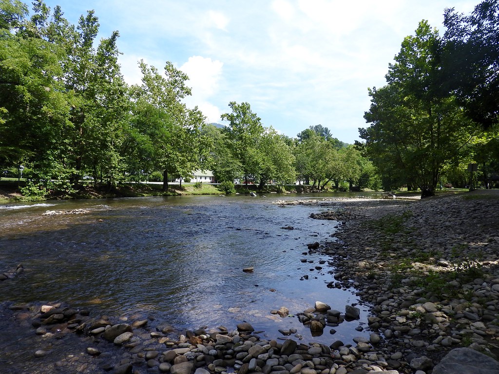
We’d been eating out a lot and visiting multiple brewpubs so we decided to do something a little bit different, a picnic lunch outdoors. I’d wondered if that might be possible as I examined Street View the previous day. The main strip seemed pretty touristy. Then I noticed a little green spot (map) while poking through online map sites. The marker said Oconaluftee Islands Park.
That was just what we needed, a little oasis of nature and solitude surrounded on all sides by water, accessible only by footbridges. Children splashed and rode inflatable tubes down a lazy river, ducks and geese floated by, the wind rustled through a bamboo forest, and we enjoyed our respite at a shady picnic pavilion. The price was right too: FREE.
Cherokee Heritage

The town of Cherokee served as the headquarters of the Eastern Band. Members of the nation descended from a small residual group of Cherokee that remained in North Carolina in the early 1800’s. They avoided the infamous Trail of Tears, however not without their own hardships. The U.S. government forced them to renounce or hide their own culture for much of the Nineteenth Century. Then they spent the next hundred-plus years trying to revive it, a process that continues today. Also they had to repurchase the land that rightfully belonged to them.
The entire history of the Cherokee people unfolded in detail at the well-done Museum of the Cherokee Indian (map). It was a large facility and it took quite awhile to see everything in the level of detail it deserved. That took us longer than expected. Other sites nearby included the Qualla Arts & Crafts Center and the Oconaluftee Indian Village. I’d wanted to see both of those and we simply ran short on time. Most visitors would probably want to spend at least an entire day in Cherokee. We didn’t have that option because I had an important geo-oddity that required my attention.
Clingmans Dome

We’d reached the summit of North Carolina’s elevation highpoint the previous day. Now it was time to do the same thing for Tennessee at Clingmans Dome, (map). Here the elevation reached 6,643 feet (2,025 metres). I know what readers are thinking — this is supposed to be an article about western North Carolina, not Tennessee. If it makes anyone feel better, the Tennessee highpoint fell directly upon the boundary between the two states. The Clingmans Dome summit also served as the highpoint for Swain County, North Carolina. Feel free to use that as a justification to maintain the sanctity of the article title. We were only ever a few feet across the border into Tennessee and only momentarily.
I expected this to be another easy highpoint directly within my lazy mountaineering ethos. It was packed! I knew we were in trouble when I saw cars parked along the access road more than a half-mile away from the official parking lot. Clingmans Dome fell within the confines of Great Smokey Mountains National Park which had 10 million visitors in 2014, making it one of the most popular properties in the entire National Parks system. It was summer. We arrive at the middle of the day. What else should we expect?
Proving the adage that sometimes it’s better to be lucky than to be good, a parking space opened up directly in front of us, practically the best spot in the entire lot. Clearly a higher power wanted me to visit the highpoint, or more likely didn’t want to hear our kids whine because we were going to the spot even if we had to park all the way down the road and walk the extra distance by golly. I didn’t drive all the way to a remote mountain and up to the top to turn around and head home.
From there we trekked from parking lot to summit along with a few hundred of our new best friends, looped to the viewing platform and jostled through the crowds searching for the horizon. I much preferred the experience of North Carolina’s highpoint the previous day, shooing away swarms of insects instead of people. The Tennessee highpoint would be best appreciated during the off-season.

Leave a Reply