There are 23 Counties in Wyoming – “The Equality State“
Also be sure to see my United States County Counting Page for the rest of the states.

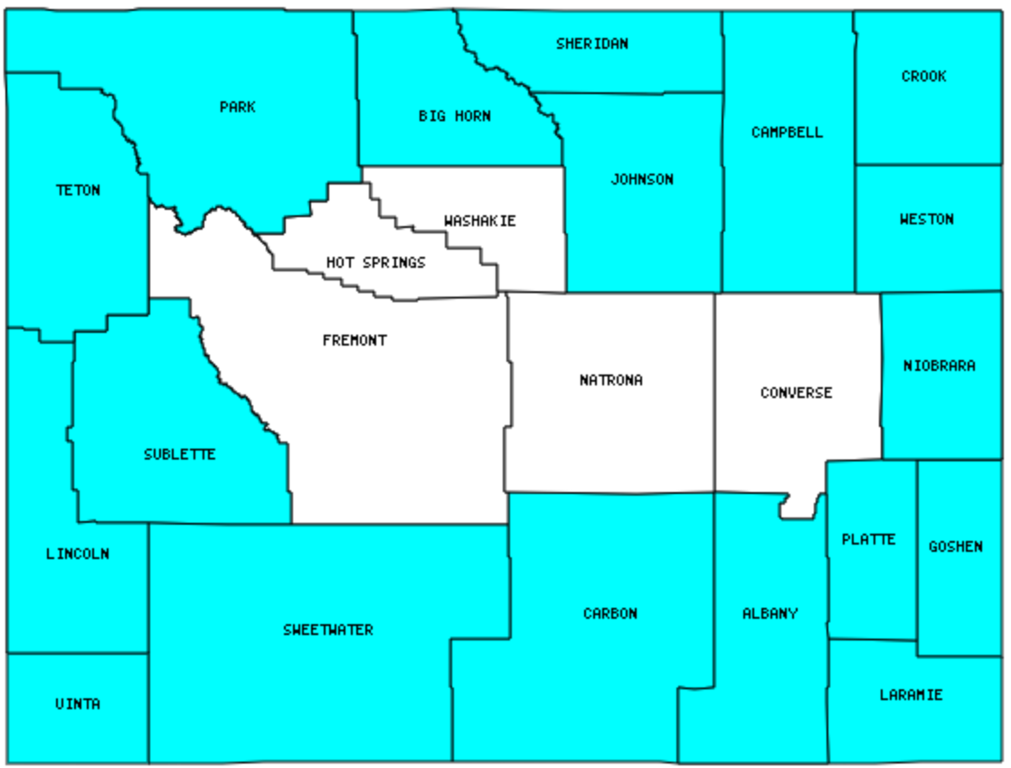
I have visited 18 Counties = 78.3% of Counties in Wyoming
Counties visited are colored-in; counties still needing to be visited are blank. Map created using Mob Rule.
Twelve Mile Circle Articles Featuring Places in Wyoming
Markers designate the Wyoming locations featured in Twelve Mile Circle articles.
Counties in Wyoming

Below are the 23 counties in Wyoming. Although infrequent, counties sometimes do change so please let me know if any of this information is out of date and I will update it. Those counties that I have visited are highlighted in Red. Readers can also link to any articles manually in this section if the map isn’t working.
- Albany: Town of Buford; Tree in Rock; Turtle Rock Loop Trail; Bought the Town; Coal Creek TAP; Library Sports Grille & Brewery
- Big Horn: Shell Falls; Adjacent Counties, Same Name, Different States
- Campbell
- Carbon: Carbon County Border; Wyoming, Texas?
- Converse
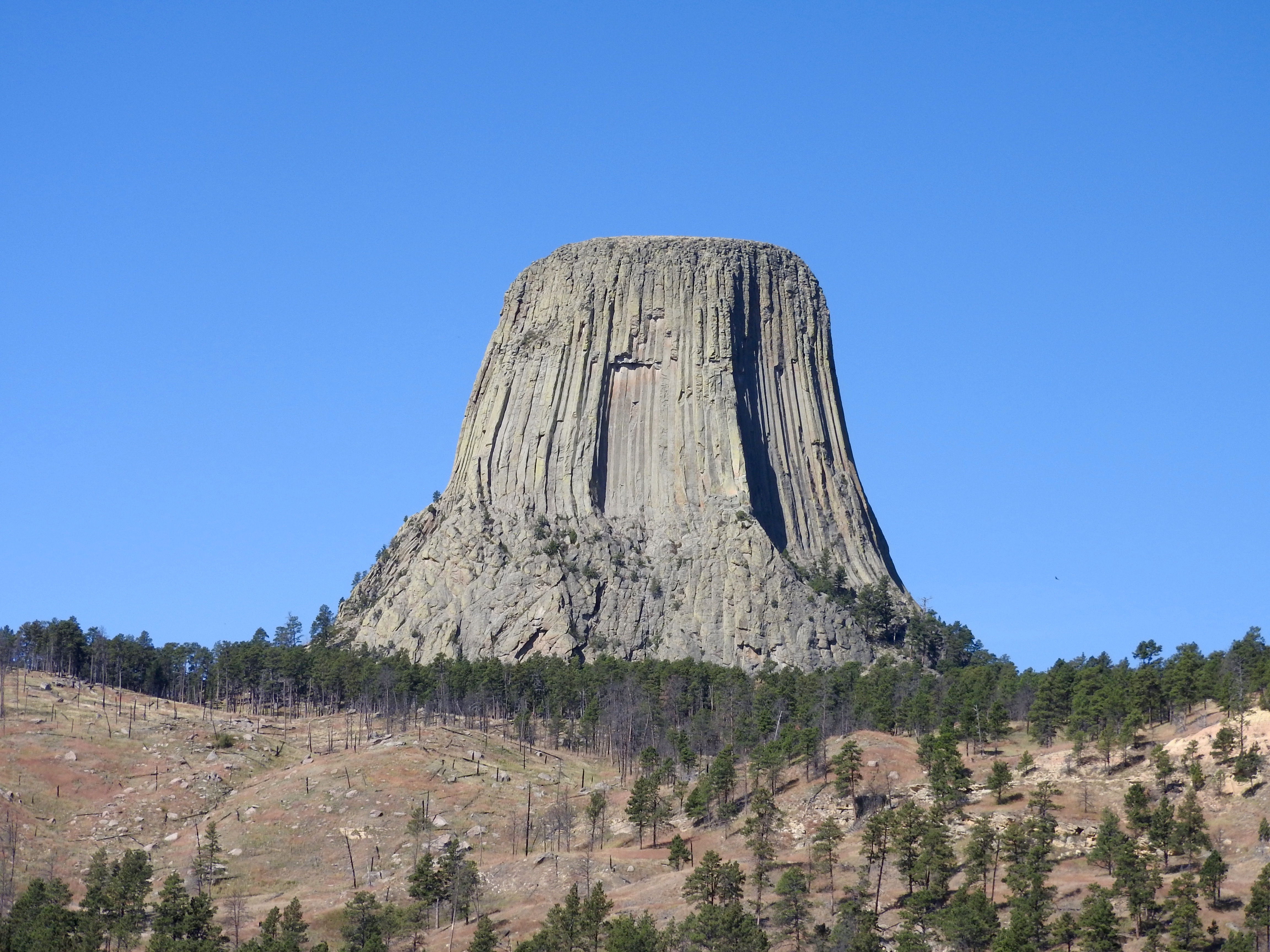
- Crook: Devils Tower; Center of the Nation; Prairie Dog Village; Dancing Pigs
- Fremont
- Goshen: Fort Laramie
- Hot Springs: Smallest county in Wyoming (2,004 square miles); The Largest Smallest US County.
- Johnson
- Laramie: Largest county population in Wyoming (81,607 people in 2000 Census); Small Change, Big Difference.
- Lincoln: Fossil Butte National Monument; Shaped Like it Sounds; Just Beyond Utah
- Natrona: Teapot Dome
- Niobrara: Smallest county population in Wyoming (2,407 people in 2000 Census).
- Park: Adjacent Counties, Same Name, Different States
- Platte: Town of Chugwater; Cold Spring – Oregon Trail
- Sheridan
- Sublette
- Sweetwater: Largest county in Wyoming (10,426 square miles); COUTWY Tripoint.
- Teton: Hidden Falls; Adjacent Counties, Same Name, Different States; Parting of the Waters
- Uinta: Suds Brothers Brewery; Something in Common
- Washakie: Triple Letter
- Weston
Quick Facts About Wyoming
- Location: Mountain West United States. See map above.
- Size(1): 97,093 square miles. Wyoming is the 9th largest state. The next larger state is Colorado and the next smaller state is Oregon.
- Population(2): 577,737 people. Wyoming is the 50th most populous state. The next more populous state is Vermont. There are no states with fewer people than Wyoming.
- Population Density: 6.0 people per square mile. Wyoming is the 49th most densely populated state. The next more densely populated state is Montana and the next less densely populated state is Alaska.
- Bordering States: Wyoming shares a border with 6 states: Montana; Idaho; Utah; Colorado; Nebraska and South Dakota.
- Admission to the Union: July 10, 1890. Wyoming was the 44th state admitted to the Union, after Idaho and before Utah.
- Capital: Cheyenne.
- Highest Point: 13,804 feet at Gannett Peak. See SummitPost’s Gannett Peak page.
- Lowest Point: 3,099 feet at the Belle Fourche River in Crook County.
- Government website: Welcome to the State of Wyoming.
- Official Tourism website: Travel Wyoming.
- Still not enough? See Wikipedia’s Wyoming page.
Sources:
(1) Wikipedia: List of U.S. states and territories by area. Land area only.
(2) Wikipedia: List of states and territories of the United States by population. Estimated population on July 1, 2019.

Leave a Reply