12MC in the Real World

What do I mean by Twelve Mile Circle in the Real World? I don’t mean the actual circle itself which would be entirely too logical, rather I mean those rare moments in time when people read an article here and use that as motivation to undertake a physical action. And by physical I don’t mean mumbling at the screen in disbelief when I say something stupid, which is probably the most common reaction, I mean getting away from the screen and actually doing something.

I’m referring specifically to situations when someone learns a new fact from the website and then visits the referenced geo-oddity. The text emanating from 12MC jumps from Internet to brain, and someone I’ve never met takes that newfound knowledge to do something fun and interesting. It’s a great feeling and I love hearing about it when it happens.


On the West Coast Where the Sun Rises Over Water
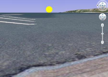
Potential sunrise over water in Port Angeles, Washington. Image created howderfamily.com using Google Earth.
I created this in Google Earth when I thought it was possible in Port Angeles, Washington. That later proved wrong

We, the readers of 12MC and myself, had a good time in 2008 trying to determine places on the east coast where the sun sets completely over water, and conversely places on the west coast where the sun rises over water. Frankly, I hadn’t done much with that topic after the initial conversation, and then Mathew Hargreaves picked it up and ran with it. You’ll see from his comments that he made it his mission to prove it was possible to experience a sunrise completely over water on the west coast of the United States, on the Olympic Peninsula.

He examined locations on the ground and returned repeatedly, hampered by the Pacific Northwest’s notoriously fickle weather. The magic spot turned out to be Sekiu on the west side of Clallam Bay on the beach by the jetty. He finally captured photographic proof on the morning of September 21, 2011. He estimates that the phenomenon exists for only a few days each September and March, and only when the clouds and fog dissipate. I can’t imagine that more than a handful of people have ever observed this occurrence and fewer still recognized its significance. Mathew’s experience may be unique.


Cricket

Phil Sites of the Weekend Roady blog is a big sports fan. He also appreciates geo-oddities with the best of them, and blends both topics together in his writings and adventures. He saw my Sports Facilities I Never Imagined entry and took note. It wasn’t long thereafter that I learned that he’d visited the Cricket field in Climax, North Carolina I mentioned. It was great to see on-the-ground photographs of a site I’d previously only imagined from a Google Satellite view.


Touring Maine

Rockland, Maine Breakwater. Photo by howderfamily.com; (CC BY-NC-SA 2.0)
The Stone on the Rockland Breakwater

Mark Sundstrom read about a time I drove north and experienced A Week in Maine. He happened to drive through that same area and he used my write-up to visit a couple of the places I mentioned. These included Ft. Knox (the abandoned one in Maine, not the one with all the gold) and the only spot on the Rockland Breakwater where a single stone covers its width. The first location is fairly standard. The second one can be enjoyed only by true aficionados of geo-oddities like Mark.


Center of the Universe

“Prullmw” described a visit to Wallace, Idaho [link no longer works] to experience the Center of the Universe, which he learned about on 12MC. He went a total of about ninety minutes (round trip) out of his way, but in his words “it was well nigh impossible not to take a late afternoon trip to this notable spot.”


Abingdon Plantation
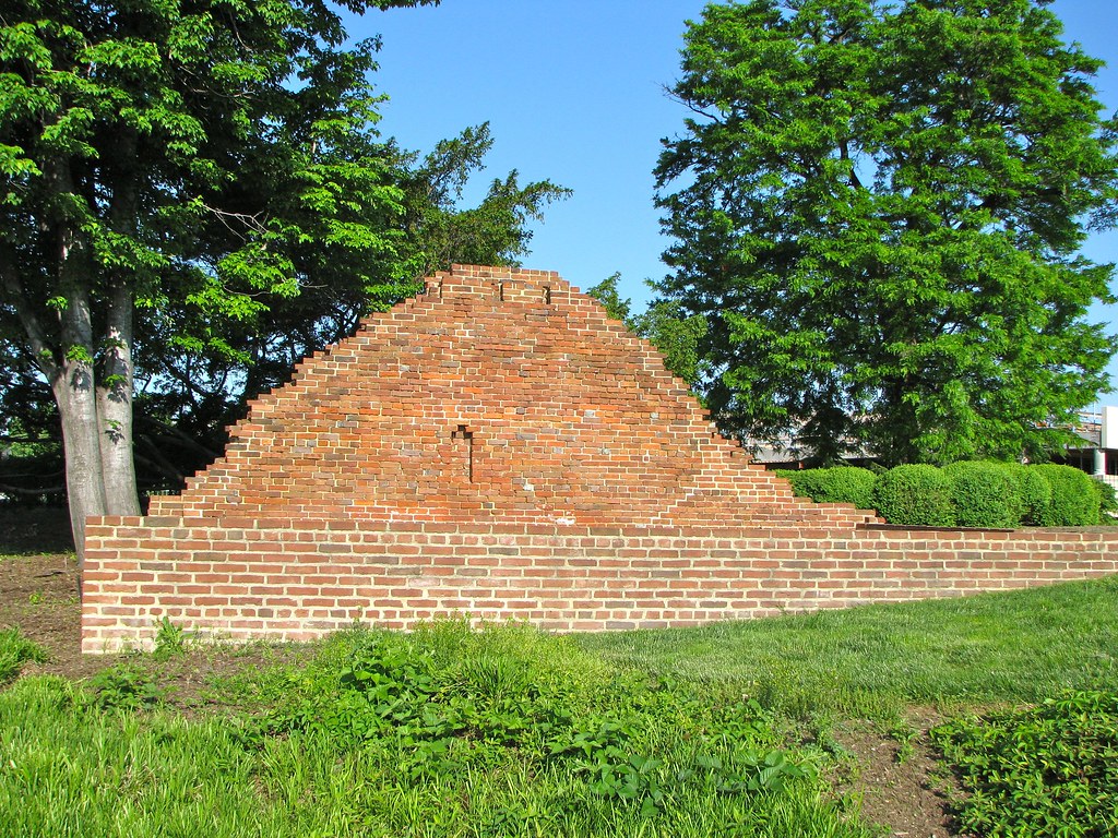
Abingdon Plantation Summer Kitchen Ruins. Photo by howderfamily.com; (CC BY-NC-SA 2.0)
The Summer Kitchen

Longtime reader Craig was fascinated by the Abingdon Plantation Ruins. He happens to live nearby and had often wondered what they were as he rode by on numerous occasions. He was hoping to visit them that very afternoon. I’ll bet by now he’s completed that visit but until then let’s call this one a near miss.


Extreme County Counting

KCJeff reacted to County Counter Extraordinaire. Certainly he had an “aha! moment” when he learned that he was among an extraordinarily small crowd that had ever crossed the border between Jackson and Ray Counties in Missouri, which is impossible to do by automobile. He was considering whether he should start counting individual county border crossings or not. Only KCJeff knows for sure. Let’s call this one a near-miss, too.

I am sure I am missing other examples, and for those of you who have let me know about your visits, please accept my apologies. There are now more than 2,000 comments on 12MC so I couldn’t review them all, and my memory is notoriously bad. Please keep those comments and emails coming, though. I love hearing about your geo-oddity adventures inspired by 12MC!

Comments

6 responses to “12MC in the Real World”

  1. Pfly Avatar
    Pfly

    I’ve thought about places where the sun rises over the sea on the west coast, but don’t remember reading your old post and speculation about Port Angeles. Since I live near there I might also have been inspired to test the theory (except for not really being a morning person!). So, Sekiu? Makes sense, looking at maps. Perhaps it works along the coast between Sekiu Point and Kydaka Point. And/or Ship Point and the coast to the southeast, although there’s no road access. I’m quite familiar with the curious way fog often hangs over the Strait of Juan de Fuca. We went on a week long camping trip in the northern Olympics recently and every time we saw the strait it was fogged in, even though every day was brilliantly sunny on land. One day we went for a hike way up in Olympic National Park’s Hurricane Ridge area. The sky was clear blue, the sun bright. We could see far off Glacier Peak and much of the northern Cascades, Mount Baker, the mountains of Vancouver Island, etc. Not a cloud in the sky. But the Strait of Juan de Fuca, which seems almost at our feet from 6000+ feet up, was white with fog. The fog ended abruptly right at the coast, except a couple spots like Ediz Hook at Port Angeles and Dungeness Spit near Sequim. I think this kind of fog over water happens a lot on the strait, especially in the summer.

    Whatever the metereological reason is, it happens fairly often over Puget Sound too. I live about a mile from the shore, close enough to hear the Edmond’s ferry boat’s horns off in the distance. The ferries don’t always blast their horns when crossing Puget Sound. Sometimes they give a blast just before leaving or just before arriving. But if Puget Sound is foggy, they blast their fog horns every minute or two as they cross. During the summer it isn’t uncommon for me to wake up to a bright and sunny day, often a cloudless day (summers here are great), then notice the sound of the ferry boat fog horns repeating, indicating thick fog on the water. Even at home, just a mile away, there’s no hint of fog. Sometimes on mornings like that I go down to the water near the ferry terminal. Typically the fog over the water is very thick and ends exactly at the shore. I’ll hang out a bit on the waterfront, under a blazing blue sky, and look out into a wall of white. The ferry pier sticks out into Puget Sound 100 yards or so, and the end, where the boats dock, will be only half visible. It’s surreal to listen to an approaching ferry, its fog horn getting louder and louder until it must be almost at the dock. Then it emerges like a ghost right at the end of the terminal and docks, while I’m getting sunburned a mere 100 or 200 yards away.

    Typically this fog effect burns off around noon, but sometimes it lasts all day. I think it is more common and persistent over the Strait of Juan de Fuca. A clear day summer dawn over the strait without fog is…well, good for Mathew managing to find one! Now I’m curious to see photos. I’d imagine Mount Baker would be very visible to the east. The Cascades in general should be, if it was a clear day. The sun must be rising somewhere south of Baker…some point where the Cascades are not visible? Mathew, if you see this, I hope you post some photos!

  2. Pfly Avatar
    Pfly

    Oh, and, one west coast place where I suspect the sun sometimes rises over the Pacific is Government Point, near Point Conception. Maybe that is the most obvious possibility…

  3. Phil Sites Avatar

    Here I go all the way to North Carolina for some cricket field when the Abingdon Plantation was right under my nose!

    In all seriousness, I’ve passed signs for this a couple times down at National when returning rental cars and wondered how the heck (or if) anyone visits this strange location for a landmark. I guess there’s at least one (or two) of you. I’ll have to get out and see it for myself next time I’m frittering about over there.

    1. Twelve Mile Circle Avatar

      I’ve been there several times and I’ve never seen another person visiting. It has to be one of the more obscure historical sights, and yet, it’s passed by thousands of people every day as it hides in plain sight.

  4. stangetz Avatar
    stangetz

    I’m up for a week of training outside of Philadelphia at the end of October. You can sure bet I have been reading intently about the actual 12MC to make a few on-the-ground visits during my off time……

    1. Twelve Mile Circle Avatar

      Be sure to drill down onto northern Delaware on the Index page. There are a whole slew of neat geo-oddities in or near the 12MC in fairly close proximity!

Leave a Reply

Your email address will not be published. Required fields are marked *

Latest Comments

  1. Does anyone have actual music to the song – Tanaha ,Timpson. Bobo and Blair ?? It was recorded by Tex…

  2. I am a grandchild of Jury and David Adams of BoBo Tx Shelby County we still have the family home…