All good things come to an end and before long our Kentucky adventure approached its natural conclusion. It was time to return home. I still had some parting opportunities as I left the state and then again as we steered through West Virginia towards the Mid Atlantic.
East Wasn’t East

Long ago in the early days of Twelve Mile Circle, all the way back in 2009, I posted an article I called USA Time Zone Anomalies, Part II. I examined places where one could travel east or west and cross into counterintuitive time zones. I mentioned that the Eastern and Central time zones split Kentucky into distinct portions. The article included an unusual occurrence I’d spotted on a map that fell along the line.
An Anomaly
I consulted the 12MC complete index map before I departed on the trip and noticed that the anomaly fell cleanly along our path. I made a note of it so I could experience it in person if the right opportunity occurred.
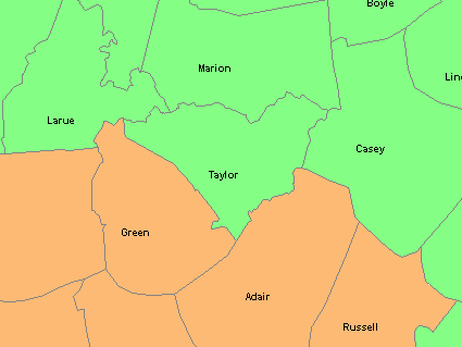
I’ve reproduced the setup in a map of central Kentucky, above. The light green counties are located in Eastern Time. The tan counties are located in Central Time. Notice how the triangular shape of Taylor County dips down between Green and Adair Counties. Theoretically, one should be able to move due east from Taylor (in Eastern Time) into Adair (in Central Time). So move east but move backwards in time, or do it in reverse. That’s the anomaly. Generally that should never happen.
The 12MC Visit

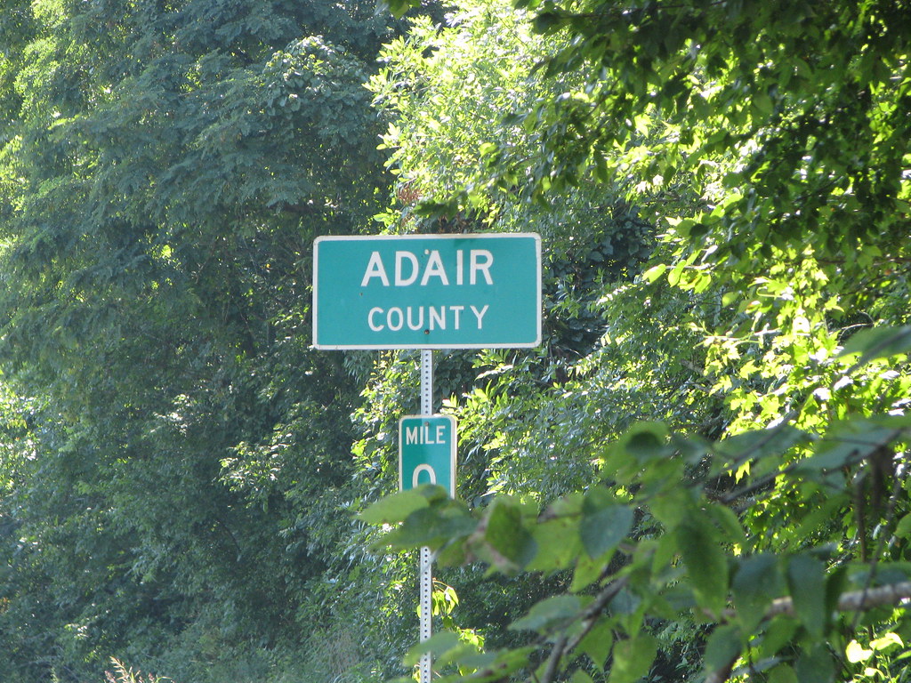
It wasn’t simply theoretical. I accomplished that exact feat in person although I didn’t bother to change my watch. I drove from Taylor County into Adair County on Coburg Road (at this spot) just as I’d described as a possibility in the earlier article. It was easy. I only hoped that nobody would run into our rear bumper while we stopped to take the photo. Imagine the explanation I’d have to give to the nice officer investigating the accident. “You see, I was simply trying to go backwards in time right here at the Adair County line…” Right. They probably would have locked me up overnight for observation.
This was one of those instances where the family didn’t have the same level of appreciation although they were willing to humor me. They’re generally good sports about my geo-oddity detours. I might have gotten more resistance had the alternate path lasted more than a few minutes.
Déjà Vu Rest Stop
We took a brief break at a highway rest stop along Interstate 64, east of Lexington, Kentucky (map). I stepped out of the car and experienced the weirdest sense of déjà vu. I knew immediately that I’d been there before, except I knew that it was impossible. I’d gone down this stretch of highway only one other time in my life and it was when I was a child. I had no recollection of ever stopping there.

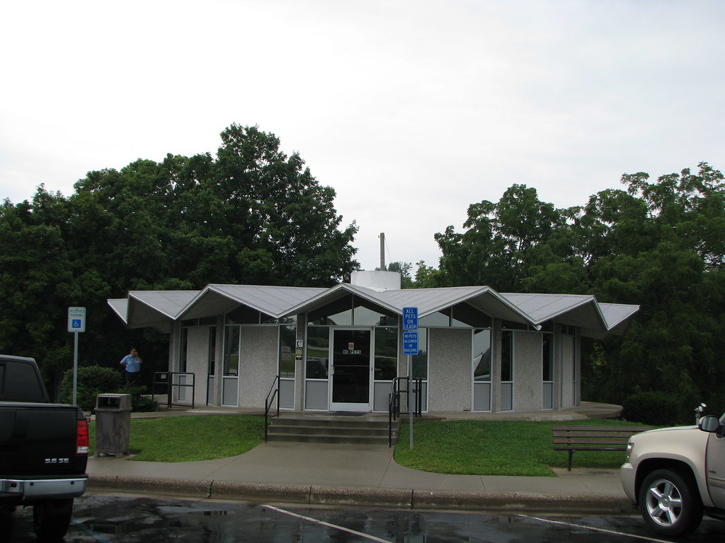
Then it dawned on me. It was nothing supernatural. I’d featured this spot on 12MC before, coincidentally also in 2009. This was one of the rest stops from the article No More Rest?. Well, actually it was the companion of an identical rest area a couple of miles farther down the Interstate on the other side of the road. However, architecturally, they were spitting images of each other. I’d marked the spot on my complete index map years ago although I hadn’t noticed it recently because it fell well outside of the target area. It was a complete surprise. I stopped in my tracks and pulled out a camera.
The stop had been referenced in a Wall Street Journal article that discussed a looming demise in roadside rest areas:
“There is one old rest area that appears safe: a circular building, put up in 1964 on Interstate 64, near Winchester, Ky., featuring a roof with multiple triangular folds. It was placed under the umbrella of the National Historic Preservation Act when the interstate system turned 50 in 2006.”
That description sounded exactly like the building I saw.
It was a strange layout by the way. People walked through a common entrance, with ladies heading towards the left curving hallway and gentlemen to the right. Both restrooms were in the middle, separated by a wall of course, and semi-circular. Imagine experiencing a facility with very few straight lines. Bizarre.
Cathedral Falls
Soon we left Kentucky for good and entered West Virginia.
Driving narrow winding country roads, we entered a small town called Gauley Bridge, set in a narrow river valley where the New and Gauley Rivers joined together to form the Kanawha River (map).

Completely randomly, we spotted a large waterfall crashing from the hillside easily visible from U.S. Route 60, the Midland Trail. A quick tap on a mobile phone provided a name: Cathedral Falls (map). That was awesome. The town created a little park at the base of the falls, and visitors could walk right up and splash in the pool at its base.
New River Gorge

Our final destination that day, however, was the New River Gorge (map).
We’d been there plenty of times before (in case you want to read about it) although our last visit occurred more than a decade ago. It was nice to ride some serious New River whitewater again. A thunderstorm the previous evening raised water levels into massive rapids, and the weather was perfect. What a wonderful way to finish our latest adventure.

Leave a Reply